Heads up, Tampa. Storms are building through the day, and travel plans may wobble. Skies are mostly cloudy and near 71°F this morning, with a high near 79°F. Showers began mid morning, and thunder is likely this afternoon and tonight. A Weather Impact Alert is in place, so stay weather aware. ☔
Today’s setup at a glance
Moist air from the Gulf is feeding into an active storm system. That is a classic recipe for fast forming downpours and gusty winds. The result, a soggy Sunday with widespread storms and a busy radar.
- Late morning to early afternoon, scattered showers and a few rumbles.
- Mid to late afternoon, storms grow more widespread, heavy rain and wind gusts of 40 to 60 mph are possible.
- Evening to overnight, storms linger, rain totals add up, and localized flooding may develop.
[IMAGE_1]
Weather Impact Alert this afternoon and evening, with a broader Central Florida weather alert day. Expect delays, brief power flickers, and ponding on roads.
Rain totals of 1 to 3 inches are likely by Monday morning. Some spots could see a bit more under slow moving storms. Lightning and quick wind bursts will be the main hazards.
Why these storms are packing a punch
Two forces are teaming up. A passing front is lifting very humid air, and waters in the eastern Gulf are still warm for December. Warm water adds moisture and energy, which can boost rainfall rates and storm strength.
Florida’s winters are changing as the climate warms. Our air can hold more water, which means heavier downpours when storms form. Across the Tampa Bay region, the share of rain that falls in short, intense bursts has grown in recent decades. That is why a “regular” storm day can still trigger street flooding.
Urban areas face extra risk. So many paved surfaces send water racing into drains at once, which can overwhelm the system. Rising sea levels also raise groundwater in low lying zones, which leaves less room for heavy rain to soak in. Put it all together, and even a marginal severe setup can be disruptive.
[IMAGE_2]
Impacts and how to prepare
Plan on slower trips this afternoon and evening. Events, youth sports, and outdoor plans face weather delays. Airport operations often slow during lightning and heavy rain, so check your flight status. Coastal neighborhoods and low spots will be first to see ponding. Never try to drive through a flooded street. Turn around, find another way.
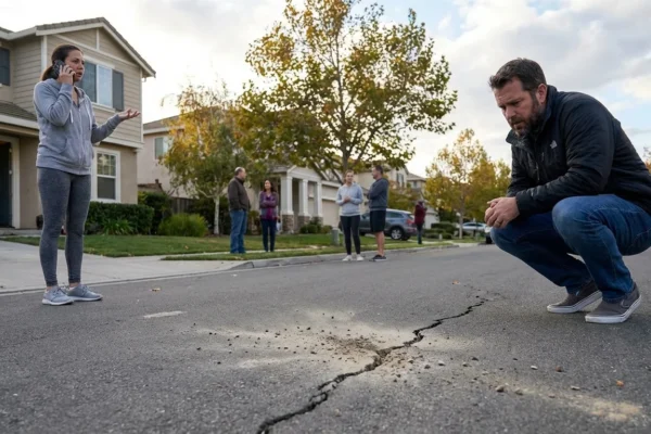
Flooding risk is highest in low lying areas, near poor drainage, and where heavy rain trains over the same spot. Water can hide road damage and deep holes.
Here is a quick checklist for the rest of today:
- Charge phones and backup batteries.
- Clear leaves from street drains if you can do so safely.
- Keep a rain jacket, sturdy shoes, and a small towel in the car.
- Set wireless alerts and follow local updates.
- Avoid flooded roads and parking lots.
If you must drive, slow down, leave extra space, and use headlights. Most hydroplaning happens under 45 mph on worn tires.
[IMAGE_3]
Sustainability and the longer view
Days like today are a preview of a wetter, stormier future for Tampa Bay. Communities are adapting with more green space that can soak up rain, smarter stormwater basins, and raised roads in flood prone corridors. Homeowners can help too. Native plants, rain gardens, and rain barrels cut runoff. Permeable pavers let water sink in instead of racing to drains. Small steps add up when many neighbors join in.
Cutting greenhouse gas pollution also matters locally. Less warming means cooler seas over time, and that can limit the fuel for extreme rain. Support clean energy, efficient transit, and walkable plans. These choices reduce risk while improving daily life.
Strong finish, Tampa has handled days like this before, and smart choices make a real difference. Keep your gear nearby, watch the sky, and look out for neighbors in low areas. Today’s storms will pass, but our long term work to build a safer, greener, and more flood ready city continues. ⚡


