
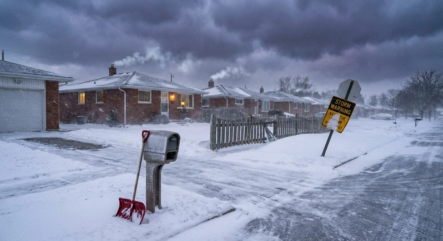
BREAKING: Storm warnings blanket millions as snow, ice, and dangerous cold surge east
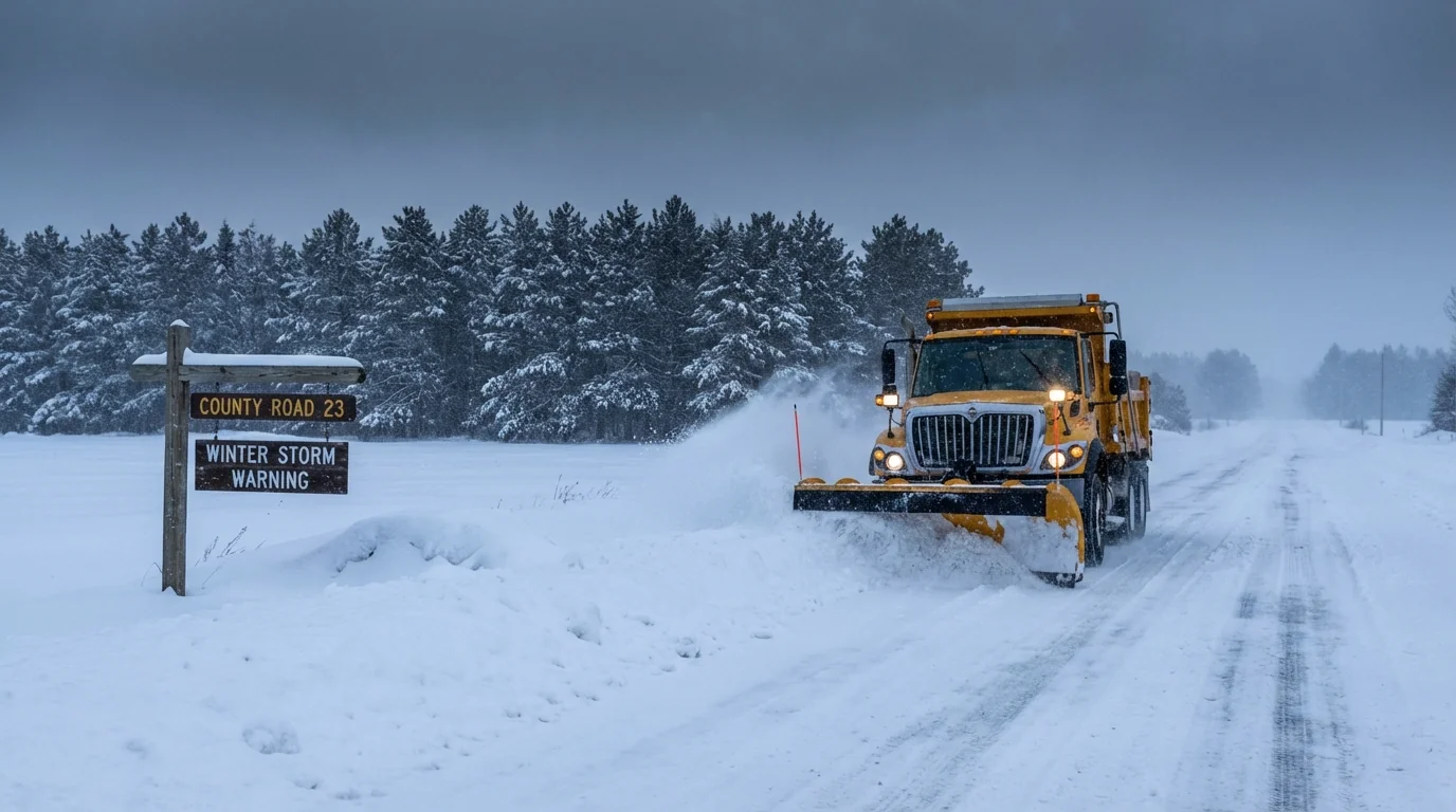
A powerful post Christmas winter storm is rolling across the Upper Midwest and Northeast tonight, and it is hitting hard. Winter Storm Warnings now cover more than 23 million people. Heavy snow, pockets of damaging ice, and winds over 40 miles per hour will make travel dangerous and power outages likely.
Wind chills will plunge to near minus 20 degrees in the coldest zones, especially late tonight through Monday morning. That kind of cold can bite skin in minutes. It can also stress the power grid while households need heat the most.
Expect tree damage, scattered power outages, and very slick roads where ice accretes. Stay off untreated roads if ice is present.
Who is most at risk, and when
The Upper Midwest, including northern Minnesota and North Dakota, stays locked under heavy snow and blowing snow. Whiteout bursts will stack up drifts and cut visibility. Gusts will create ground blizzards on open roads.
The New York metro will see a messy mix. Roads can flip from wet to slick as temperatures slide toward freezing overnight. Bridges, overpasses, and sidewalks will glaze first. Commuters should expect delays early Monday.
Eyes are on New England, especially Vermont and New Hampshire. Model guidance and ground reports point to significant ice. Totals of 0.40 to 0.60 inches are possible in some valleys and foothills. That is near, and in places above, typical Ice Storm Warning levels. Expect the greatest risk from late evening into early Monday.
- Today into tonight, heavy snow Upper Midwest, mixed precipitation Northeast
- Late tonight, icing risk peaks in VT and NH valleys and foothills
- Monday morning, subzero wind chills Upper Midwest, hazardous commute Northeast
- Monday daytime, gradual taper west, lingering mixed bands in New England
What the warnings mean
A Winter Storm Warning means serious winter hazards are expected soon, or already happening. That can be heavy snow, sleet, ice, strong winds, or a mix. It signals high impact, not just nuisance weather.
An Ice Storm Warning is more specific. It flags dangerous ice buildup, often a quarter inch or more, sometimes closer to a half inch. Ice that thick can snap branches, pull down lines, and turn roads into rinks.
Winter Storm Warning, multiple hazards expected. Ice Storm Warning, substantial freezing rain and glaze, high outage and crash risk.
In this storm, many counties sit near the rain snow line. A small shift in temperature will change the outcome. One town gets plowable snow. The next town over gets a coating of ice.
Why this storm looks messy, and what climate science says
This is a classic clash. Arctic air near the ground is meeting milder, wetter air riding in from the south. Warm air above freezing passes over a shallow cold layer at the surface. Snowflakes melt into rain, then freeze on contact. That is freezing rain.
A warming climate adds a twist. Winters are warming fastest at night and in shoulder seasons. That nudges more storms into the mixed zone near 32 degrees. More moisture is also in play. Warmer oceans add water vapor to storms. That can mean heavier snow where the cold holds, and more ice where it does not.
This is why we are seeing bigger gradients during winter storms. A few miles can mean the difference between a foot of snow and a half inch of glaze. It is also why grid planning, tree care, and road treatment strategies must adjust. The new normal includes more mixed events, not just pure snow.
How to prepare now, and build resilience
If you live in the warning area, act before the worst arrives. Keep travel limited once precipitation starts. Charge phones and battery packs. Set heat a bit higher now, in case of an outage later. Park cars away from large limbs. Bring pets inside.
- Stock water, shelf food, meds, flashlights, and a battery radio
- Prepare a safe heat plan, never run generators indoors
- Protect pipes, open cabinets, let faucets drip in cold spots
- Check on neighbors, especially elders or those without reliable heat
Salt smart and early, but do not overuse it. Clear storm drains, that reduces refreeze and protects streams. If you lose power, close interior doors, wear layers, and use only approved backup heat.
Cities and utilities can cut risk too. Prune problem trees along feeders before winter. Harden critical circuits and add microgrids at hospitals and shelters. Bury the most outage prone lines where feasible. Expand warming centers near transit. These steps save lives during ice events and deep cold.
Local notes
New York metro, prepare for a slick morning commute. Expect slushy snow north and west of the city, with icy spots on ramps and bridges. Give plows room and watch for black ice on shaded streets.
Vermont and New Hampshire, this is an ice heavy setup in selected valleys and foothills. If you rely on a well, fill bathtubs now for flushing. If you depend on electric heat, identify a backup warm place before the freezing rain starts. Power crews may need time to clear lines if icing tops half an inch.
The bottom line
This storm is high impact and fast changing. More than 23 million people are under warnings for a reason. Heavy snow, damaging ice, strong wind, and dangerous cold will stretch from the Upper Midwest to New England into Monday. Make your moves now, stay off risky roads, and follow local alerts. I will continue to track the shift zone and update on any Ice Storm Warnings in Vermont and New Hampshire. Stay warm, stay safe, and take care of each other. ❄️


