BREAKING: Sleet or snow, Texas, the difference decides if you slide or stay safe tonight
What you are seeing right now
A winter storm is pushing across Texas. Houston, San Antonio, and the Hill Country are in the crosshairs. Temperatures near the ground are close to freezing in many spots. Just a few hundred feet up, a thin layer is warmer. That setup is a classic ice maker. It favors sleet and pockets of freezing rain over fluffy snow.
I am tracking a shallow warm layer aloft over southeast and south central Texas. Cold air is dense, so it sits low. Gulf moisture is riding up and over it. That is why your windshield may ping with pellets in one neighborhood and glaze over in another. The type of precipitation changes over short distances tonight and into Saturday.
Sleet vs snow vs freezing rain
Here is the simple truth. Snowflakes form high in the cloud and stay frozen all the way down. Air from cloud to ground remains below freezing. The flakes reach you soft and quiet. Roads can get slick, but traction is often better than with ice.
Sleet starts as snow high up. It falls through a warm slice of air, melts into droplets, then drops into a cold layer near the ground. It refreezes into tiny ice pellets before landing. Sleet bounces. It sounds like sand hitting your car. It piles up fast and turns roads into marbles.
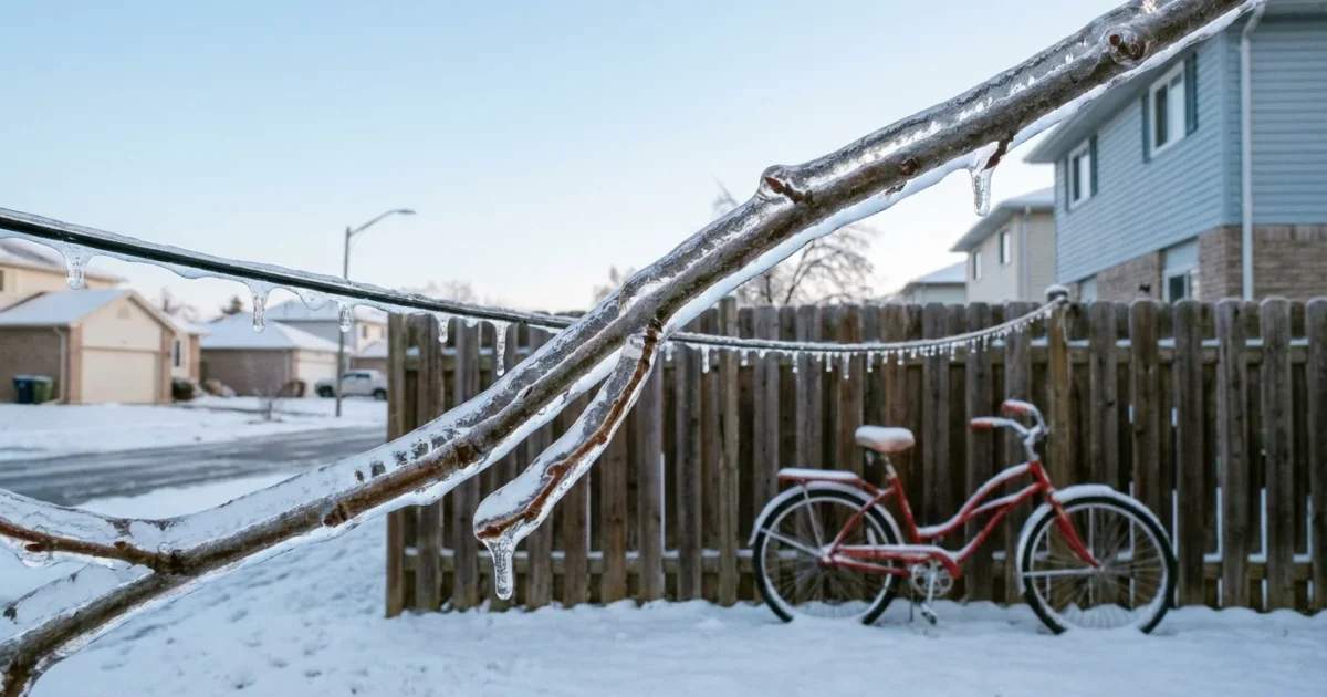
Freezing rain is different. The droplet stays liquid in the air. The air near the ground is below 32 degrees. The droplet freezes the instant it touches a surface. That creates glaze ice. It is smooth, hard, and heavy. It can snap tree limbs and power lines.
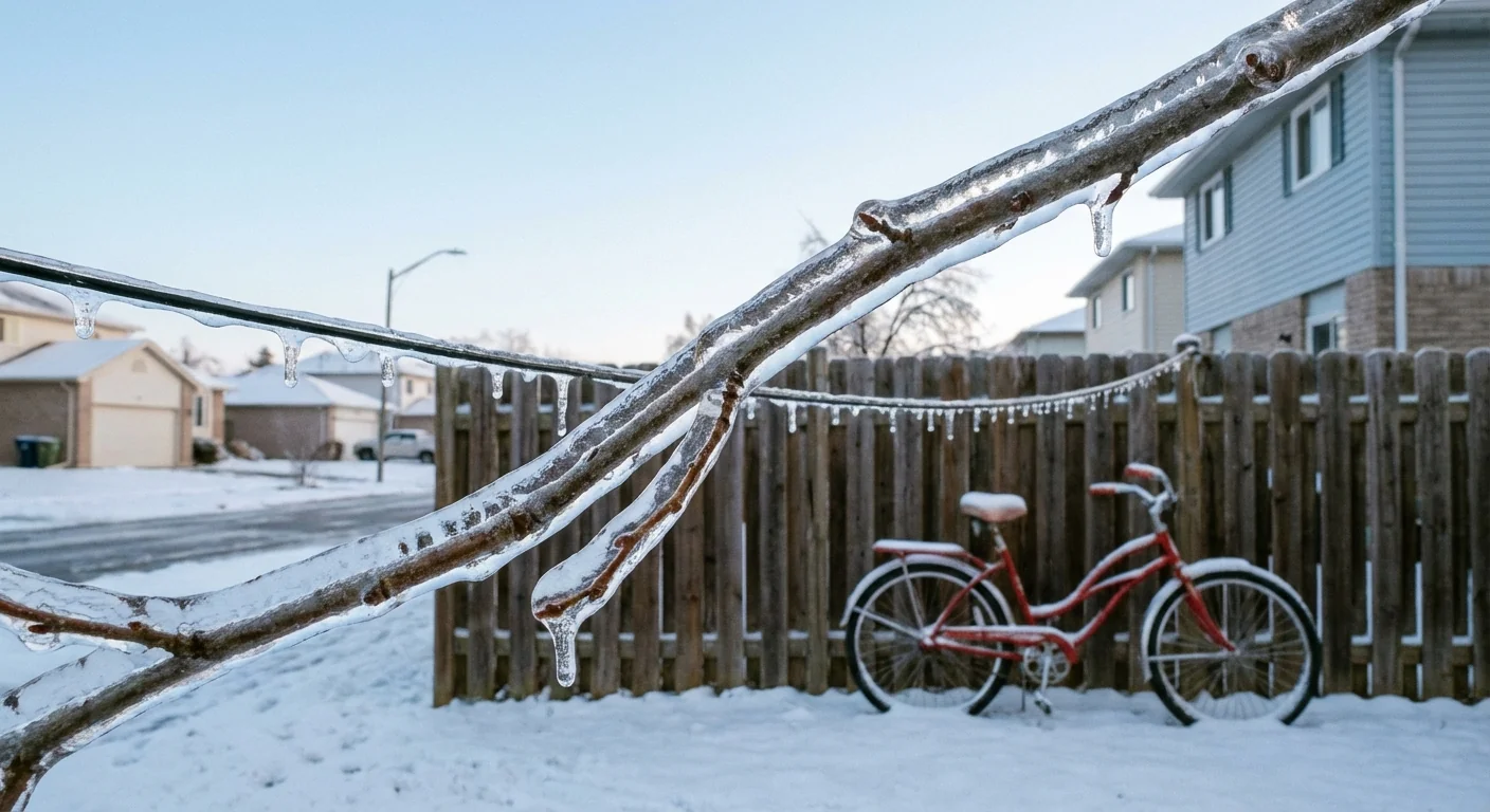
If it pings and bounces, it is sleet. If it coats and turns glass milky, it is freezing rain. If it floats and quiets the world, it is snow.
Why Texas is getting ice tonight
Think of the atmosphere like a layer cake. Bottom layer, very cold. Middle layer, a thin slice a bit above freezing. Top layer, cold again where snow forms. When that middle slice is shallow, sleet wins. When it is a touch deeper and closer to the ground, freezing rain takes over. Pure snow needs no warm slice at all.
Tonight’s profile favors sleet from the I‑10 corridor north and west. It favors freezing rain where the warm slice reaches lower, often closer to the coastal plain. The exact line slides as the storm breathes. A few miles can flip the script.
Bridges and overpasses ice first. They chill on all sides and lose heat fast. Avoid them if at all possible.
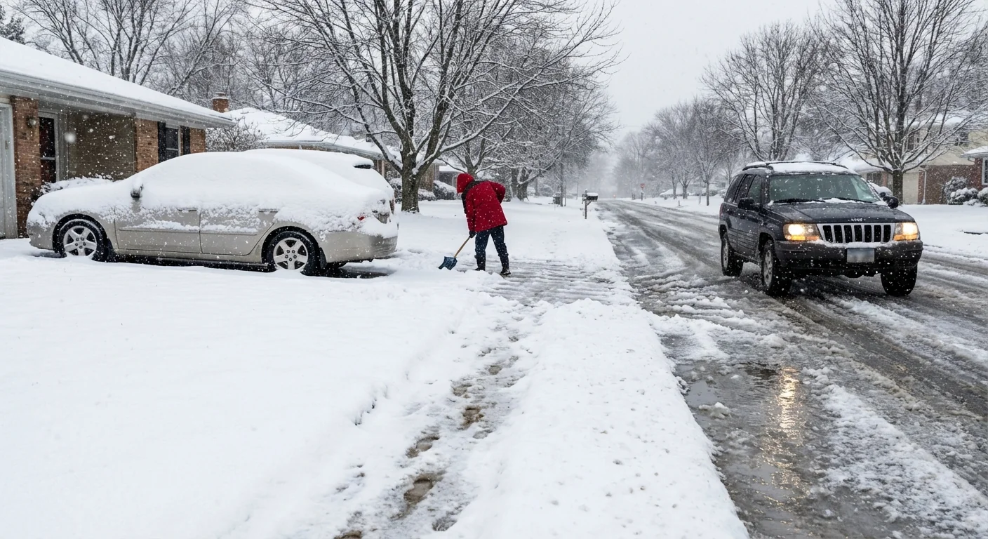
Travel and power impacts
Sleet and freezing rain are not just a nuisance. They are high impact. A thin glaze creates a crash risk within minutes. Road crews need time to pretreat and plow, and chemicals work slowly in cold rain. Power crews face falling limbs and slick access.
If you must drive, use these steps:
- Slow down and leave triple the usual space
- Avoid elevated roads and ramps
- Brake gently, steer smoothly, and do not use cruise control
- Delay trips, or take transit if it is operating
Lines can ice where freezing rain is steady. Tree limbs can bend and break. That can interrupt power in pockets, especially on the edges of colder air. Reduce load at home to help the grid. Lower your thermostat a few degrees. Turn off nonessential lights. Charge devices now.
Preheat your home, top off your car, and bring in pets. Keep a warm coat, water, snacks, and a phone charger in your car.
The climate signal and smarter choices
This is winter weather in a warming world. The background climate is warmer on average. The air can hold more moisture. Cold outbreaks still punch south, but they meet juicier air. That mix builds more marginal events with a warm layer aloft. The result can be more sleet and freezing rain in places that used to see dry cold, including parts of Texas.
Cities can adapt and cut risk. Weatherize the grid and critical stations. Trim urban trees with power safety in mind. Upgrade building insulation to hold heat. Expand de‑icing plans that match mixed precipitation, not just snow. Use brine carefully and target it where needed. Heavy salt runs off into bayous and bays and can harm fish and plants. Sand and beet‑based brines can reduce salt use and protect waterways when applied correctly.
Smart choices save money and lives. Drive less in ice. Carpool or delay freight when possible. Keep stormwater drains clear so meltwater does not refreeze into hidden sheets.
Bottom line
The type of wintry precipitation depends on the sky’s layers. Tonight and Saturday, Texas sits under a thin warm slice aloft. That means sleet for many, with pockets of freezing rain. Both can outmatch pure snow for road danger. Expect slick bridges, slow travel, and spotty power issues where glaze builds. Stay put if you can. Keep energy demand low. This is a fast moving but high impact event, and it is part of the new winter reality in a changing climate. Stay alert, stay patient, and let the ice pass. ❄️⚠️


