
Breaking: The Skagit River is surging tonight. A powerful atmospheric river is dumping record December rain across the basin, and the river is rising toward major flood levels. Emergencies are in effect. Evacuations and water rescues are underway from Concrete to Mount Vernon. This is a fast moving, high risk situation, and the next 48 hours will decide how bad it gets.
What is happening now
A long plume of Pacific moisture has parked over western Washington. It is pouring over the North Cascades and feeding straight into the Skagit River system. Mountain slopes are taking the heaviest hit, and that runoff is racing downstream. Low lying neighborhoods and farm fields are already taking on water. Key roads are closed. Crews are sandbagging, and shelters are open.
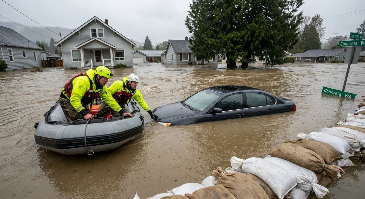
In Concrete, the river pushed past major flood stage, and more water is on the way. In Mount Vernon, officials have declared an emergency as the surge moves downstream. Levees and barriers are being watched around the clock. First responders are pulling people from stranded cars and flooded homes.
If you live in a flood zone and are told to evacuate, leave now. Do not wait for the next crest.
Why this storm is so intense
This is an atmospheric river at Category 4 to 5 strength. Think of it as a sky river thousands of miles long, loaded with tropical moisture. Warm air holds more water, so when it hits our mountains, it releases massive rain. Freezing levels are high, so rain is falling at elevations that often see snow in December. That means more liquid water and faster runoff into the Skagit and its forks.
Climate plays a role here. Warmer oceans and air are giving these moisture plumes more fuel. The heaviest atmospheric rivers are getting wetter. That raises the odds of floods that push past old benchmarks.
Forecasts and risk to records
Multiple crests are expected between December 9 and 12. The first surge peaked upstream, and the second, larger wave is moving through the valley now.
Concrete
Forecasts show a first crest near 35 feet around Tuesday morning, then a higher peak early Thursday. That second peak could reach the upper 30s. Worst case guidance has hinted at a spike near 40.6 feet. Major flood stage is around 32.5 feet, so every extra foot matters for homes, roads, and farms near the channel.
Mount Vernon
A first peak near 34 feet is expected tonight into early Wednesday. A higher crest is projected for early Friday. That second peak could reach 36 to 37 feet, which is near the highest levels measured since 1951. Major flood stage is near 32 feet in town. That threshold is already in play for many levee protected areas and unprotected lowlands.
Crest windows can shift by a few hours. Small timing changes mean big differences on specific streets. Check official river gauge updates often.
Hydrology explains the double peaks. Mountain rain arrives first upstream, then pulses downstream. More rain on saturated ground adds a fresh surge. That is why we may see one crest, a lull, then a higher crest. Prepare for both.
Safety and response
Rescue teams are active across the valley. County emergency managers have opened shelters, stocked sandbag stations, and raised operations to high alert. Some infrastructure is already flooded. Mudslides are possible on steep, rain soaked slopes.
Here is what to do now:
- Move people, pets, and livestock to higher ground
- Do not drive through water on roads, turn around every time
- Pack meds, chargers, documents, and a flashlight, leave before dark if asked
- Shut off breakers if water threatens outlets, then get out
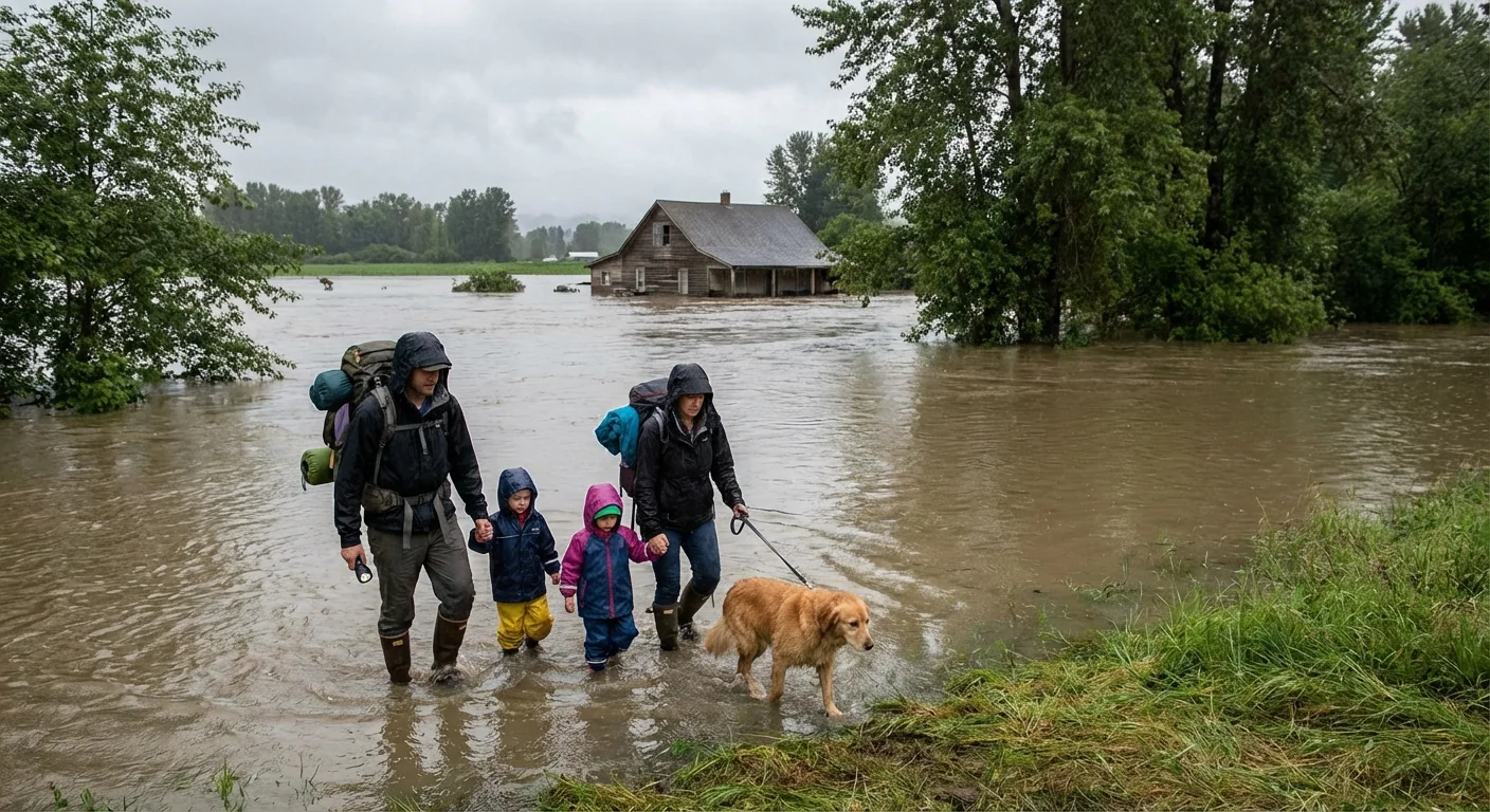
Park vehicles on high ground. Elevate furnaces, freezers, and well pumps if you can. Take photos for insurance before you leave.
Water levels can rise quickly, especially overnight. Keep your phone charged. Keep a radio on. Help neighbors who may not get alerts.
Conclusion
The Skagit River is in a dangerous rise, powered by an extreme atmospheric river and warmed by a changing climate. Multiple crests are lining up through Friday, with levels that threaten to match or top mid century highs. The science is clear, and the impacts are already here. Protect life first. Follow evacuation orders. Keep off flooded roads. The river will decide its final level in the next 48 hours. Our actions now will decide the rest.


