
BREAKING: Coastal Flood Advisory Hits NYC and North Jersey Friday
A coastal flood advisory is now in effect for parts of New York City and the New Jersey shoreline, including low-lying areas of Bergen County. Strong onshore winds and heavy rain arrive with Friday’s high tides. The setup will push water into bays, harbors, and river mouths. Expect minor to locally moderate flooding, with fast travel slowdowns and scattered road closures.
What This Advisory Means, Plain and Simple
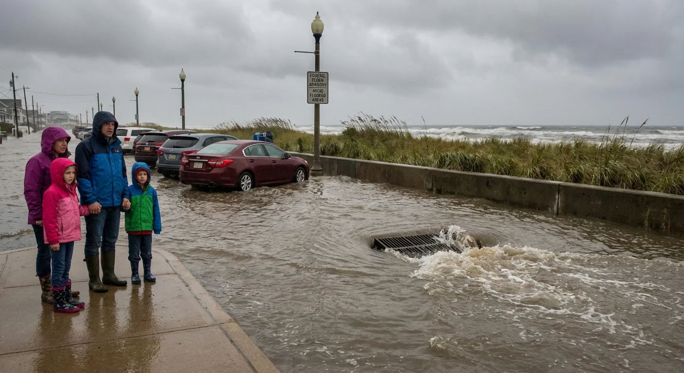
This is not a life-threatening storm surge. It is the kind of flood that fills curb lanes, swamps underpasses, and chews at dunes. Basements near the shore can take on water. Storm drains can back up. A few inches where you drive can become a foot where the wind piles water against a seawall.
High tide timing is the key. An ordinary storm, if it hits at the wrong hour, can cause real problems. Friday’s tide cycle lines up with the wind and rain, which raises the risk in waterfront blocks and low spots near inlets.
Tide plus wind equals higher water. The match between peak wind and high tide is why this advisory matters.
Rising water will cover some low-lying roads and waterfront paths for a few hours around each high tide. That window usually includes the hour before and the two hours after the peak. Plan for brief but disruptive flooding, then a slow retreat as the tide falls.
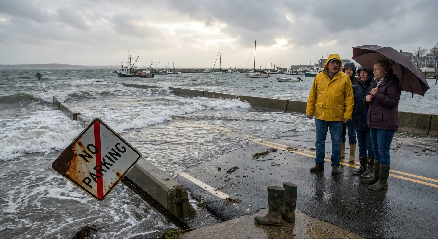
Who Is In The Water’s Path
Back-bay flooding is the big concern. Water is being pushed into the New York Harbor system and trapped in narrow channels. That pinches the flow and raises levels on the edges.
- Staten Island east and south shores, including Midland Beach and Great Kills
- Brooklyn waterfront, Red Hook to Coney Island and Sheepshead Bay
- Lower Manhattan and South Street Seaport
- Queens shoreline, Rockaways and Broad Channel
- Hudson River and Hackensack waterfronts, Hoboken, Jersey City, Edgewater, and Bergen County low spots
Waterfront parks, bike paths, and some coastal roads may go under. Expect ponding near storm drains as heavy rain overlaps the tide. Ferries and rail near the water could see delays if docks or tracks are swamped.
Timing, Travel, and What To Expect
Winds turn onshore and strengthen into Friday, with gusts pushing water toward the coast. Rain bands will be heavy at times, which limits visibility and overwhelms drains. The worst flooding risk comes during the morning high tide, with a second round possible with the evening tide.
Roadway trouble spots include underpasses, ramps near rivers, and sections of the FDR Drive and Harlem River Drive during peak water. Waterfront routes in Hoboken and Jersey City often see quick spikes. Bergen County creeks that empty into the Hackensack and Overpeck can back up when the tide is high.
Do not drive through flood water. You cannot see hazards under the surface. Turn around. 🚧
Transit riders should build in extra time. Local detours may pop up with little notice. Side streets in flood-prone blocks can close for an hour or two, then reopen as the tide drops.
Why This Keeps Happening
Here is the climate link. Sea level in our region has risen about a foot over the past century. That higher baseline means smaller storms now reach higher on our streets. Tidal flooding that once felt rare now returns with more frequency. Add stronger onshore winds and heavier bursts of rain, and you get compound flooding. The water comes from both the sky and the sea, at the same time.
Shoreline shape also matters. Our bays and tidal rivers act like funnels. They focus the wind-driven water into tighter spaces, which lifts water levels faster. Bulkheads and seawalls protect against waves, but they reflect water and can worsen street flooding when drains cannot empty at high tide.
What To Do Right Now
Move early, not after the water rises. Give yourself room to adapt. A few simple steps lower your risk.
- Move vehicles off low-lying streets and waterfront lots
- Avoid driving through water, use alternate routes
- Secure trash bins, construction materials, and outdoor gear
- Expect transit delays and allow extra time
- Track local tide times and advisories
Park on higher ground before the tide window. Save a photo of your route options in case apps lag.
For Homes and Businesses
Clear leaves from drains and stairwell grates. Lift items off basement floors. If you use a pump, test it before the rain. Keep important items in sealed bins. If you live on a flood-prone block, tell a neighbor your plan. Simple checks now prevent messy cleanup later.
The Bottom Line
Coastal flooding will be uneven, brief, and disruptive. Most of it will be minor, but pockets of moderate inundation are possible where wind and tide stack up. Respect the water. Time your trips around the high tides. Coastal flooding is becoming a more regular visitor in our region, and today’s advisory is another reminder. Prepare early, travel smart, and stay alert as conditions change. 🌊


