BREAKING: Ice is taking hold across metro Atlanta. Freezing rain from Winter Storm Fern is glazing roads, snapping at tree limbs, and pushing the power grid to its limits. I am tracking conditions in real time as WSB-TV keeps continuous coverage on the air. Travel is hazardous. Disruptions are mounting by the hour. ❄️
What Atlanta needs to know right now
Freezing rain and sleet are coating streets from the Perimeter to the foothills. Bridges and overpasses are the first to freeze. Side roads are turning slick as ice builds. Driving tonight is dangerous, even for short trips. Authorities are urging people to stay off the roads.
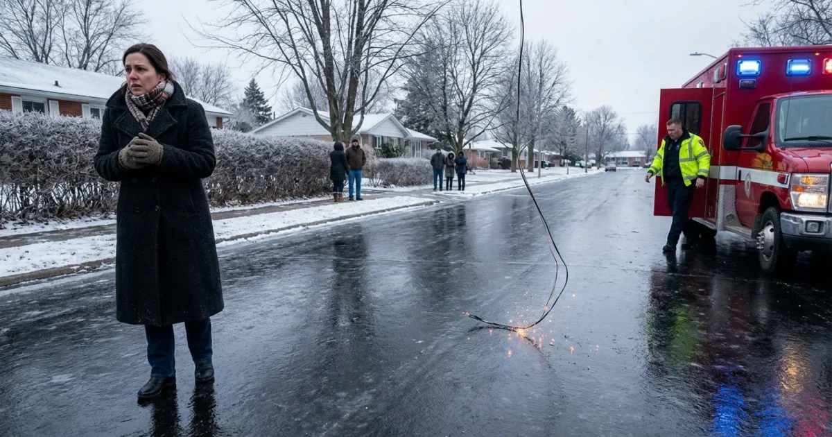
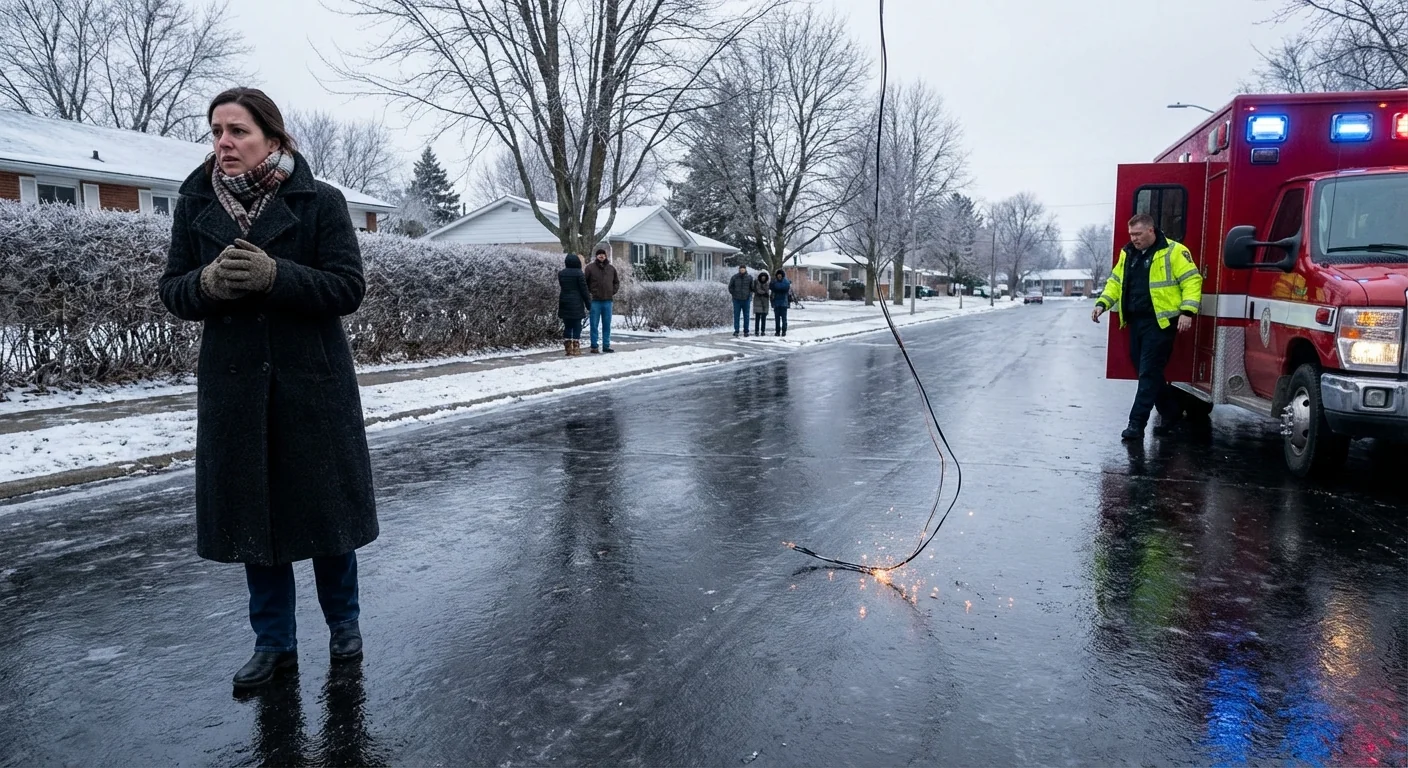
Ice is also loading trees and power lines. That raises the risk of outages as the storm continues. Expect limbs to crack without warning. Crews are ready, but access will be slow on icy streets.
Air travel is already hit hard. More than 1,000 flights are canceled at Hartsfield-Jackson Atlanta International Airport. If you do not need to travel, do not. If you must, check your airline before you leave, then check again.
WSB-TV is running live updates on road conditions, outages, school and office closures, and the forecast timeline. Keep a battery backup for your phone so you can stay connected if the lights go out.
Black ice is invisible. If you cannot see pavement texture, assume it is ice. Downed power lines can be live. Stay at least 30 feet away and call 911.
Why this storm is so dangerous
This is classic freezing rain. Warm air sits a few thousand feet up, melting snow into rain. Near the ground, shallow cold air chills those drops below 32 degrees. They freeze on contact, forming a clear glaze. It looks pretty on pines, but it is heavy and destructive.
A quarter inch of ice can snap weak branches. A half inch can bring down large limbs and power lines. Sleet helps a little, since it bounces and builds less glaze. But tonight, freezing rain is winning in wide parts of the metro. Expect more icing as long as surface temperatures hold near or below 32.
This pattern fits a warming world in a key way. A warmer atmosphere can carry more moisture. When that moisture rides over shallow cold air, the Southeast can get ice instead of snow. That makes storms like Fern high impact, even without deep cold.
Keep WSB-TV on in the background. Their live map updates, outage trackers, and timing changes will help you plan hour by hour.
Getting around, or staying put
The safest choice is to stay home until temperatures climb and crews treat the roads. If you have to go out, plan like a pro.
- Slow to a crawl and leave long gaps.
- Avoid bridges, overpasses, and steep hills.
- Do not slam brakes, steer gently, and do not use cruise control.
- Pack a small kit with water, snacks, a blanket, and a phone charger.
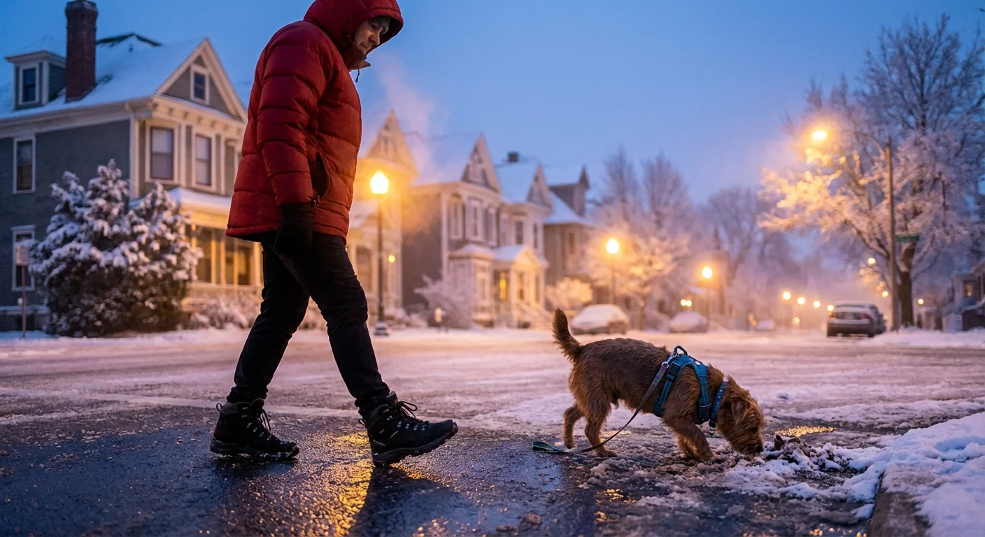
If you walk, use shoes with traction. Treat every dark patch as ice. Keep pets on a short leash, and rinse paws after any deicer contact.
Power, trees, and the grid
Tree stress tells the story tonight. Evergreen pines carry more ice, so they shed limbs first. Mixed hardwood streets will follow if icing thickens. If the lights blink, reduce your load to help the grid stabilize. Turn off extra lights. Lower the thermostat a few degrees. Avoid running ovens and dryers at the same time.
Prepare for a short outage. Charge devices now. Fill a few bottles with water. Know where your flashlights are. If you use a generator, run it outside, far from doors and windows. Never use a grill or oven for heat. Carbon monoxide is deadly and has no smell.
City crews will move as conditions allow. Give them space. Do not clear heavy limbs overhead by yourself. The weight of ice can shift fast and cause injury.
Climate context and what comes next
The Southeast is warming, yet winter risk is not leaving. It is changing. Warmer oceans feed moisture into Gulf storms. Shallow cold air from the Appalachians can undercut that flow. The overlap zone is where ice storms bloom. That is metro Atlanta tonight.
Long term, we can blunt the damage. Strategic tree pruning, stronger utility poles, and selective undergrounding protect lines. Home weatherization cuts energy spikes in cold snaps. Heat pumps with smart thermostats ease demand, especially when paired with better insulation. City planning can prioritize shaded streets in summer and hardened lines in winter. Resilience is climate action you can feel on a night like this.
The bottom line
Stay home. Stay warm. Stay connected. I will keep tracking this as WSB-TV continues live coverage of Winter Storm Fern. Expect more icing through the evening, scattered power issues, and limited travel. Check on neighbors, especially seniors. The thaw will come, but the next few hours matter most.


