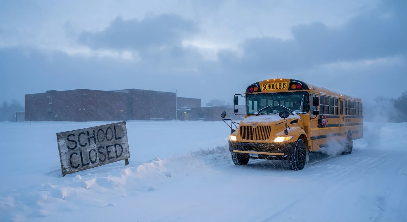
Breaking: A fast‑building winter storm is shutting classrooms across Mid‑Michigan today. I am tracking a second, heavier burst of snow that hits hardest before sunrise and through the morning drive. Many districts in Tuscola and Sanilac counties, and nearby areas, have closed for Wednesday, December 10. Safety on rural routes, icy side streets, and limited visibility are driving the decision.
What is closed today
The closure map is wide. Bad Axe, Caseville, Cass City, Deckerville, Elkton‑Pigeon‑Bay‑Port‑Laker, Harbor Beach, North Huron, Ubly, and Unionville‑Sebewaing are closed. Carsonville‑Port Sanilac, Marlette, Sandusky, and the Sanilac Career Center are also closed. Akron‑Fairgrove, Caro, Kingston, Mayville, Millington, Reese, and Vassar have called off classes as well. Technical centers in Huron and Tuscola are closed.
There are a few child care notes. Cass City says child care remains open. Marlette says no daycare today. Kingston will close daycare. North Huron includes the Early Learning Center in its closure. Some districts kept early dismissal as a backup, then pivoted to closures as snowfall rates rose.
Travel will be most hazardous from midnight to 6 am, with snowfall rates that can top 1 inch per hour.
The storm setup and what to expect
This is the second wave in a two‑part event. The first round primed roads with a light glaze. The second round builds late tonight. Advisories run from 10 pm through 4 pm Wednesday. Snow peaks before dawn, then slowly eases after late morning. Most spots land at 3 to 6 inches. A few lake‑enhanced bands can push totals past 6 inches where lift is strongest.
The snow is heavy and wet. Pavement cools fast before sunrise, so slush flips to ice in spots. Wind is modest, but sticky snow will cling to branches and lines. That raises a low, but real, risk of scattered outages. Side streets, bus turnarounds, and rural county roads will be slow to clear before the first bell.
Heavy, wet snow adds weight to weak limbs and older roofs. Clear entries in stages and lift with your legs.
Climate context
Storms like this draw on abundant Great Lakes moisture. Fall and early winter lake warmth has lasted longer in recent years. That keeps the low levels humid and can juice snowfall rates when cold air finally arrives. Year to year swings are large, but the long trend shows bigger downpours and heavier snows in narrow windows. We are seeing that pattern today, short, intense bursts that hit the commute.
How districts made the call
Superintendents were on the phone with transportation leads and county road crews before dawn. Plow timing and bus safety ruled the morning. Many districts planned for early dismissal, then faced a harder truth. If the heaviest snow targets the first pick‑ups, it is safer to cancel early. Career centers and ISD programs followed suit to keep routes consistent.
I am watching pavement temperatures and radar trends closely. Bands will wobble along county lines. That makes hyper‑local calls tough. The guiding principle is clear. If snow rates exceed clearing rates near first bell, buses should not roll.
Safety, travel, and sustainability
Plan for slick travel into early afternoon. Lower speeds and longer stops are key. Keep a full tank and a winter kit in the car. If you must shovel, take breaks. Wet snow is dense. Clear the downwind side of driveways first so plows do not rebury you.
Salt works slowly near 15 to 20 degrees. Use it sparingly. Sand or fine grit adds traction with less runoff. Keep piles away from storm drains to protect streams.
If power blinks, unplug sensitive gear, close interior doors to hold heat, and keep fridge doors shut to save cold air.
- Parents, check your district page for remote learning plans.
- Daycares may have different hours, confirm before heading out.
- Teen drivers should delay travel until crews make a first pass.
- Pet owners, clear a safe pad so paws avoid salt.
What comes next
Snow lightens after late morning, then tapers in the afternoon. Crews will catch up once the peak band passes. Temperatures hold near freezing today, then dip tonight. Refreeze will create black ice on untreated roads and sidewalks. Another weak clipper may brush the Thumb later this week, but no major storm signal follows right now.


