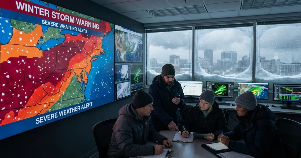
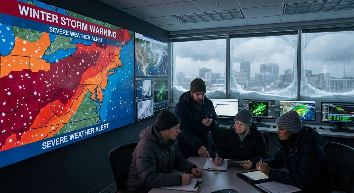
BREAKING: Winter Storm Warning Map Lights Up As New York Takes Biggest Snow In Years
A fast building winter storm has dropped the heaviest snow New York has seen in nearly four years. Flights are snarled, roads are slick, and plows are racing the clock. I am tracking live alerts across the region. Winter storm warnings are active from the city to the northern suburbs, with bands of heavy snow still rotating in. Power crews are addressing scattered outages on Long Island as wet snow clings to lines and tree limbs.
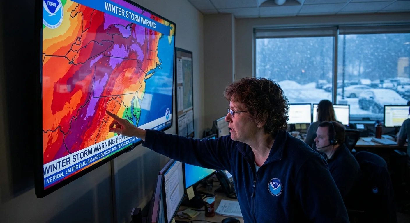
How to read the winter storm warning map
The winter storm warning map is your first filter. It shows where the worst conditions are likely. Warnings mean a high chance of dangerous snow, wind, or ice in the next 24 hours. Advisories point to lower impact, often where totals or winds are less intense.
Color codes at a glance
On most official hazard maps, pink means a winter storm warning. Purple means a winter weather advisory. If you see deep red in coastal zones, that is often for high wind. Overlay snowfall forecasts and radar to see how the warning connects to real conditions. Heavier snow often shows up as darker blues on accumulation maps and as bright bands on radar.
Timing and totals
Check the start and end times in the warning box. That window tells you when travel is riskiest. Look at the snowfall forecast map for bands, not just the top number. Tight gradients can swing totals a lot from one neighborhood to the next. In today’s setup, the coastal low is funneling Atlantic moisture west into colder air. That pairing is ideal for rapid accumulation.
Tap your county on the warning map to open the full text alert. It lists timing, hazards, and official advice.
Build a clear picture by combining maps
No single map answers every question. I advise layering these tools before you head out:
- Hazard and snowfall maps for the where and how much
- DOT road condition maps and cameras for the now on pavement
- Airport status boards or flight trackers for delays and cancellations
- Utility outage dashboards to see if power is unstable near you
This storm shows classic coastal low behavior. The track hugs the shoreline, pulls in deep moisture, then pivots a heavy snow band over the metro. That band aligns with the most intense warnings. Road cameras confirm slushy to snow covered lanes in the hardest hit corridors. Airport traffic managers are spreading out takeoffs to keep deicing lines moving, so expect knock on delays even after the snow eases. On Long Island, wet snow and gusts are producing a few localized outages, mainly where trees hang over lines.
If visibility drops below a quarter mile, do not push through whiteout. Exit safely and wait for conditions to improve.
Step by step: Use the warning map to make a travel call
- Find your location, then read the warning start and end times.
- Check the snowfall forecast map for your zone and the one upwind.
- Open road cameras on your route. Look for plow passes and lane visibility.
- Confirm your airport status or transit changes before leaving home.
If all four signals point to deteriorating conditions, delay non essential travel. If you must go, slow your target speed, leave twice the distance, and pack a winter kit.
Why this snow is so intense, and what climate has to do with it
Snow is simple physics. Cold air meets deep moisture, crystals grow, and gravity does the rest. Today, ocean fed moisture is abundant. Sea surface temperatures off the Mid Atlantic have run warmer in recent winters. Warmer water loads storms with extra vapor. When a strong low intersects a pocket of subfreezing air, that extra moisture can fall as heavier snow. That is why we sometimes see sharp, high impact bursts even in a warming climate. Fewer cold days on average, yet bigger precipitation when cold and storm track line up.
This has real costs. Plow fleets burn more fuel, and salt use can spike. Salt runoff harms streams and trees in the thaw. Smarter road prep matters. Targeted brine before onset and measured salt after plowing cuts waste and keeps traction.
What to do now
Stay map literate as the storm evolves. Watch for the warning map to shift to advisories once the core band slides east. That lag is your cleanup window. Clear sidewalks in stages so ice does not lock in. Keep storm drains open to prevent street flooding when temps bounce above freezing.
Pack a simple storm kit if you travel. Include water, snacks, a phone charger, a small shovel, a blanket, and sand or kitty litter for traction. Conserve battery power if your area loses electricity. Lower your thermostat a degree or two if you have stable power, it eases strain on the grid and helps neighbors in outage zones.
This storm will pass, but the pattern will return. Warmer oceans, more moisture, and sharp cold snaps set the stage for bigger swings. Learn the warning map now, because it is your fastest read on risk. When the colors light up, decisions get easier, and you get home safe.


