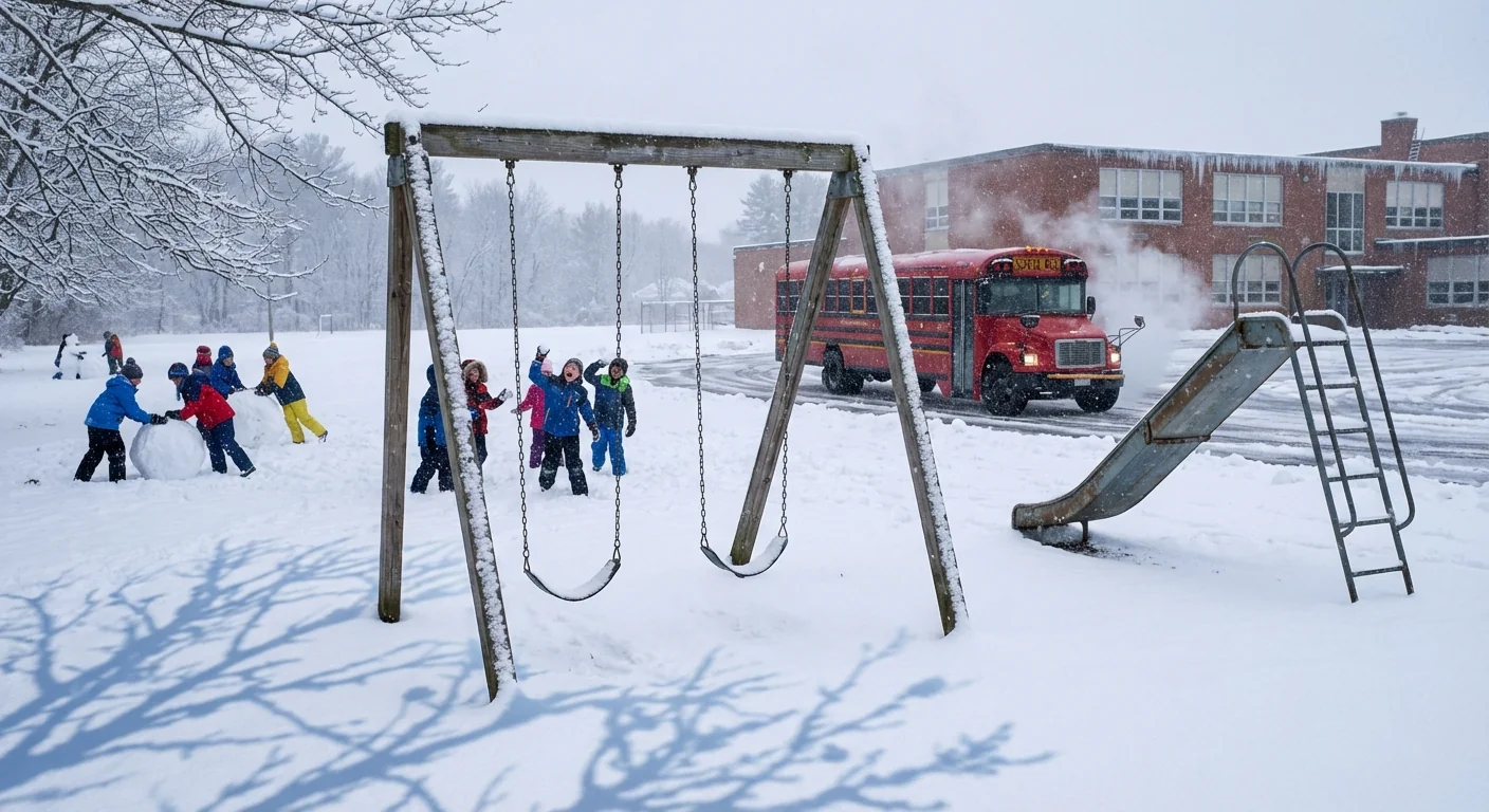
Breaking: Schools across Michigan’s Thumb and Metro Detroit are closed today as a fast winter storm locks in snow and ice. I am tracking dozens of full closures, early dismissals, and two hour delays after pre dawn bands dumped snow, glazed roads, and cut visibility. The same storm is triggering closures and delays across parts of the Midwest, the Mid-Atlantic, and into New England.
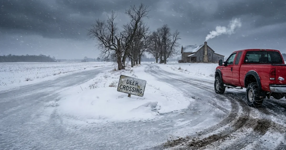
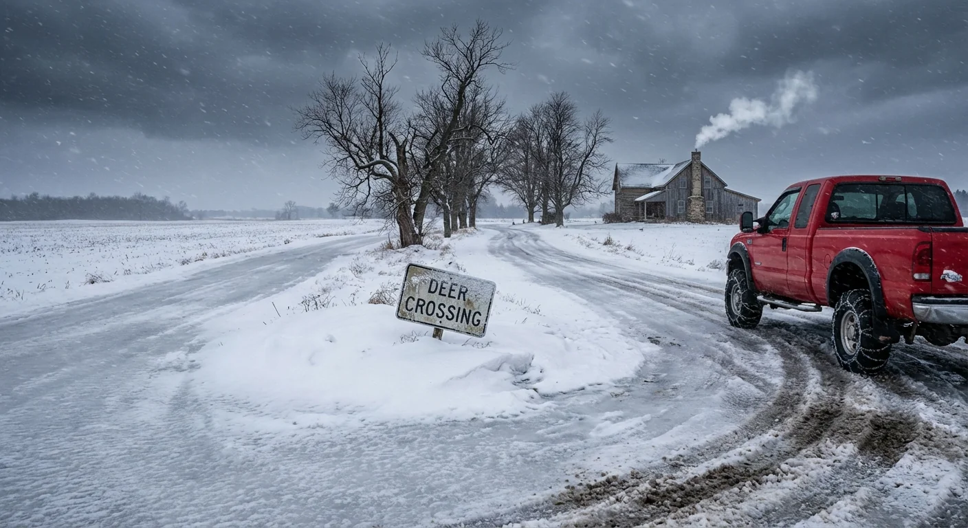
Roads are the story. Rural routes in Huron and Sanilac counties turned slick fast, then froze harder as temperatures dropped. Crews report ice under a powdery layer that hides danger at normal speeds. In places, lake effect bursts off Saginaw Bay made whiteouts. That forced the call.
What is happening now
In the Thumb, districts in Bad Axe, Caseville, Cass City, Deckerville, Harbor Beach, North Huron, Owendale Gagetown, and Ubly shut down to keep buses off untreated roads. The mix of snow and freezing rain iced intersections and gravel stretches where plows struggle to bite. Metro Detroit districts joined with widespread closures. Side streets and bridges turned slick during the morning push. Drifting has reduced lines of sight on north south routes.
This system stretches well beyond Michigan. I am confirming early dismissals and delays across parts of Ohio and Indiana. Schools in Virginia and northeastern North Carolina moved to modified schedules. Some districts around Washington, D.C., and into New England held two hour delays where a light glaze formed before snow filled in. Expect more changes if another round of freezing drizzle redevelops this afternoon.
How districts made the call
Here is how today’s decisions came together. Transportation directors started test drives before dawn. They checked hills, bridges, and rural turns where crashes cluster in early winter. Superintendents reviewed pavement temperature data, along with radar showing narrow snow bands. They stayed in constant contact with county road crews and local police. The threshold was simple, safety first. If buses could not brake cleanly on untreated stretches, or if visibility dropped below a safe margin, routes were pulled. In farm country, long distances and open fields raise the risk, even when city streets look wet but passable.
Flash freeze conditions form when wet pavement meets falling temperatures, then a thin ice film locks in under new snow.
The weather setup
This is a moisture rich January style storm arriving in early December. It carries a warm layer aloft that creates freezing rain near the surface, then flips back to snow as cold air deepens. Over Lake Huron and Saginaw Bay, cold air passing over warmer open water fueled lake effect bands. Those bands can sit for an hour, then shift ten miles, which is why some towns saw near whiteout while others saw flurries. Gusty northwest winds pushed snow into drifts across east west roads. That made plowed lanes icy again within minutes.
What it says about our climate
The Great Lakes are staying ice free longer into winter, and the water is often warmer than normal. Warmer water gives storms more moisture to work with. That can mean intense, short lived snow bands, and thicker glazes of ice when temperatures ride the freezing line. We are also seeing sharper swings between thaw and freeze. That whiplash makes black ice more common. It does not mean every storm is bigger. It does mean the pattern is less steady, and it challenges school schedules and road plans more often.
What families can do today
Closures put pressure on parents and caregivers. They also buy time for crews to clear roads. Plan for both.
- Set a simple childcare backup, like a neighbor share or a family check in.
- Charge devices and keep class links handy if your school pivots to remote work.
- If you must drive, slow down, leave space, and avoid sudden braking on shaded roads.
- Keep a winter kit in the car, with blankets, snacks, and a phone charger.
- Clear walks and steps, spread sand or salt, and check on older neighbors.
Warm up the car outside, never in a garage. Keep tailpipes clear of snow to prevent carbon monoxide buildup.
Bridges and overpasses freeze first. Even when main roads look wet, assume those spots are icy.


