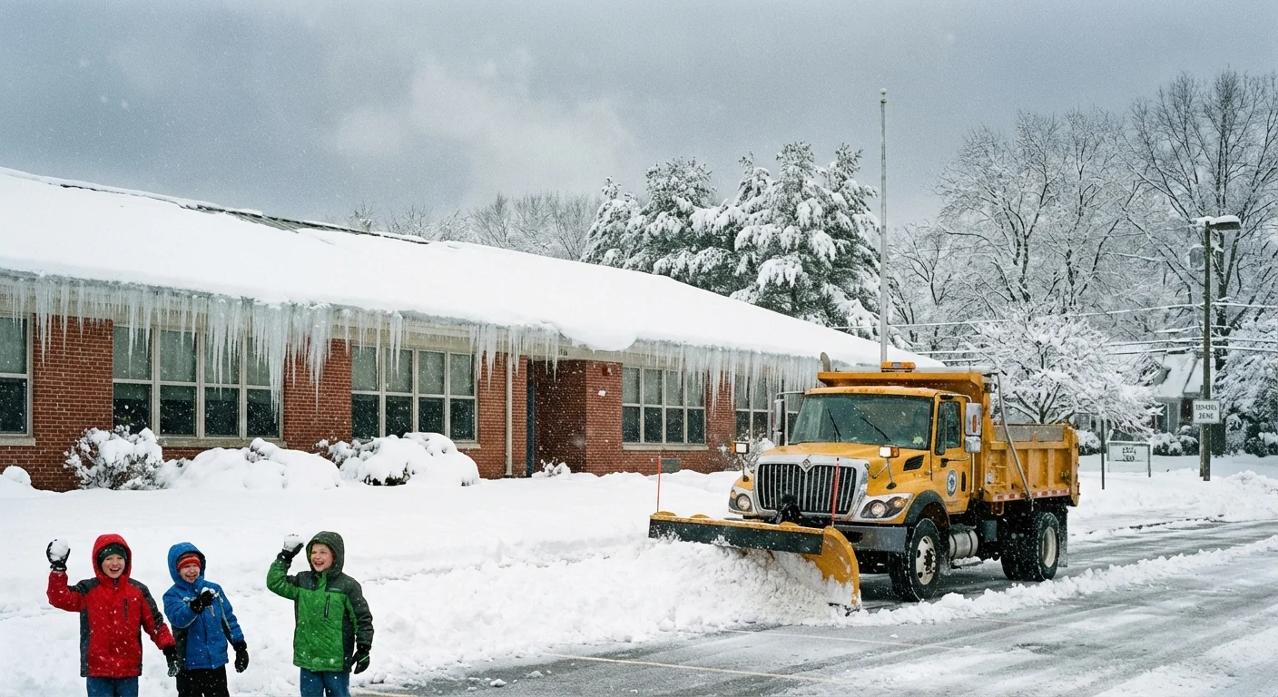
Schools Close Across Michigan’s Thumb As Ice Glazes Roads, Buses Parked For Safety
I am confirming widespread school closings this morning across Michigan’s Thumb. Black ice and drifting snow have turned early routes into a hazard. Superintendents called it early, and they were right to do so. Travel is treacherous on rural roads with open fields, and the glaze beneath the snow is catching even slow drivers off guard.

What Is Making The Roads So Dangerous
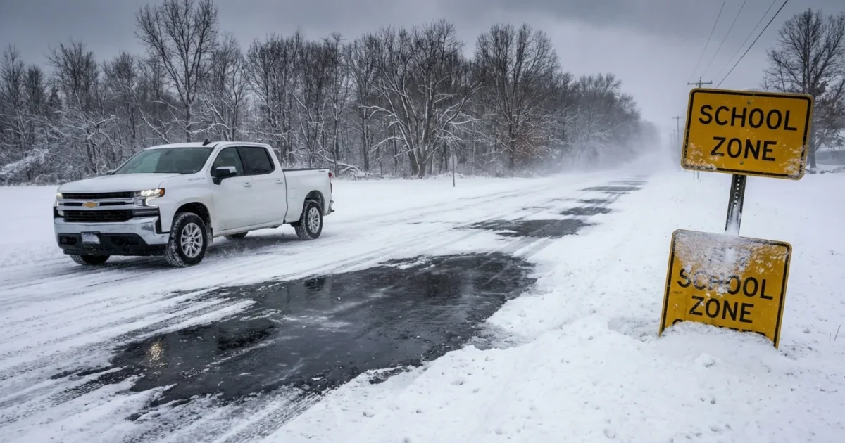
This storm arrived with air right around freezing. That is the ideal setup for an icy glaze, then a quick coating of snow. Gusts are lifting and pushing that snow back across plowed lanes. Drifts refill in minutes. Underneath, a thin glassy layer remains. That is black ice. You often do not see it until you slide.
Winds are strongest in open country. The Thumb has long straight stretches and few windbreaks. That allows snow to blow, stick, and then freeze again on pavement. Salt works more slowly in these temperatures. Refreeze is likely on shaded roads all day.
Black ice is invisible in low light. Assume bridges, curves, and untreated rural roads are slick.
Where Schools Are Closed Right Now
Closures are spread across Sanilac and Tuscola counties. I am seeing full district shutdowns, not just delays, as leaders keep buses off the ice. Here are the key clusters closed this morning:
- Bad Axe, Caseville, Cass City, Harbor Beach, Ubly
- Caro, Reese, Vassar, Mayville, Kingston
- Laker Schools, North Huron, Owendale Gagetown, Unionville Sebewaing
- Huron Technical Center, Tuscola Technology Center, Deckerville, Akron Fairgrove
The call was made before sunrise. Transportation teams reported sheets of ice below the new snow. Plows could not keep up with drifting along farm fields. Many bus routes include long gravel sections. Those roads glaze fast and offer little traction.
The same storm is slowing starts in parts of Iowa and Wisconsin. There, districts are stacking delays and select closures as bands shift. Conditions change mile to mile, and the safest choice is often to wait for daylight and salt to work.
The Climate Link, Why These Icy Mixes Are More Common
Winters are warming fastest at night. That means more events sit near freezing. Instead of dry snow alone, we get rain, sleet, then snow. The first phase leaves a thin ice film. The second hides it. That two layer setup is what we faced at dawn today.
Warmer Great Lakes also load passing systems with moisture. The Thumb sticks into Lake Huron’s fetch. Even small shifts in wind tap that moisture. The result is heavier bursts and longer periods of blowing snow. Add repeated thaw and refreeze, and you get a season of slick mornings.
Policy has started to adapt. Michigan now allows some northern districts to forgive up to 15 storm days. That takes pressure off risky calls when buses would be out at the worst time. It also pushes planning. Districts are building better remote options for days like this.
How Districts Decide
Superintendents review live road reports, bus driver checks, and weather radar before 5 a.m. They drive the worst routes. They look at bridges, hills, and open mile stretches. If ice is widespread, they close. If drifting is relentless, they close. The first duty is to get every child and driver home safe.
If your district is closed, keep cars off county roads early. Let road crews salt and scrape. Give them room to work.
What Today And Tonight Look Like
Expect winds to stay gusty through the afternoon. Drifting will rebuild in open areas. Side roads will be slow to improve. Temperatures will wiggle around freezing, so treated roads will vary block to block.
After sunset, refreeze returns. Any melt in daylight will turn slick again. If you must travel, plan daylight trips, go slow, and avoid sudden moves. Watch tomorrow’s early updates. Another round of delays is possible if winds keep drifting through the night.
Building Resilience, One Storm Day At A Time
Districts are using closures to test backup plans. Hotspots include Wi Fi hubs for students without home internet, printed packets for short closures, and radio or text alerts that reach families early. Transportation teams are refining storm routes, adding pre treatment brine, and trimming idling to cut emissions. Electric buses now in a few fleets handle cold well with proper charging, and they reduce diesel fumes at school doors.
Salt saves lives, but it can harm streams. More crews are using brine ahead of storms. It sticks to pavement and uses less salt overall. That helps budgets and waterways, and it works better in a freeze thaw pattern like today.
Conclusion
Today’s closures were the right call. A thin icy glaze hid under new snow, and winds kept roads unstable. This is the winter pattern we see more often now, near freezing, messy, and deceptive. Safety comes first, then smart recovery. Let crews work, check official alerts, and plan for another careful morning.


