BREAKING: Winter Storm Warnings Light Up From Rockies To Mid‑Atlantic
A fast Alberta clipper has slammed into bitter Arctic air today, and it is unlocking a sprawling winter storm. I am tracking active winter storm warnings from the northern Rockies and High Plains, across the Great Lakes, and into the Mid‑Atlantic and parts of the Southeast. Heavy snow, harsh wind, and bursts of sleet and ice will make travel dangerous. Some mountain zones will measure snow in feet. This storm is moving fast. The impacts will not be.
Where Warnings Are Active And What To Expect
Warnings cover Montana, Wyoming, Colorado, North Dakota, Minnesota, Wisconsin, and Michigan. Farther east, alerts stretch through parts of West Virginia and Virginia, with winter weather reaching into the Carolinas. The setup brings a tight gradient. Many communities will see a few inches. Higher terrain and far northern areas can reach 1 to 2 feet. Some Colorado mountain counties could push near 17 inches by early tomorrow.
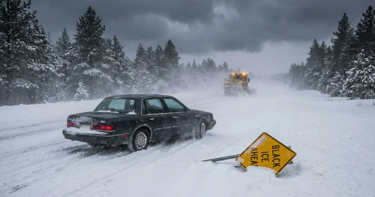
Wind is a second hit. Gusts in mountain corridors may reach 60 to 70 miles per hour, which will flip powder into whiteouts. Around the Great Lakes, 30 to 35 mile per hour gusts will blow snow across open roads. In the Mid‑Atlantic and parts of the Southeast, a snow to sleet mix will glaze roads and overpasses. That is when black ice becomes the hidden threat.
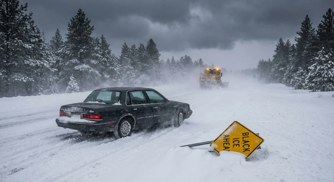
Whiteouts and ice will develop quickly, sometimes in minutes. If you cannot see road markings, pull off at the next safe exit and wait.
Why This Storm Is Happening
This is a classic cold season one-two punch. A quick Alberta clipper dragged a ribbon of moisture into the heart of Arctic air. The storm taps that cold and spins up fast. The jet stream is bent south, which lets the cold spill deep into the country. Recent disruptions in the polar vortex helped set that stage, keeping temperatures well below normal.
There is a climate layer here. The Arctic is warming faster than the globe. That pace can increase jet stream swings. When the jet wobbles, cold can dive farther south. Over the Great Lakes, warmer lake waters add fuel. That heat and moisture boost snow squalls, so snowfall rates can spike even if the storm center is small.
Who Faces The Worst Impacts
Northern Rockies and Colorado High Country
Expect the deepest totals in windward mountain ranges. Travel over passes will be treacherous. Blowing snow and avalanche risk will rise on steep terrain. Gusts can top 60 miles per hour near ridgelines.
Upper Midwest and Great Lakes
North Dakota to Michigan faces steady snow and blowing snow. Lakeshore bands will stack on extra inches. Visibility will drop fast in open country. Rural roads can drift shut.
Mid‑Atlantic and Parts of the Southeast
This is a high impact, lower total setup. Snow will change to sleet in many valleys. A thin ice glaze is enough to lock up bridges and shaded streets. Interstates 77, 81, and 64 are problem corridors during the evening commute.
Travel And Home Safety, Right Now
If you are under a winter storm warning, make choices early. Road conditions will swing faster than forecast maps can update. Power blips are possible in the mountains and where ice forms on lines.
- Delay nonessential trips. If you must drive, keep your tank half full and your phone charged.
- Pack an emergency kit with water, snacks, a flashlight, blankets, and medications.
- At home, set heat a bit lower but steady. Open cabinet doors under sinks to protect pipes.
- Clear storm drains and downspouts. Ice needs an escape path when it melts.
Program your local NWS office on your phone, enable Wireless Emergency Alerts, and keep a battery radio for backup.

Climate, Energy, And Community Resilience
Cold snaps push energy demand higher. Hold indoor temps steady to ease strain on the grid. Use space heaters with care and never on extension cords. If you have a heat pump, keep it in normal mode. Resist emergency heat unless the unit calls for it.
Think local, too. Check on older neighbors and anyone who relies on medical devices. Share shoveling duties and salt. Electric snow blowers and shovels cut emissions and noise. Avoid idling cars while scraping windows. Idling wastes fuel and adds harmful air pollution right where you breathe.
Conclusion
This is a fast storm with sharp teeth. The blend of heavy snow, strong wind, and pockets of ice will stretch from the Rockies to the Atlantic. I will continue tracking banding shifts, wind peaks, and changeover lines as new data arrives. Stay put if you can, prepare if you must move, and keep your alerts on. Winter has arrived, and it means business. ❄️


