A coast to coast winter storm is hammering the country today. Here in New England, the focus is survival and timing. Heavy wet snow, biting wind, and a glaze of ice are moving in. Power grids are stressed. Roads are rough. This is when a local lifeline matters. In Massachusetts and across the region, WCVB, Boston’s Channel 5, is that lifeline.
What we are seeing right now
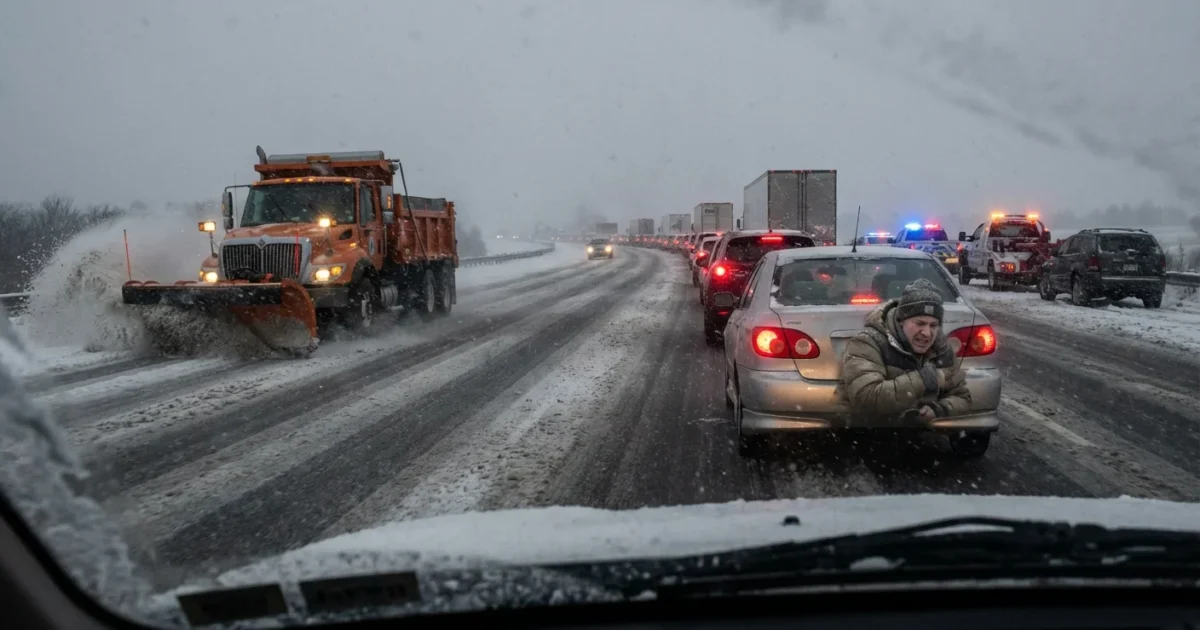
Bands of snow are stacking over the interior. Along the coast, a wintry mix is chewing away at traction. The rain snow line keeps wiggling, and that means fast changes by town. Gusts are strong near the water, and tree limbs are loaded inland. Expect rapid drops in visibility during the heaviest bursts.
Air travel is taking hits. Delays and cancellations are piling up as crews fight crosswinds and runway ice. On the ground, interstates are passable in bursts, then slick again minutes later. If you do not need to be on the road, do not be. Plows need room. Emergency teams need clear lanes.
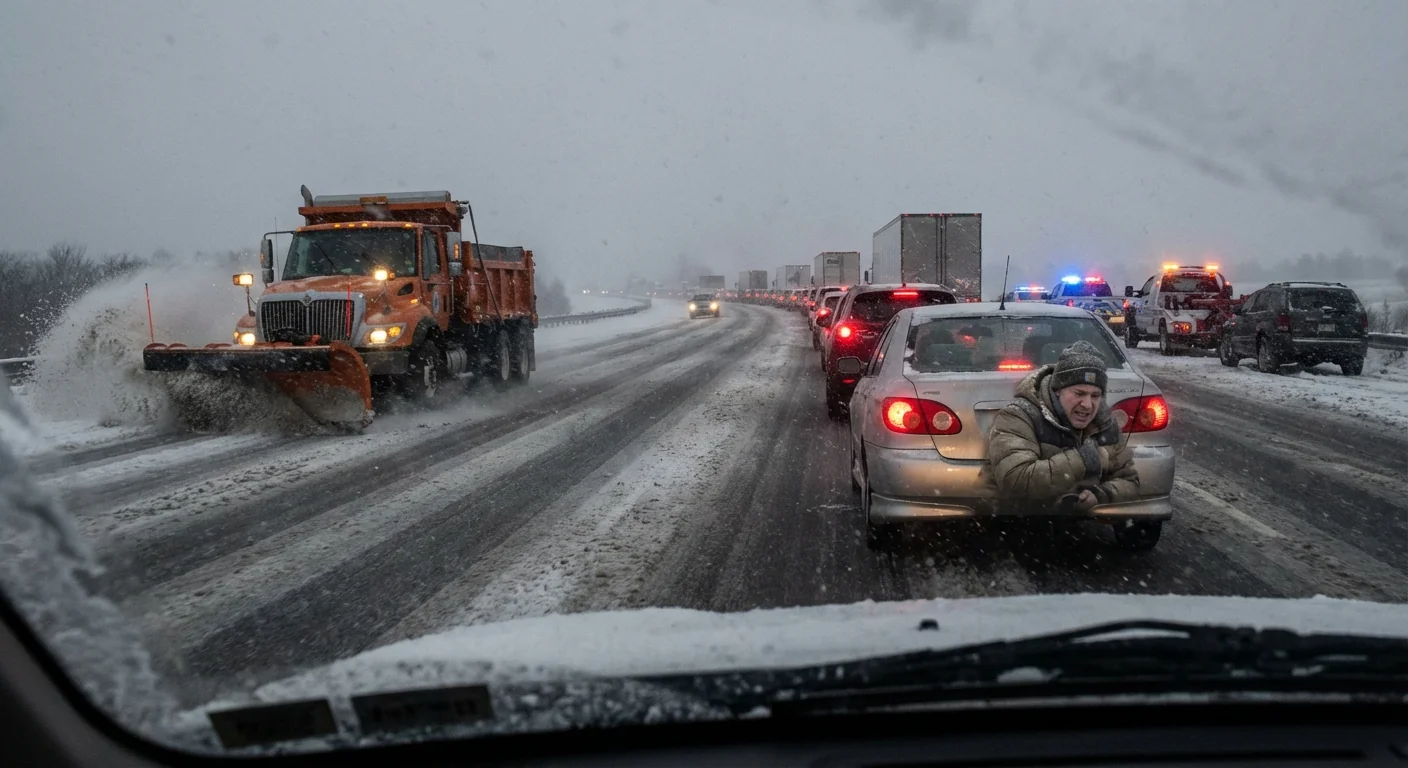
I am tracking a core of colder air pressing south this evening. That will flip mixed zones back to snow. It will also set up a refreeze risk on untreated surfaces. Farther north and west, snow stays dominant with rates that can top an inch an hour.
Why WCVB is the storm hub New England needs
When weather turns dangerous, seconds matter. WCVB is linking residents to what they need in real time. Alerts, closings, outage maps, and shelter info are landing in one place. That keeps decisions simple when stress runs high.
Their meteorologists are watching radar in short loops. That catches narrow snow bands that hit hard. It also highlights where ice is accreting on lines and trees. Timing matters most on nights like this, and their push alerts lock onto that timing.
What WCVB is centralizing right now:
- School and municipal closings, posted as they come in
- Power outage maps by utility and town
- Airport and highway updates with detours and delays
- Wind and ice advisories as the storm evolves
This is critical local infrastructure. It turns noise into action. It also keeps the region aligned, from city desks to rural roads.
Enable severe alerts on your phone, charge devices fully, and bookmark your utility’s outage page before any loss of power.
The climate signal behind this winter blast
This storm is a classic winter setup, turbocharged by a warmer world. Warmer oceans feed storms more moisture. More moisture means heavier snow when surface air stays below freezing. Small temperature swings decide snow, sleet, or freezing rain. That is why one town sees powder, and the next town sees glaze.
Arctic warming is also changing the jet stream. The upper flow can dip and stall. That lets cold air meet deep Gulf and Atlantic moisture over the same corridor. The result is what we are living today, long bands with intense precipitation, and sharp gradients over short distances.
These forces do not cause every storm, but they load the dice for extremes. New England knows snow. What is new is how often we see high impact swings. We see rain changing to heavy snow in hours. We see ice zones that linger, adding weight to lines and trees. Planning must match that new reality.
What this means for the next 24 hours
Expect a slow easing after the heaviest bands pass. Then watch for a hard refreeze tonight. Winds will stay brisk, which can slow line repairs. Secondary bands may flare on the back side of the system. Keep alerts on, and expect scattered disruptions into tomorrow morning.
Safety, travel, and sustainability moves to make today
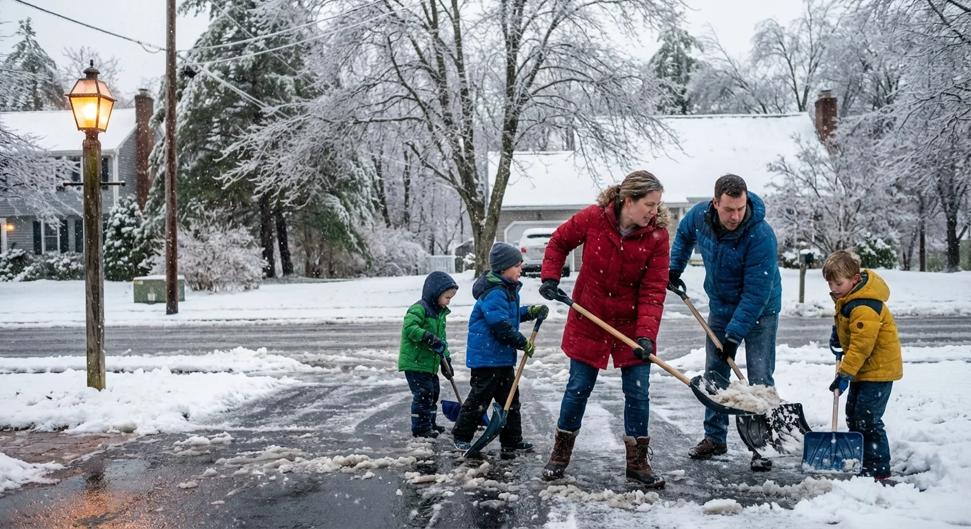
The safest trip is the one you do not take. If you must travel, tell someone your route. Pack water, a blanket, and a small shovel. Give plows wide space. Never swerve around a closed road sign. It is there for a reason.
At home, clear snow from heat vents to prevent carbon monoxide backup. Run generators outside only. Space heaters need three feet of clearance. Check in on neighbors, especially if the power goes out. A quick knock can save a life.
Small energy moves help the grid ride out the spike. Lower the thermostat a degree or two. Delay running big appliances until off peak times. Unplug unused chargers. These steps reduce strain and speed restoration.
- Stay off roads during peak bands and refreeze periods
- Keep phones charged, backups ready, and flashlights handy
- Clear exhaust vents and hydrants near your home
- Report downed lines, then keep far back
Assume every downed wire is live. Do not touch it. Do not drive over it. Call it in and keep others away.
The bottom line
This storm is big, fast, and unforgiving. WCVB is serving as the region’s nerve center, pulling alerts, outages, and timing into one clear stream. That clarity saves time, and it saves lives. We will keep mapping the bands, tracking the ice, and guiding New England through the next phase. Stay alert. Stay patient. Stay safe as the storm pushes through and the cleanup begins. ❄️


