Western Washington is under water tonight. I am tracking record river crests from the Skagit to the Snohomish. Entire neighborhoods are flooded, with water up to rooftops in places. Crews are racing the clock, and another storm is lining up.
This started December 8, when a powerful atmospheric river parked over the region. In some valleys, more than a foot of rain fell in days. Rivers kept rising as soaked hillsides poured runoff into already swollen channels. Now a second surge of moisture is due Sunday into next week. The risk is far from over.
Where the water is hitting hardest
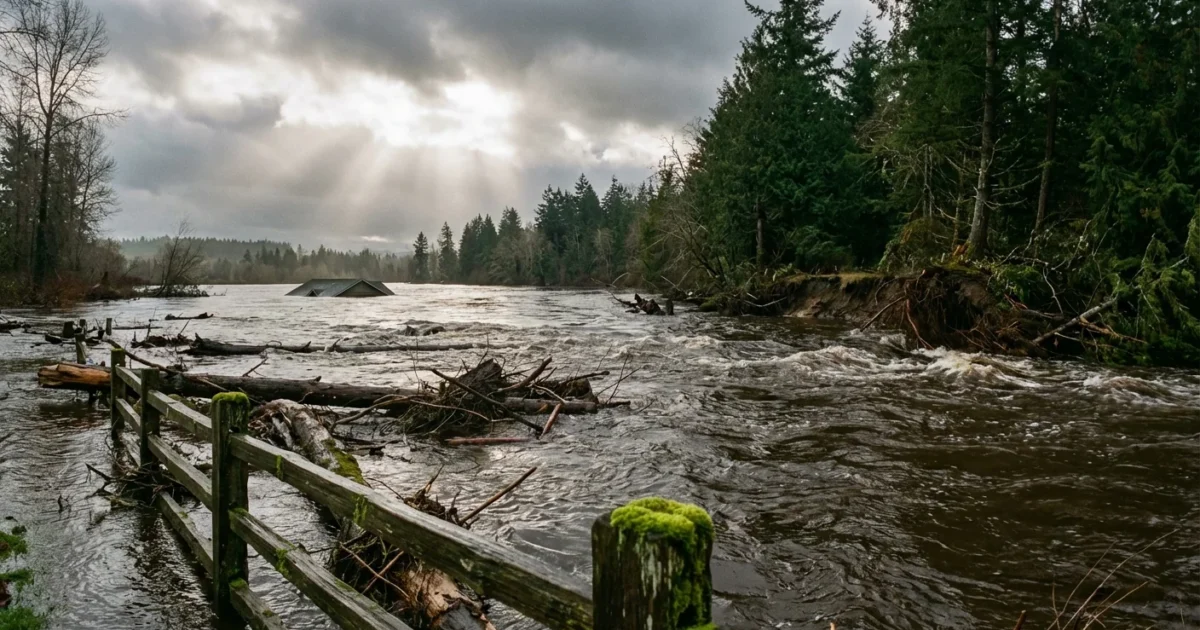
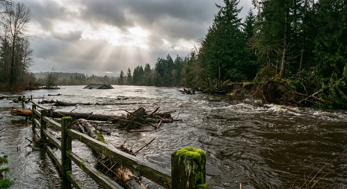
Major rivers have blown past flood stage, with some reaching all time records. The Skagit River near Concrete crested near 47 feet. Near Mount Vernon, it reached about 41 feet. That pushed water into Burlington and Mount Vernon streets. The Snohomish, Snoqualmie, Cedar, and Cowlitz also overtopped levees and low bridges.
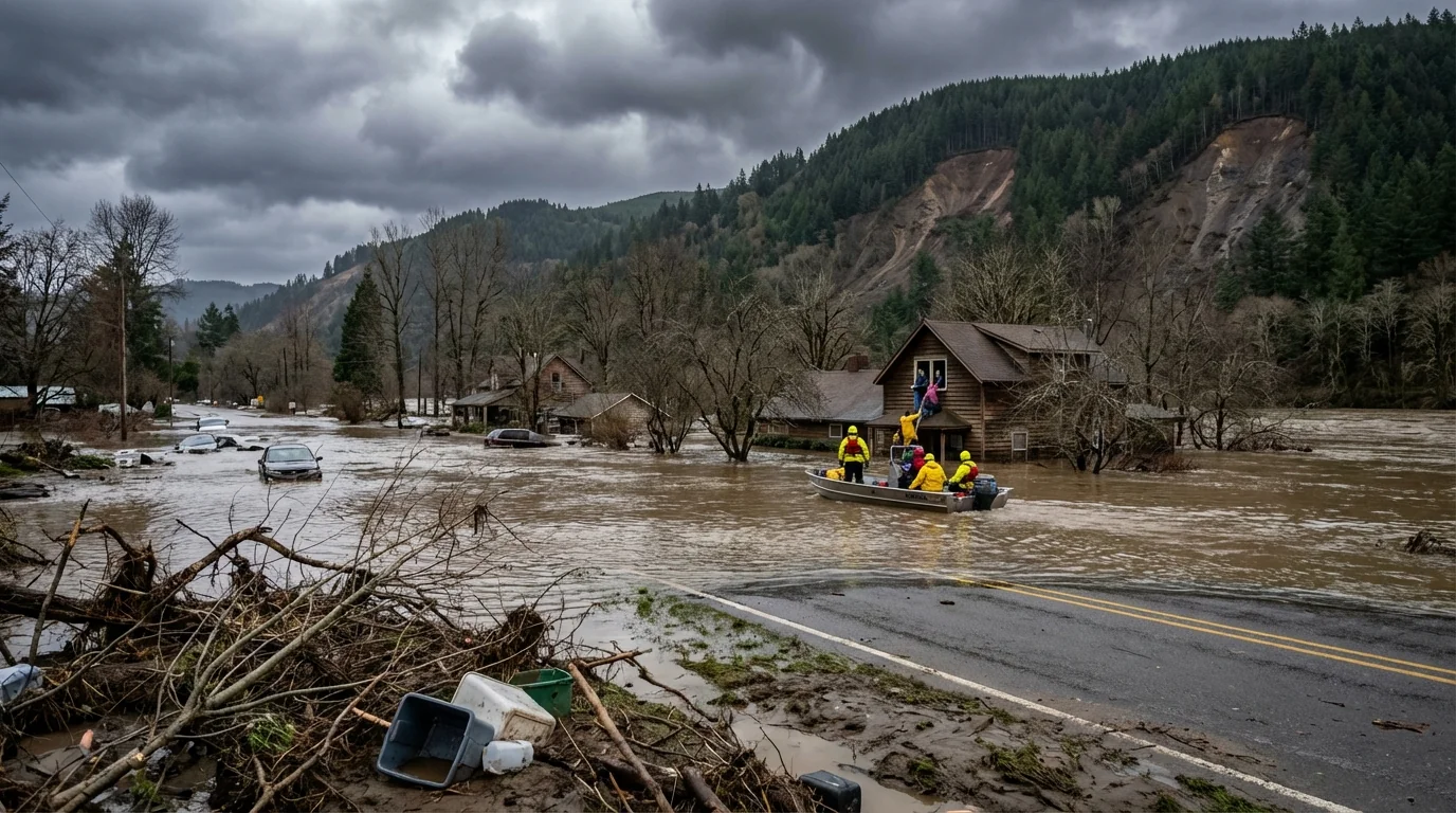
Sumas, Everson, Nooksack, and Marietta have seen house to house rescues. In parts of the floodplain, water reached 15 feet deep. Helicopters lifted people from attics. Thousands more fled by boat and high clearance trucks.
Evacuation zones now cover more than 100,000 residents. The state has activated the Washington National Guard, about 300 soldiers, to aid rescues, sandbagging, and welfare checks. The White House has approved emergency aid, unlocking federal support for shelters and recovery.
Road and rail closures are widespread. Mudslides have cut key corridors. U.S. 2 is blocked in spots. Parts of I-90 and SR 12 are shut. BNSF rail segments are out until inspectors clear the tracks.
Do not drive through floodwater. Most flood deaths happen in vehicles. Roads may be washed out beneath the surface. ⚠️
Communities under greatest strain right now
- Skagit County, especially Concrete, Mount Vernon, and Burlington
- Whatcom County towns, including Sumas, Everson, and Nooksack
- Snohomish River Valley, floodways near Snohomish and Monroe
- Low lying areas along the Cedar and Cowlitz rivers
What is driving this flood
An atmospheric river is a long band of tropical moisture. Think of it as a sky river that carries huge amounts of water. When it slams into our coastal mountains, the air rises and cools, and heavy rain unloads.
This one stalled, which is why totals got so extreme. Soils became fully saturated, so every new drop ran off into creeks and rivers. Even as rain eased, river levels stayed high because the watershed kept draining.
The next hit is coming
Another atmospheric river arrives Sunday into early next week. Forecast guidance shows 3 to 4 inches of rain possible in Whatcom, Skagit, and Snohomish counties. Lesser, but still soaking rain, will reach King and Lewis counties.
Rivers are already high, and levees are stressed. Even moderate new rain can push them back to major flood levels. Landslide risk will also climb on steep slopes and along highways. Crews are rotating, but access is hard, and response times are stretched.
If you live near a river or slope, pack a go bag now. Include meds, chargers, water, pet supplies, and important papers.
Climate context, and what must change
Warmer air holds more water vapor, which means heavier rain when storms form. Back to back atmospheric rivers are becoming more common as oceans and the atmosphere warm. That raises the odds of compound floods, like we are seeing this week.
We need to adapt our infrastructure to a wetter future. That means stronger river corridors, smarter land use, and earlier warnings. It also means lowering flood risk by giving rivers room to spread.
- Restore floodplains and wetlands, especially along the Skagit and Snohomish
- Elevate or relocate homes that flood again and again
- Upgrade culverts, storm drains, and pump stations for bigger storms
- Build levee setbacks and overflow basins to reduce urban damage
How to stay safe right now
If you are told to evacuate, go. Do not wait for the next crest. Keep your phone charged and your car fueled. Stay off closed roads, even if the water looks shallow. Watch for sudden rises overnight when upstream runoff arrives.
If you can help, volunteer through official channels. Unplanned rescues put more people at risk. Donate to established aid groups, and check on neighbors when it is safe.


