Lights out across Vancouver, Washington. A fast moving windstorm, paired with blizzard conditions in higher terrain, has snapped branches, dropped trees, and cut power to wide parts of the city. Roads are slick. Visibility drops to near zero at times. I am tracking outages, school changes, and the storm’s next moves as crews work into the night.
What is happening right now
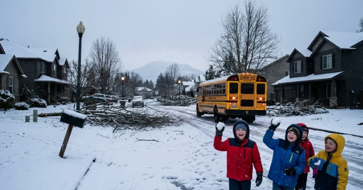
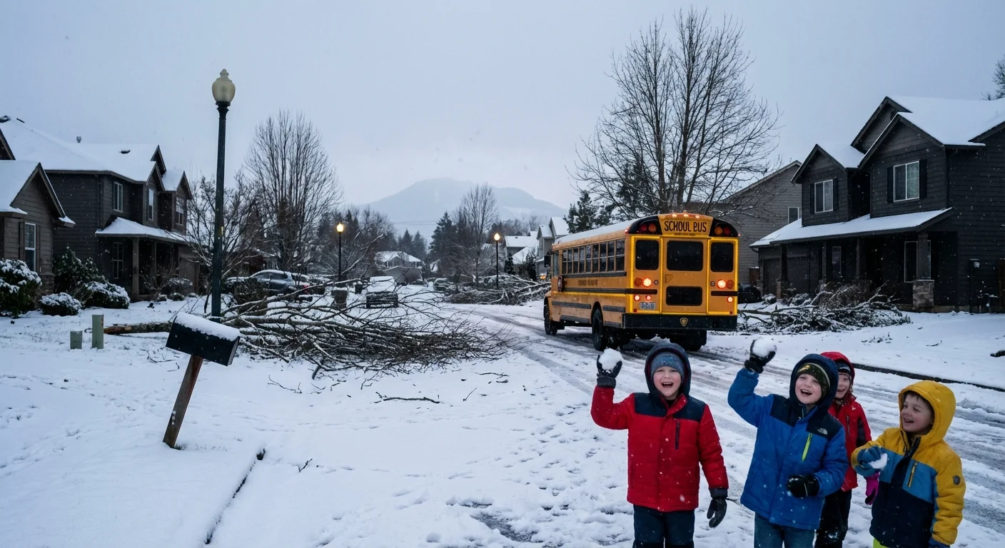
Gusty winds are punching through Clark County, with the strongest bursts rocking exposed ridges and open corridors. Cold air funneled west overnight, turning rain to heavy, blowing snow in spots above the valley floor. The mix of soaked ground and powerful gusts is bringing limbs down. Power lines are taking the hit. Signals are dark at some intersections. Give yourself extra time and treat dark lights like four way stops.
School districts across the area have moved to delays or cancellations. Buses face icy patches, and many side streets are blocked by debris. Air feels raw and the wind keeps rising between squalls. Expect changing conditions by the hour as the core of the system shifts inland.
Why this storm packed a punch
This is a classic Pacific setup. A deep low swept in from the ocean, pulling bands of moisture into the metro area. A tight pressure gradient helped produce damaging wind. At the same time, colder, denser air slipped through the Columbia Gorge and pooled west of the Cascades. That kept snow levels low in the hills and added whiteout conditions to mountain passes.
Storms like this draw energy from warm ocean waters and sharp temperature contrasts. Climate change is loading the dice. Warmer seas add moisture to the air, which can make wind driven snow and rain bursts more intense. We are also seeing bigger swings, with mild spells followed by quick cold snaps. Those swings stress trees and soils, increasing the chance of toppled trunks when the wind hits.
Safety first, Vancouver
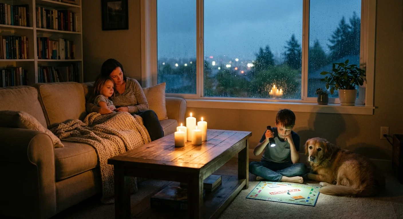
If your power is out, assume it could be several hours before full restoration. Utilities are prioritizing damaged main lines, then neighborhood circuits. Timelines can shift as wind knocks down new limbs.
- Keep phones and battery packs charging if you have power.
- Dress in layers and close interior doors to hold heat.
- Use flashlights, not candles.
- Check on neighbors, especially seniors or those with medical needs.
Stay far from any downed line. Never try to move it. Call 911, then notify your utility. Even a line on the ground can be live.
If you must drive, go slow. Debris often hides in slush and standing water. Chains and winter tires are smart if you head into higher elevations. Do not run generators indoors or in a garage. Place them outside, at least 20 feet from doors and windows.
Save battery. Switch your phone to low power mode, dim the screen, and limit video streaming until service returns.
How restoration works and what to expect
Crews begin with damage assessment as soon as winds fall to safe levels. They make hazards safe, clear broken limbs, then rebuild the backbone of the grid. After that, they move to smaller lines that feed neighborhoods and individual homes. In storms like this, new outages can appear even as others are fixed. Plan for a rolling timeline through today and tonight.
Warming centers are opening around the region. If you need heat, transportation help, or a place to charge devices, call 211 or check the city and county websites for locations and hours. Bring medicines, chargers, and ID. Pet friendly options may be limited, so call ahead.
The climate lens and resilience
Today’s chaos is a warning. Stronger Pacific storms, wetter soils, and stressed urban trees raise outage risks. We can lower that risk. Smarter tree care, more selective undergrounding, and weather hardened lines help. So do home level steps, like heat pumps that sip power, backup batteries, and better insulation. Neighborhood microgrids and community solar can keep critical services running when the big grid is down. Every upgrade reduces the hit the next time wind and snow team up.
The bottom line
The wind is still working, and the storm is not done with us yet. Vancouver is resilient, but tonight it pays to be ready, patient, and kind. Check on one another. Keep a clear path for crews. The lights will come back, and when they do, we have work to do to build a grid and a city that can ride out storms like this with less pain and less risk. Stay safe. 🌧️❄️


