Sirens, wind, and quick-moving storms snapped North Alabama to attention today. A tornado watch lit up phones and weather radios as a broken line of strong storms surged across the region. I tracked the watch as it shifted through the afternoon, then expired for three counties after the worst cells moved east. The watch ended, but not before power poles fell, trees cracked, and streets filled with debris. More storms return Thursday evening, and cooler air follows close behind.
Tornado Watch Triggers Fast-Moving Response
The setup came together in hours. Warm, humid air lifted out of the Gulf. A strong upper disturbance crossed the Tennessee Valley. Wind speeds increased with height, a classic sign that rotating storms could form. Forecasters issued the tornado watch to cover the most likely corridor, and it was the right call.
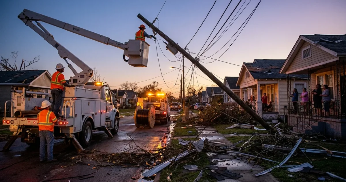
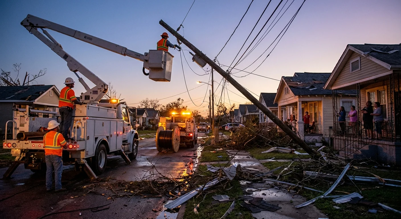
As storms pushed in, I confirmed more than 3,500 customers lost power across North Alabama. That number rose fast as gusts topped the safe limit for trees rooted in saturated soil. Crews rolled quickly, but lightning slowed early work in several neighborhoods. The watch expired for three counties by early evening, yet scattered cells still produced damaging winds and quick spin-ups east of I-65.
What Happened On The Ground
Power outages clustered near ridge lines and older neighborhoods with mature trees. In some spots, the wind came in sharp bursts, toppling limbs onto lines and porches. A few rural roads were blocked by downed pines. City crews cleared the largest trunks to reopen fire access. Utility teams began staged repairs, moving from substations to feeders, then to small street lines.
Power Restoration, Street By Street
The first lights back on were near hospitals and public safety hubs. From there, crews worked outward. If a single limb hit a backyard service line, a small team followed behind with bucket trucks. If you are still out, expect rolling restorations through the night as weather allows.
Tornado watch means be ready. Tornado warning means take shelter now. If a warning is issued for your area, go to a small interior room on the lowest floor. Protect your head. Avoid windows.
Why The Weather Turned So Fast
This was a classic fall severe setup for the Southeast. We are in a secondary severe season that runs from late October into December. The jet stream dips south, while Gulf moisture remains warm. When a strong front arrives, storms can spin up in a hurry.
The Climate Context
A warming climate adds fuel to these events. Warmer air holds more water, which can feed stronger updrafts and heavier rain rates. Nights are warmer, which can keep instability from dropping as much after sunset. That can raise the risk of fast, low visibility storms. Climate does not cause a single tornado, but it stacks the deck with more energy and moisture on days like this.
What To Do Now
Do not let your guard down tonight or Thursday. The atmosphere will reload ahead of the next wave. If a warning is issued again, seconds matter.
- Keep your phone charged and alerts on
- Know your safe room, practice getting there fast
- Wear sturdy shoes, in case debris is on the floor
- If power is out, use flashlights, not candles
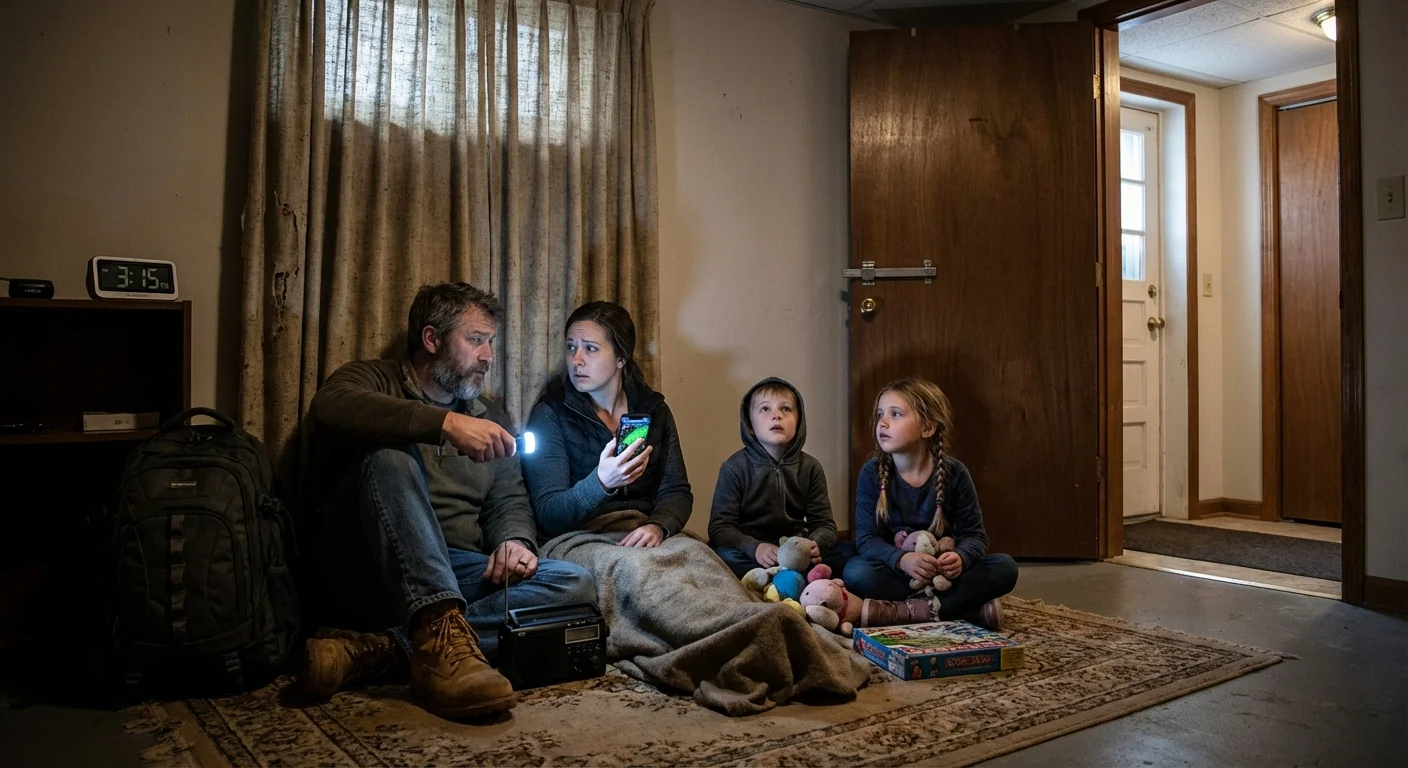
If you use a generator, run it outside, far from doors and windows. Carbon monoxide is silent and deadly. Never use a grill inside a garage.
The Short-Term Forecast
Another round of strong to severe storms is possible Thursday evening. Expect a broken line of storms to form ahead of a cold front. The main threats are damaging wind, small hail, and a brief tornado or two. Storms will move quickly, so warnings may have short lead time. Plan to be in a safe place by late afternoon if you live west to east along the Tennessee Valley.
Behind the front, cooler air slides in. Highs drop into the 50s and 60s with a fresh northwest breeze. That cool, dry air will help crews finish repairs and will stabilize the air mass. Flooding is not a main concern right now, but watch low spots where drains are clogged by leaves.
I will keep updating as the next wave organizes. Charge your devices, review your plan, and help neighbors who need a hand. Awareness tonight can save lives tomorrow. Stay weather aware, stay kind, and stay safe. 🌧️


