
Tornadoes are on the ground in central Oklahoma this morning. I am tracking multiple rotating storms, fast motion, and fresh damage. This is a dangerous outbreak. If you are in the path, act now.
Breaking news on 6: Tornado outbreak across central Oklahoma
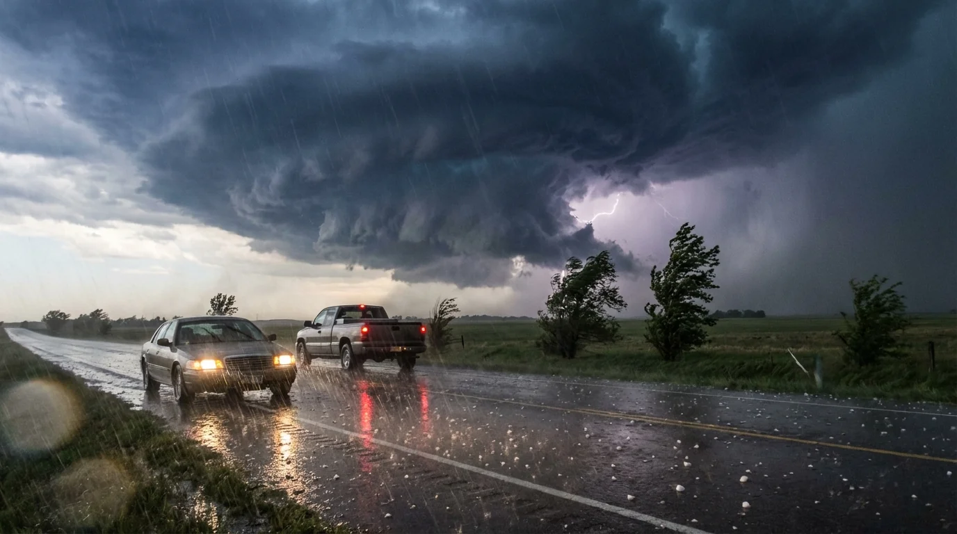
Several tornadoes have been observed from dawn onward. Tornado warnings are active and shifting as storms race northeast. I am seeing confirmed wind damage in Purcell, with trees and roofs hit. Power lines are down in spots, and more damage is likely as the line matures.
These are classic spring supercells, tight rotation wrapped in heavy rain. Hail is large in the strongest cores. Wind gusts are severe along the leading edge. Flash flooding is a secondary risk where storms train over the same roads and creeks.
If your phone or NOAA Weather Radio issues a tornado warning, move to shelter immediately. Do not wait to confirm the threat.
Where the storms are heading next
The most intense cells are tracking across the I-35 and I-40 corridors. Motion is quick, so warning lead time may feel short. Expect rapid storm development on the warm side of the boundary, then merging into bows that push damaging winds.
Areas at immediate risk include:
- Purcell, Norman, and Moore
- Oklahoma City metro and nearby suburbs
- Chandler, Shawnee, and Seminole
If you live east of these towns, prepare now. Charge devices, clear porches, and keep vehicles under cover if possible. The risk zone will expand through late morning and midday as the low-level jet feeds new updrafts.
Why this outbreak is so intense
A strong jet stream is digging across the Plains, pulling warm, humid air from the Gulf. That moisture is fuel. The sun added extra heat at daybreak, so storms had energy to spin up fast. Winds are changing speed and direction with height, known as wind shear. That shear helps storms rotate and tighten into tornadoes.
We often see outbreaks when a sharp cold front meets rich Gulf moisture and a strong upper wave. Today checks all those boxes. The structure favors large hail near the storm core, then straight-line winds and short-lived but violent tornadoes along the inflow notch. Rain rates are high, which raises the flash flood threat in low spots.
What you should do right now
Use the next clear minute to set up your safe space. Interior room, lowest floor, no windows. A basement is best. A small bathroom or closet works if reinforced. Put on shoes and a helmet. Keep your phone, radio, and a flashlight within reach.
- Get to your safe place now if under a warning.
- Cover your head and neck, use pillows, blankets, or a mattress.
- Keep pets and kids close, on leashes or in carriers if needed.
- Do not try to drive to outrun a tornado or cross flooded roads.
- After the storm passes, watch for downed lines and gas smells, then check on neighbors.
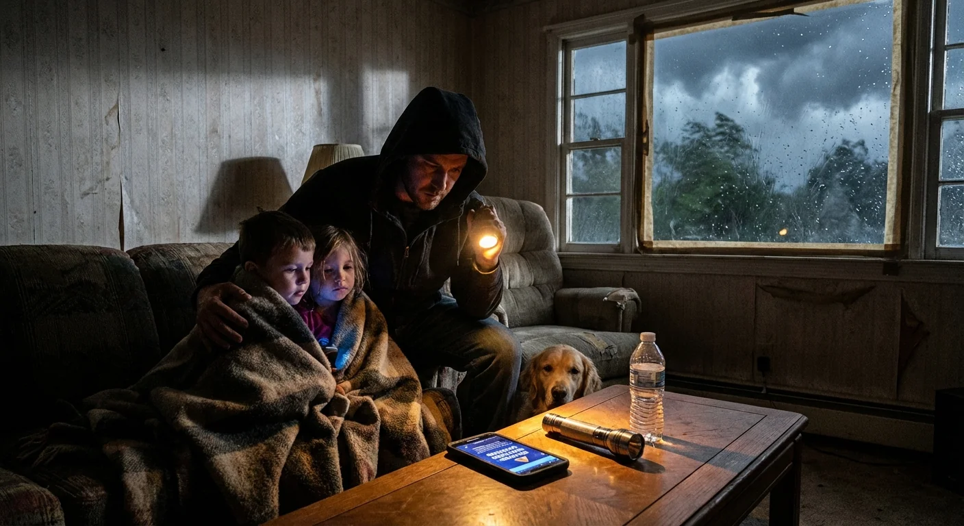
Store a whistle, chargers, and ID in your safe room. A bike helmet can prevent head injuries from debris.
Climate context and building smarter
Oklahoma is no stranger to severe weather. But a warming climate is loading the dice. Warmer air holds more moisture, which boosts storm energy and increases extreme rain rates. That means more days with the ingredients for big hail and flash flooding. The link between climate change and tornado counts is complex, and yearly numbers bounce. Still, the background moisture and heat, the fuel for storms, are trending higher.
Resilience matters here. Safer homes and smarter towns can blunt the hit:
- Safe rooms and community shelters save lives.
- Stronger roofs and impact-rated materials reduce losses.
- Green infrastructure, like rain gardens and bigger culverts, helps manage flash floods.
- Redundant power and communications keep warnings flowing when lines go down.
Do not rely on sirens alone. Keep multiple alert paths, including Wireless Emergency Alerts, NOAA Weather Radio, and local broadcasters.
How to stay informed as this evolves
I am tracking fresh warnings and confirmations in real time. Expect updates as rotations tighten and new cells form. Keep your devices charged and your safe space ready. Monitor the National Weather Service and trusted local TV and radio for polygon-specific alerts. If you are in a warned area, shelter first, then check details.
Conclusion: Central Oklahoma is under active threat from tornadoes, large hail, damaging winds, and flash flooding this morning. We have confirmed wind damage in Purcell and more impacts are likely as storms continue. Take warnings seriously. Move to shelter fast. With good decisions, strong alerts, and ready safe rooms, we can get through this burst of severe weather, then rebuild smarter for the next one. Stay alert, stay safe.


