BREAKING: Tornado Touches Down In Purcell As Warnings Sweep Central Oklahoma
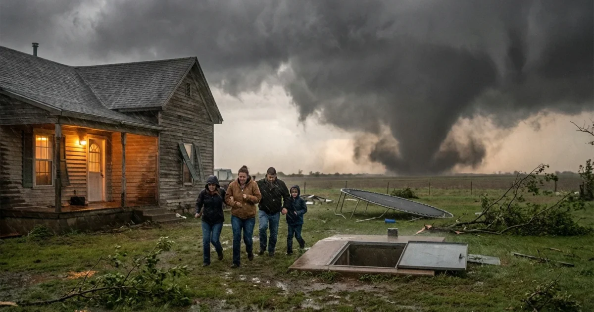
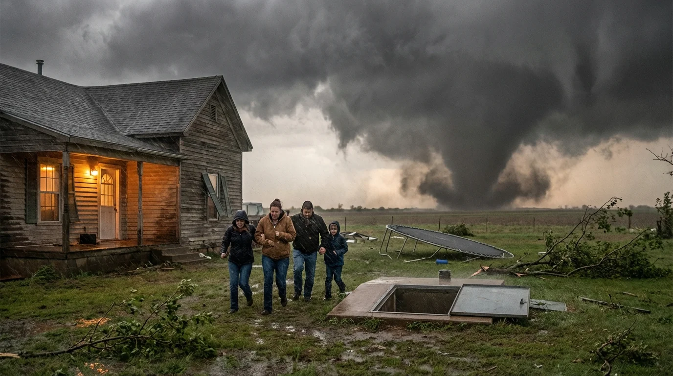
Sirens are sounding across central Oklahoma tonight. A confirmed tornado touched down in Purcell, carving a path of damage as severe storms fire along the Plains. Multiple tornado warnings are active, and more storms are building. If you are in a warned area, move to shelter now. These storms carry damaging winds, large hail, and blinding rain. 🌪️
What We Know Right Now
A tornado hit Purcell as a powerful storm intensified over McClain County. Early reports point to roof damage, downed power lines, and trees snapped near roadways. Lightning is frequent. Some hail has been golf ball size. Flooding is possible in the heaviest cores.
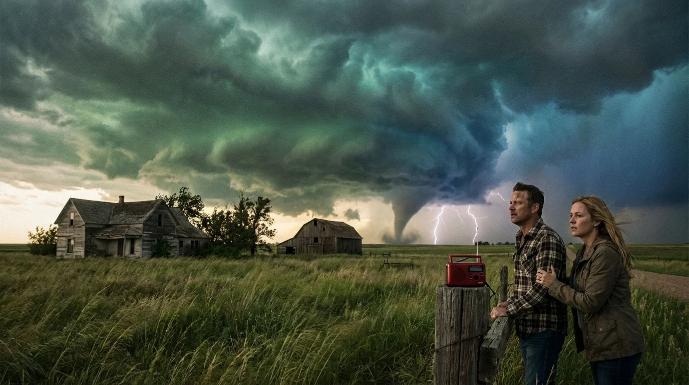
Tornado warnings remain in parts of central Oklahoma this evening. Storms are tracking east to northeast, and they can spin up quickly. Do not wait to see it. You may not get a clear view in rain and darkness.
NOAA Weather Radio and local alerts are issuing updates by the minute. Expect rapid changes. New warnings may be issued as storms merge along a boundary and tap strong upper level winds.
Tornado warning means take shelter now. A tornado has been spotted or indicated by radar. Do not drive. Do not wait.
What A Warning Means For You
If your phone sounds or sirens activate, move fast. Interior rooms on the lowest floor are your safest option. Put as many walls as possible between you and the outside. Basements or storm shelters are best.
- Go to a small interior room, bathroom, or closet on the lowest level.
- Cover your head and neck with a helmet, pillows, or a mattress.
- Wear shoes, keep your phone, ID, and a flashlight with you.
- Stay put until the warning expires and a new update says it is safe.
If you are in a mobile home, you are at higher risk. Move to a site-built shelter if you can get there safely and quickly.
Keep a go bag ready. Include water, medications, a battery pack, sturdy shoes, a whistle, and copies of important documents.
Why The Storms Turned Violent
Warm, humid air surged north from the Gulf of Mexico today. A sharp front dropped in from the west. Overhead, fast winds in the jet stream created strong spin in the atmosphere. That mix can turn a thunderstorm into a rotating supercell. Tonight, that is exactly what we are seeing.
Storms are feeding on deep moisture. That moisture loads storms with energy, which boosts updraft strength. The result is larger hail and stronger, longer lasting cells. You may see storms train over the same areas. That increases the risk of flash flooding.
This outbreak is part of a wider severe pattern across the Southern Plains. As the low pressure center moves east, the risk zone will shift. Keep your devices charged. Have multiple ways to receive warnings in case power fails.
The Climate Signal Behind Nights Like This
One night does not define climate. Still, the background matters. Warmer air holds more water vapor. The Gulf has been running warmer in recent years, which can add extra moisture to Plains storms. That can mean heavier downpours and more fuel for severe weather.
Scientists see signs that environments favorable for severe storms, with strong moisture and instability, are showing up more often in some regions. Tornado counts vary a lot year to year, and a clear national trend is not confirmed. But heavy rain rates are rising, and hail potential can increase when storms grow taller in a moist, unstable atmosphere. On warm spring nights, that can sharpen the edge of danger.
Safety, Recovery, And Building For What Comes Next
As warnings continue, focus on safety first. After storms pass, avoid downed lines and flooded roads. Treat all lines as live. Report gas smells and structural damage. Check on neighbors, especially those who are older or live alone.
Longer term, we can cut risk. Safe rooms and storm shelters save lives. Strong roof connections and impact rated shingles reduce damage. Planting native wind firm trees and creating defensible space can limit debris. Cities can harden grids, bury key lines, and design streets and parks to drain floodwater faster.
- Keep three ways to get alerts, phone, NOAA Weather Radio, and local TV or radio.
Power can fail. Your phone can die. NOAA Weather Radio is a lifeline when towers go down.
The Bottom Line
Purcell has taken a hit. Central Oklahoma is still under the gun tonight. If you are under a tornado warning, move to shelter now and stay there until you get the all clear. The storm setup remains volatile, and new warnings are likely as cells mature and merge. Stay low, stay informed, and stay ready. I will keep tracking these storms and bring clear updates as conditions change.


