BREAKING: “How many inches of snow today?” The real story is ice
A fast moving winter storm is striking the Carolinas right now. Many of you want a simple number. I am tracking totals across the region, and the answer depends on where you live. For many communities, inches of snow are not the headline. Ice is.
What fell and where
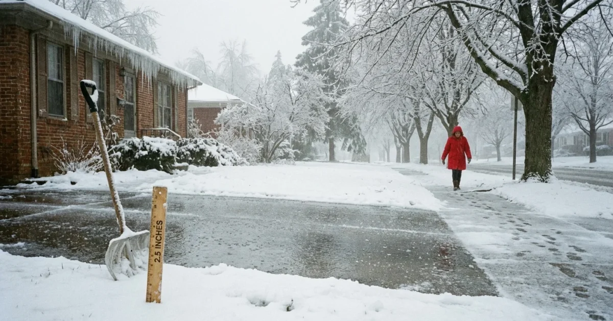
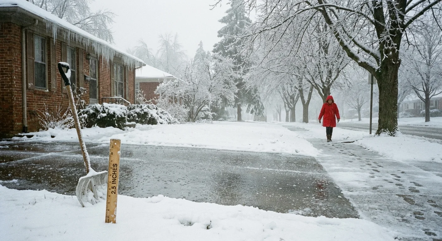
Cold air at the ground met a warm layer above. That setup turned snow into sleet and freezing rain for much of the I-85 corridor. The mountains saw steady snow with several inches at higher elevations. The foothills picked up a mix that compacted quickly. The Triad reported a coating to a few inches. The Charlotte area leaned icy, with sleet and a glaze of freezing rain doing most of the damage.
That mix matters. Sleet looks like snow on first glance, but it packs down. Freezing rain does not show up in inches on the ground. It grips trees, lines, and roads like glass. I am seeing patchy white yards that hide very slick driveways. That is why your ruler may be lying to you today.
Ice accretion is more dangerous than a similar depth of snow. Expect tree limbs to fail and travel to stay hazardous longer.
Why inches mislead today
We often judge winter storms by snow depth. Not today. The storm’s warm layer turned fluffy flakes into pellets and glaze. Sleet compacts into a dense layer that is hard to shovel. Freezing rain does not pile up like snow, but it adds weight to everything it touches.
- One quarter inch of ice can trigger power outages faster than several inches of snow
- Two inches of sleet can weigh more than four inches of dry snow
- Wet snow clings to branches, then ice locks it in place
- A half inch difference at your house can mean clear pavement or a skating rink
If your yard shows only one or two inches, that does not mean the risk is low. Today’s totals are about type as much as amount.
Measure in a flat, open spot away from buildings and trees. Clear a small board each hour to track new snowfall. Do not include sleet in snow depth. Report sleet and freezing rain separately if you can.
Travel and power impacts now
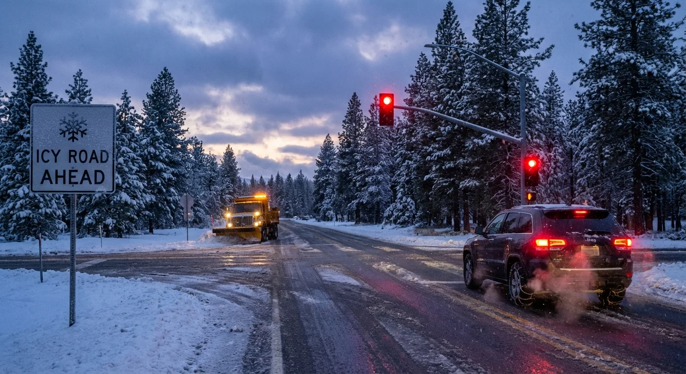
Road work is in full force. More than 200 plows are running on interstates and major routes across North Carolina. Crews are treating bridges and shaded spots where ice hangs on. Progress is steady, but refreeze is likely this evening as temperatures dip again. Black ice is already forming on ramps and secondary roads.
Expect slick travel through tonight, especially east of the mountains where ice leads. Give road crews room. Slow down well before stoplights and bridges. If you can delay travel, do it. Utilities are staging extra teams as lines begin to glaze. Isolated to scattered outages are possible where ice loading is heaviest.
If a line is down, treat it as live. Report it. Never move it yourself. Keep generators outside and away from windows.
How to get your local total
Your neighborhood can differ a lot from the next town over. Elevation and small temperature swings make big changes.
- Check your local National Weather Service office for the latest storm reports and maps
- Open your state DOT road map for live conditions and camera views
- Use your utility’s outage tracker to see current restoration times
These tools give you the most accurate picture for your block, not just your city.
Climate context, and what this means
This storm fits a growing pattern in the Southeast. Winters are trending warmer overall, but the air still dips near freezing often. A warmer atmosphere holds more moisture. When that moisture rides over shallow cold air, we get more mixed events, not fewer storms. That means less powder and more ice risks for cities along and east of the mountains.
There is a sustainability lesson here. Brine helps, but heavy salt use damages streams and soils. Communities can prepare without oversalting. Smarter choices include targeted pretreatments, better plow timing, and clear priority routes. Urban forestry also matters. Planting wind firm, ice tolerant trees under lines reduces breakage. Utilities can harden the grid with tree management and strategic undergrounding in the most outage prone gaps. Homes can adapt with heat pump systems that work well in cold, plus backup plans for short outages.
Today’s storm is a crossroads of weather and climate. We will see more of these mixed setups in coming winters. Planning for ice is now as important as planning for snow.
In short, do not let inches be your only guide today. Look at what fell, not just how much. Ice on a branch can be more telling than a number on a ruler. Stay off slick roads if you can, charge devices, and check official updates through the evening. I will keep tracking changes and translating the numbers into real world impacts. Stay safe out there ❄️


