
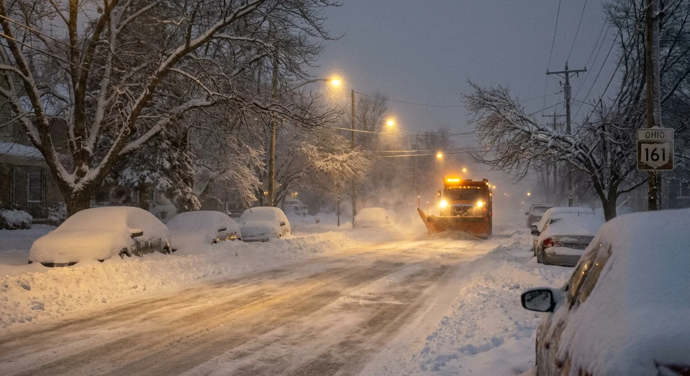
Snow is coming down hard, the wind is howling, and road crews are losing ground. I am confirming multiple counties in central and southwest Ohio have declared a Level 3 snow emergency. That is the highest alert. Roads are closed to non‑emergency travel. Visibility is poor, drifts are building, and ice is sealing over side streets. Stay put if you can. Conditions are dangerous and can change by the minute.
What Level 3 Means, and Who Decides
Level 3 is not a suggestion. It is an order to stay off the roads unless you are essential or emergency personnel. County sheriffs set the level after consulting road supervisors, emergency managers, and weather briefings. They look at crash reports, drifting, plow progress, and hospital access. When roads are impassable or visibility drops to near zero, Level 3 is the tool that saves lives.
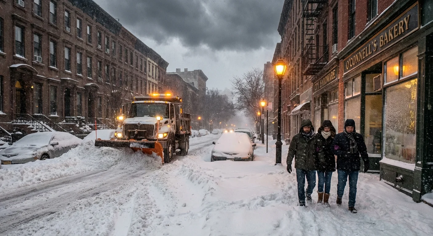
Travel is prohibited for the general public. Drivers can be cited if they ignore it. Essential workers may still be allowed to report, but even they should expect severe hazards. Plows will focus on primary routes first, then secondary streets. City parking bans may be active on snow routes so crews can clear lanes.
Roads are closed to non‑emergency travel under Level 3. Do not drive unless you are officially required to respond.
Why Conditions Escalated Today
A deep low pressure system is crossing the Ohio Valley with a strong temperature drop behind it. Moist air fed into the storm overnight. Then Arctic air pushed in and turned heavy rain into heavy snow. Bands have formed along the low’s wraparound, where lift and wind overlap. Snowfall rates have spiked, and gusts are blowing powder back across lanes as fast as plows can move it.
This storm is tapping warm, humid air that has become more common in winter. A warmer atmosphere can hold more moisture. When that moisture meets sharp cold, snow can fall in brief but intense bursts. We also have a wavier jet stream pattern today, with tight gradients. That supports narrow, persistent snow bands that dump fast totals. This setup, plus strong winds, is a classic recipe for whiteouts and drifts that swallow cars.
What You Should Do Right Now
If you are in a Level 3 county, the safest place is home. Give crews time and room to work. Keep sidewalks and hydrants clear if you can do so safely. If you lose power, report it to your utility and use safe heat sources only.
- Do not drive unless you are essential or responding to an emergency
- Keep phones charged and conserve battery by lowering screen brightness
- Move vehicles off snow routes and out of cul‑de‑sacs to help plows
- Shovel in short shifts, push not lift, and take breaks to avoid injury
- Check on neighbors who may need help, especially seniors
If your employer requires you on site, confirm your travel status and route before leaving. Expect whiteouts near open fields and on bridges. Keep an emergency kit in your vehicle, including warm layers, water, and a small shovel. If you get stranded, stay with your vehicle and call for help.
Reduce salt use by shoveling early and often. Use sand for traction on walkways. Excess salt harms streams and drinking water.
The Climate and Sustainability View
Big snow in a warming world can feel confusing. Here is the link. Warmer air stores more water vapor, so storms can produce heavier precipitation. If the air is cold enough at the surface, that extra moisture falls as snow, not rain. That is why we see brief, high‑impact bursts in storms like this one.
Our infrastructure is feeling it too. Repeated freeze and thaw cycles break pavement and force more salt and fuel use. Crews are brining roads to cut salt waste, and some cities are switching to better spreaders. That saves money and protects waterways. You can help by clearing your sidewalk and driveway to bare pavement before it refreezes. Then you will need less salt later.
Cutting non‑essential trips during Level 3 does more than prevent crashes. It lowers emissions for a day, protects air quality near busy corridors, and frees plow crews to do their job faster. It also keeps emergency rooms open for true emergencies, which matters in a storm with ice injuries and hypothermia risks.
Where to Get Reliable Updates
Statuses can change quickly, and they vary by county. Confirm your county’s level directly from official sources. County sheriff offices post snow emergency levels and any changes. The Ohio Department of Transportation traffic map shows closures, crashes, and plow progress in real time. City governments post parking bans and tow alerts tied to snow routes. Local TV and radio outlets provide county by county updates and timing on when levels are lifted.
Stay patient. Roads will reopen when crews have safe sightlines, cleared lanes, and fewer drifting hotspots. I am tracking the storm’s core and the wind shift behind it. Once the snow bands weaken and plows widen primary routes, Level 3 counties can step down to Level 2 and Level 1. Until then, the safest move is the simplest. Stay home, stay warm, and let the crews push this storm out of our way. ❄️


