BREAKING: Flash Flood Warning as Holiday Storm Slams Southern California
Torrential rain is pounding Southern California right now. Streets are turning into fast streams. Creeks are jumping their banks. Flash flood warnings are active across multiple counties. Officials have posted a rare high risk flooding alert for parts of the region. This is a fast moving situation, and the next several hours are critical. ☔️
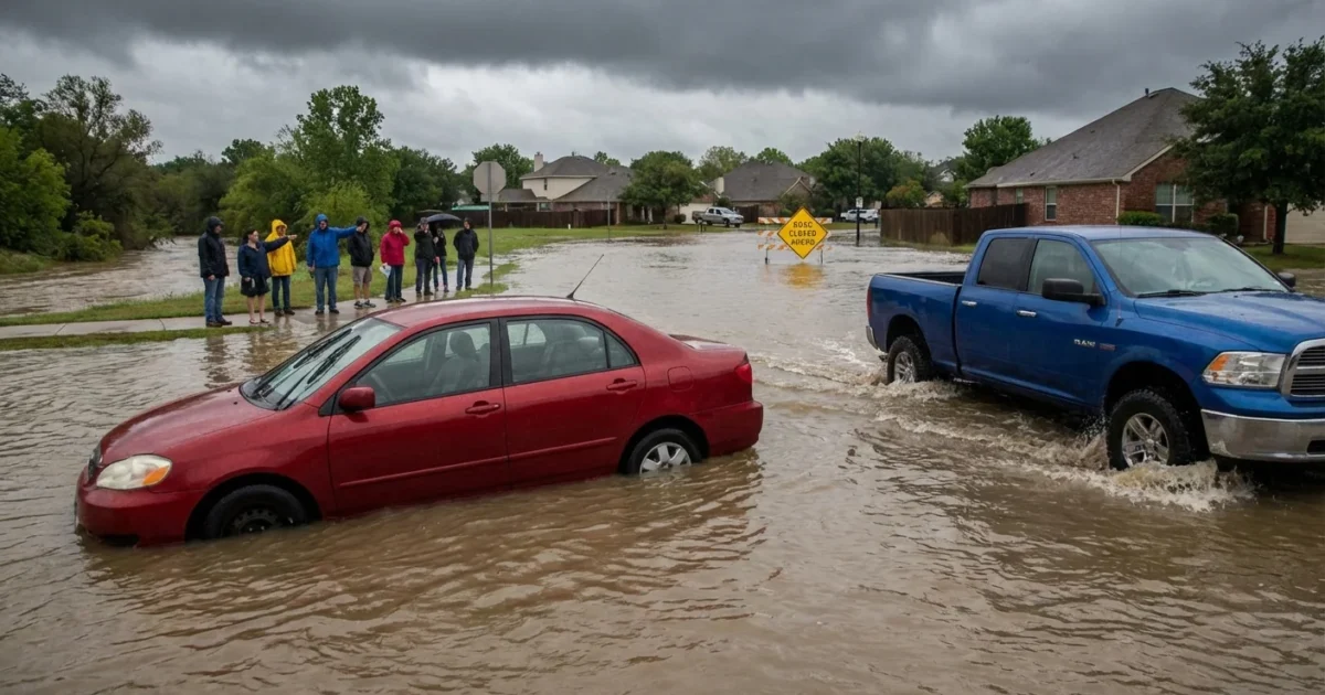
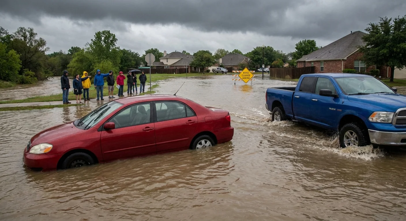
Cars are already getting stuck in rising water. Low spots are filling fast. Emergency managers are closing roads and planning evacuations in the most at risk zones. If you live near a creek, a canyon, or a recent burn scar, prepare to move quickly.
What a Flash Flood Warning Means, and why “High Risk” matters
A flash flood warning means flooding is happening now, or will start very soon. It is not a watch. It is a direct call to act. Rainfall rates are intense, and water will rise faster than you can drive out.
High risk is the strongest flood outlook forecasters issue. It is rare here. It signals high confidence that many places will flood. It also means some floods could turn dangerous in minutes. Small canyons, underpasses, and urban dips will fill first. Once water covers the road, it can hide sinkholes and downed power lines.
If you are told to evacuate, go now. Do not wait to see the water. Never drive through flooded roads. Turn around. You do not know how deep it is. ⚠️
What I am seeing across Southern California
Bands of rain are training over the same neighborhoods. That means the clouds keep reloading over one spot. When that happens, the ground cannot keep up. Storm drains overflow. Backyards slump. Hillsides let go. Burn scar slopes are especially fragile. Mud and rock can move with little warning.
Coastal areas face a double hit. Strong onshore winds push water toward the beaches. High tides add extra height. Flooding at river mouths and low boardwalks is likely. Inland, rapid runoff is swamping dips on freeways and feeder roads. Stranded cars are blocking lanes, which slows help from reaching trouble spots.
This storm is one of the strongest Christmas period systems we have seen in years. Soils were already wet from earlier rounds. Today’s intense burst is the trigger. That mix leads to fast, messy flooding.
Why this storm is so strong
The Pacific is unusually warm this season. A warmer ocean feeds storms with extra moisture. The jet stream is also aimed straight at Southern California. That pipeline brings repeated waves of rain. A warmer atmosphere holds more water vapor, which supercharges downpours. When the clouds let go, the rain can fall in buckets.
Urban growth adds to the risk. Concrete and asphalt do not absorb water. They move it. That sends more runoff into storm drains, which then back up into streets and homes. Wildfire scars remove the natural sponge of roots and plants. Water runs off bare slopes faster, carrying debris and mud into neighborhoods.
This is what climate change looks like in our daily lives. Fewer drizzles, more extremes. Longer dry spells, then heavier rains when storms arrive. Planning for that new normal is now part of public safety.
What to do in the next few hours
Follow these steps if you are in or near a warning zone:
- Charge your phone and keep alerts on. Set ringer volume high as you sleep.
- Move your car to higher ground. Do not park on flood‑prone streets or near storm drains.
- Pack a go bag, include meds, chargers, water, and key papers. Keep it by the door.
- Avoid travel. If you must drive, check closures, and never cross water.
- If water rises, get to higher floors or higher ground. Call 911 only for life threatening emergencies.
Sandbags help, but place them before heavy rain peaks. Stack them like bricks, plastic side up, two layers high at doorways and garage openings.
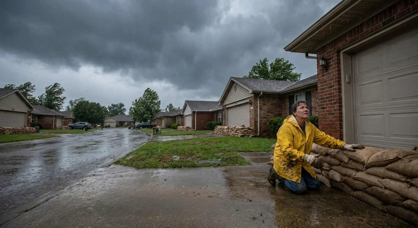
Check on neighbors who may need help. Older adults, people with disabilities, and families on steep streets face higher risks. Pets panic in storms, keep them leashed and close.
Looking ahead, building for resilience
This storm will pass. The pattern behind it will not. Warmer oceans and a stronger moisture feed mean heavier downpours are more likely in future winters. We can lower risk. Cities can add green streets, rain gardens, and wider channels where creeks run through neighborhoods. Homeowners can direct downspouts to permeable areas, not driveways. Hillside homes can use native plants, good drainage, and regular slope checks.
Each step reduces runoff, slows water, and keeps mud where it belongs, on the hill, not in your living room. That is sustainability at street level. It keeps people safe today, and it pays off during the next storm.
Conclusion
Flash flooding is underway and conditions are changing by the minute. Stay alert, stay off flooded roads, and follow local orders. Keep your phone charged, your go bag ready, and your car on high ground. Check on your neighbors. I will keep updating as this system evolves. The next few hours will matter most. Stay safe, Southern California.


