Snow is stacking up fast across New Jersey and the greater New York City area tonight. I am tracking verified measurements and radar in real time, and the picture is clear. This is a high impact, high moisture winter storm with sharp gradients. Early totals already show big differences from block to block. The next 12 to 24 hours will decide who wakes up to heavy, cement like snow, and who sees lighter slush.
What has fallen so far
Bands of intense snow are arcing across North Jersey, the lower Hudson Valley, New York City, and southern Connecticut. Under the deepest bands, rates have topped one inch per hour. Where the band stalls, totals jump. Just a few miles away, amounts can be half that.
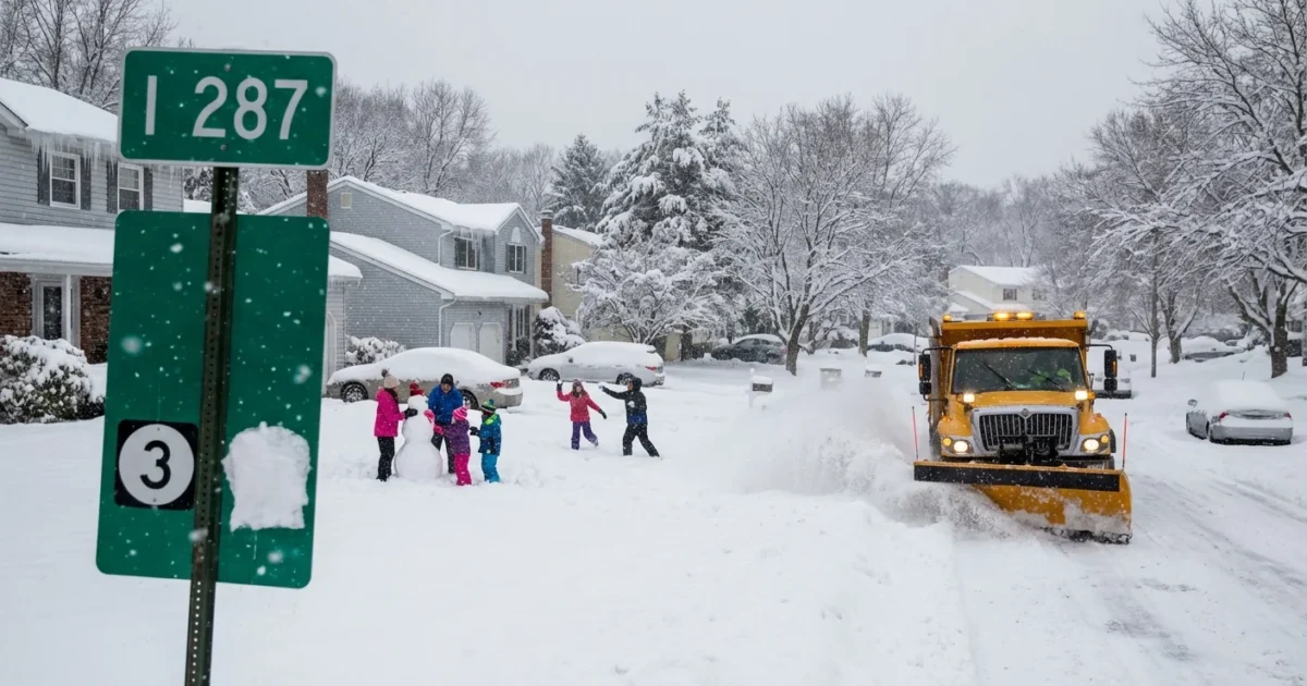
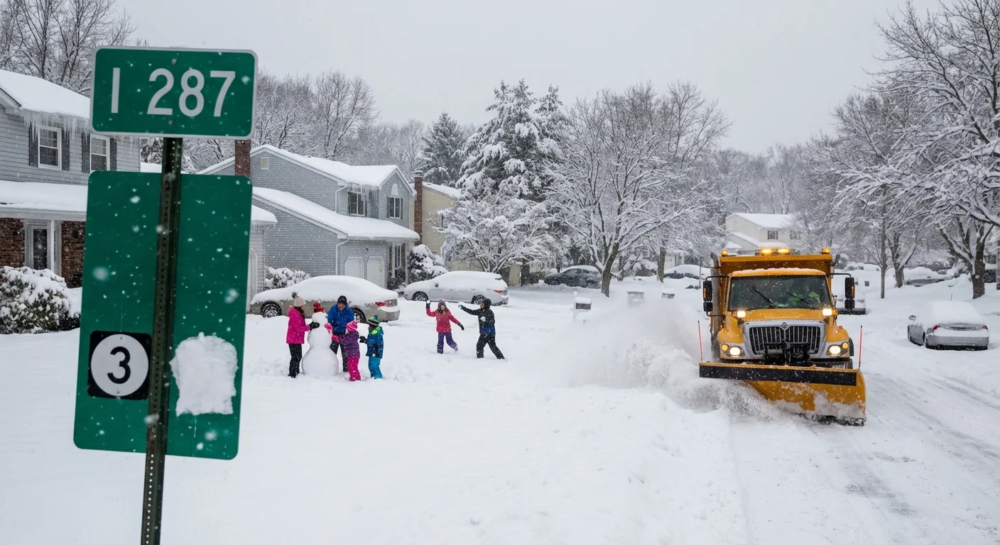
Early spotter reports show a wide range. Coastal New Jersey is running lower, with lighter, wetter snow and some mixing near the shore. Move inland toward the I 287 and Route 80 corridors, and totals climb fast. Northwest New Jersey and hill towns north of the city are reporting the highest numbers so far, with localized pockets where plows are already on repeat loops.
Banding is the story. If you are under the band, you pile up inches. If you are between bands, you wait. That is why neighbors a couple of exits apart are calling in very different totals. Expect official numbers to shift as more certified readings come in.
Snow totals will be refined overnight as trained spotters file certified measurements. Hyperlocal bands can double amounts over just a few miles.
Why totals vary so much
This storm feeds on warm Atlantic moisture and just enough cold air inland. The result is narrow conveyor belts of heavy snow. Cold air is deepest north and west of the city, which favors higher totals there. Near the coast, the air is marginal. A thin layer of above freezing air trims accumulation and makes the snow heavier and wetter.
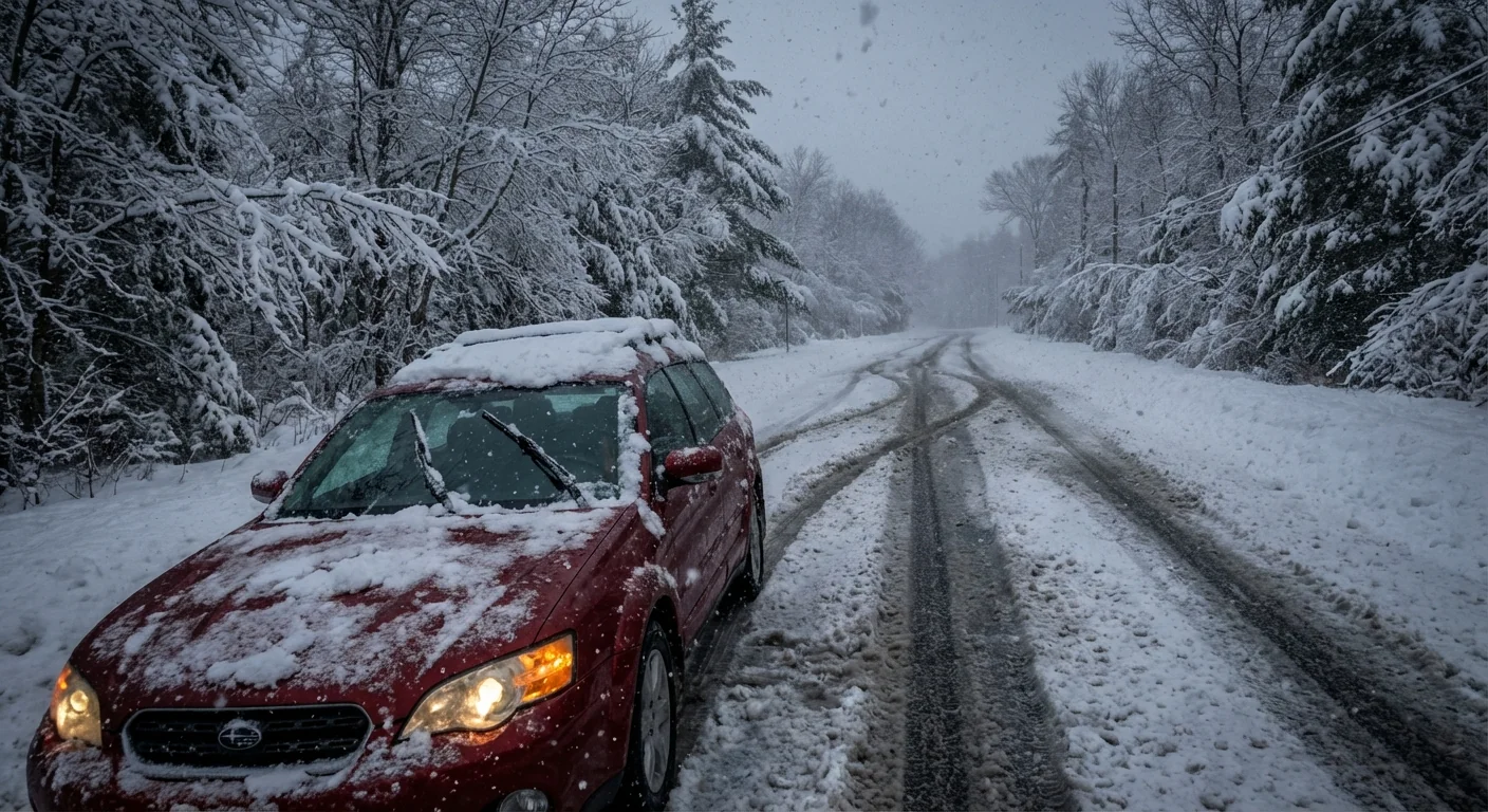
The snow to water ratio is low tonight, closer to paste than powder. That means fewer inches can still equal a lot of weight. It also means trees and lines are more vulnerable, and shoveling will be tougher on the back.
What to expect overnight and for Monday
Snow will continue through the overnight in pulses, with the heaviest bands redeveloping before daybreak. Commuters across New York, New Jersey, and Connecticut should plan for disrupted travel. Many school districts have already moved to closures or delays for Monday, January 26. Plow crews will focus on mains first, then secondaries, then neighborhoods, which will take time.
- Roads: Expect snow covered lanes and reduced visibility where banding sits
- Transit: Watch for modified schedules and possible service suspensions on bus routes
- Power: Heavy, wet snow on limbs raises the risk of scattered outages
- Timing: Lull pockets are possible, but another push near the morning commute is likely
If you must travel, slow down and leave extra space. Heavy, wet snow makes stopping distances much longer and hides black ice.
How to read your town’s total
Your town’s number is a snapshot. It depends on when it was measured, where it was measured, and whether the location sat under a band. A reading from a wind swept driveway will differ from one taken on a flat, open board. The most reliable totals come from trained observers measuring on a snow board, cleared each hour.
To measure at home, use a flat surface away from buildings, take several readings, then average them. Clear the board between hours to prevent compaction.
The climate signal behind heavy snow
A warmer atmosphere holds more water vapor. When enough cold air is in place, that added moisture can supercharge snow. That is what we are seeing tonight, long, rich feeds of Atlantic moisture swinging into cold pockets inland. These setups produce sharp gradients and intense banding, with big winners and losers over short distances.
Longer term, winters are warming in the Northeast. The season is shorter on average, and rain is eating a larger share of cool season storms near the coast. But paradoxically, the biggest snowfalls can grow heavier when the air cooperates. That means fewer big events, with higher ceilings when they hit. Planning for both realities is now part of winter life here.
Safer, smarter cleanup
Heavy, wet snow demands careful cleanup. Shovel in small lifts to reduce strain. Push, do not toss, when you can. If you use salt, go easy. Chlorides damage rivers, soils, and drinking water, and more salt does not always mean more melt. Brine, sand, and prompt plowing often work better than dumping rock salt after the fact.
Cities and towns can cut both costs and pollution by brining before the next wave, using calibrated spreaders, and clearing catch basins to limit street flooding when melting starts. Residents can help by clearing hydrants and storm drains, and by keeping piles off bike lanes and bus stops.
The bottom line
Snowfall totals tonight are a tale of bands and boundaries. North and west of the city, the deck is stacked for higher amounts. Near the coast and across the city, wetter snow and mixing hold numbers down, but add weight and risk. Expect revised totals by morning, more plow passes, and a slow go for the commute. We will keep tracking the bands and the totals, and we will update you as the measurements come in. Stay safe, stay patient, and clear smart. The storm is still writing its last chapters.


