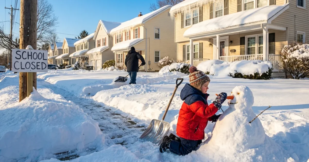
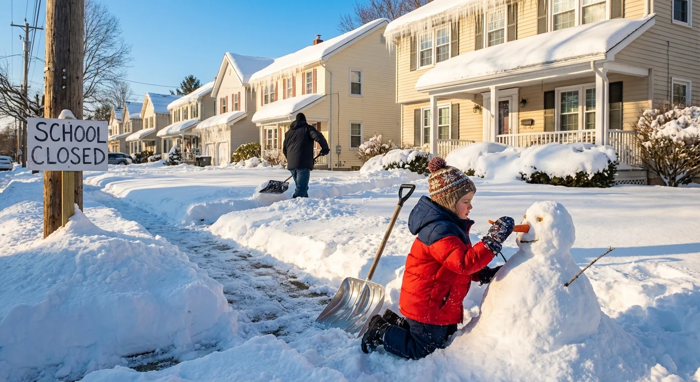
Schools across the Mid-Atlantic and Northeast will not open on time Monday. A winter storm is laying down heavy, wet snow and a dangerous glaze of ice. I am confirming closures and delays district by district tonight, with more updates coming at first light. Travel will be slick before sunrise. Expect plans to shift as bands of snow and freezing rain pulse through the morning commute. ❄️
Storm snapshot, Monday impact
This storm has two engines. Cold air is locked near the surface, while warmer, wetter air rides above it. That setup builds snow to the north and west, and ice right along the transition zone. The icing risk is highest before dawn, when temperatures bottom out and road salt works more slowly. Side streets and sidewalks will stay treacherous longer than main roads.
Power bumps are possible where the snow clings to trees and lines. Plow crews will improve conditions by late morning, but refreeze is likely again Monday night as skies clear.
Black ice will form faster on bridges and untreated neighborhood roads. If you must drive, slow down and leave extra space.
Region by region, what schools are doing
I am tracking confirmed school decisions across the region tonight. Many districts in the Washington region, central Maryland, and northern Virginia have already declared closures or two hour delays for Monday, January 26, 2026. Others are watching temperatures and will decide near dawn. Expect a patchwork of status changes as the snow to ice line wobbles.
In New Jersey, northern and central counties face a longer icing window. Many districts are moving to delayed openings to give crews time to treat roads. Some will close where ice accretes on trees and power lines. Coastal areas may see more slush than snow, but bridges will still ice.
Across the Tri State interior, including western Maryland, eastern West Virginia, and south central Pennsylvania, colder valleys favor snow. These areas lean toward closures where totals are higher and rural routes drift in the wind. Hill towns may remain slick into the afternoon.
New York’s lower Hudson Valley and parts of western Connecticut sit near the transition band. Superintendents there are watching radar and reported road temps. Expect staggered decisions after 5 a.m., with many opting for two hour delays to assess secondary roads.
Status will continue to update overnight. If conditions worsen, delays may flip to closures. If icing eases, some districts may hold classes with late starts.

Why this storm is so tricky
A warmer atmosphere holds more moisture. That fuel can make winter storms more intense when cold air is in place near the ground. The result is heavy snow on one side of the freeze line and slick, dangerous ice on the other. In our region, shallow cold air often pools in valleys and along the Piedmont. Warm air rides above it, which turns snowflakes to rain aloft, then to ice pellets or glaze before they hit your street.
Climate signals also point to bigger swings. More frequent temperature flips mean more storms with mixed precipitation. That raises the risk of ice, which is far harder to treat and far more dangerous for buses and walkers.
How to confirm your district, fast
Districts will push final calls before dawn. Have a quick plan to verify your school’s status.
- Check your district website or mobile app after 5 a.m.
- Turn on text, phone, and email alerts, then keep your phone off Do Not Disturb.
- Look for bus, meal, and after school notices, not just the headline status.
- If closed, watch for remote or asynchronous instructions from teachers.
Add your district alert number and website to your phone favorites. Save time when every minute matters.
If you do not see an official notice, assume normal hours until your district states otherwise. Local stations will post rolling lists, but treat your district’s message as the final word.
Safer, greener storm habits at home
Winter safety and sustainability can work together today.
- Shovel early and often, before snow compacts to ice.
- Use less salt, blend with sand for grip, and keep it off lawns.
- Clear storm drains so meltwater does not refreeze on your block.
- Avoid idling during warmups, start the car, clear windows, and go.
- Lower the thermostat two degrees and wear layers to ease grid stress.
These small steps cut runoff, protect pets, and help neighbors who rely on walkable paths. They also reduce peak energy demand while crews restore power.
The bottom line
Monday will start slow. Many schools are already closed or delayed, and more will adjust at dawn. Snow and ice will not clear evenly, and refreeze will follow at night. I will continue tracking district updates through the morning. Put safety first, verify your school’s status early, and give road crews the space to work. This storm is short, but it is sharp. Keep your plans flexible and your steps steady. ⚠️


