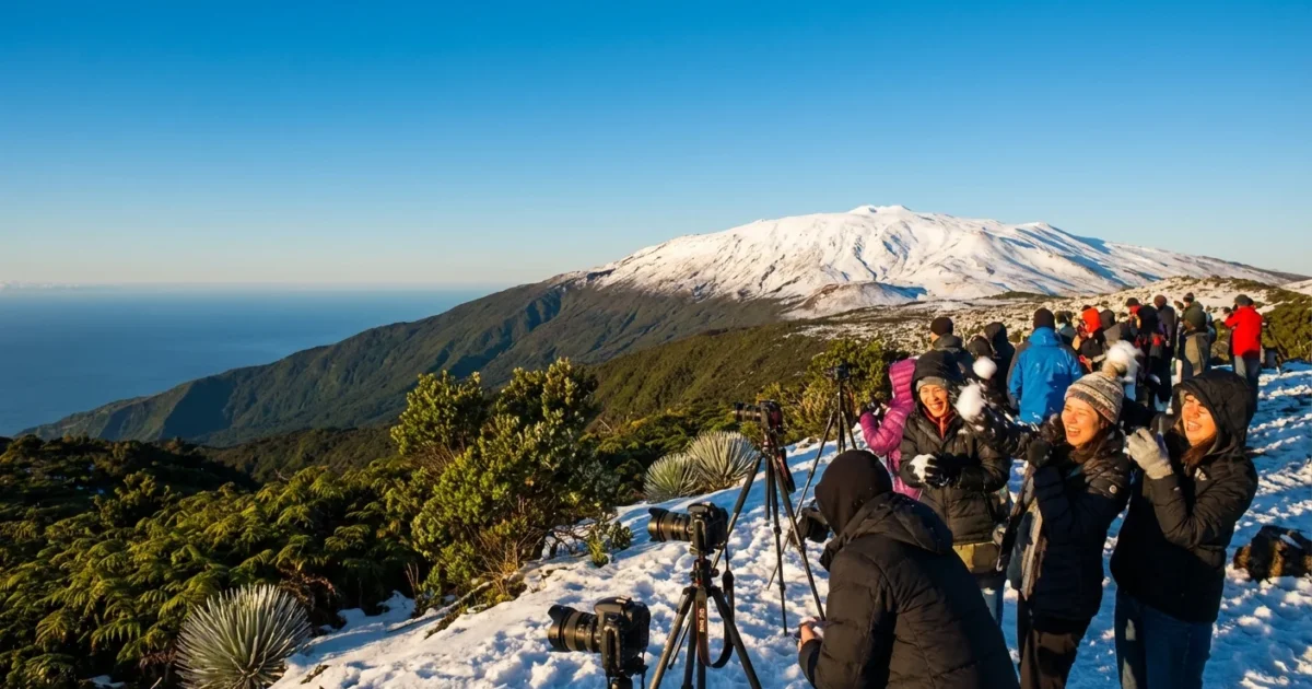
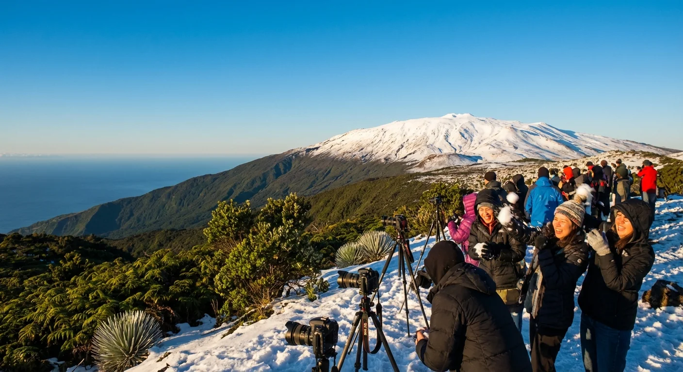
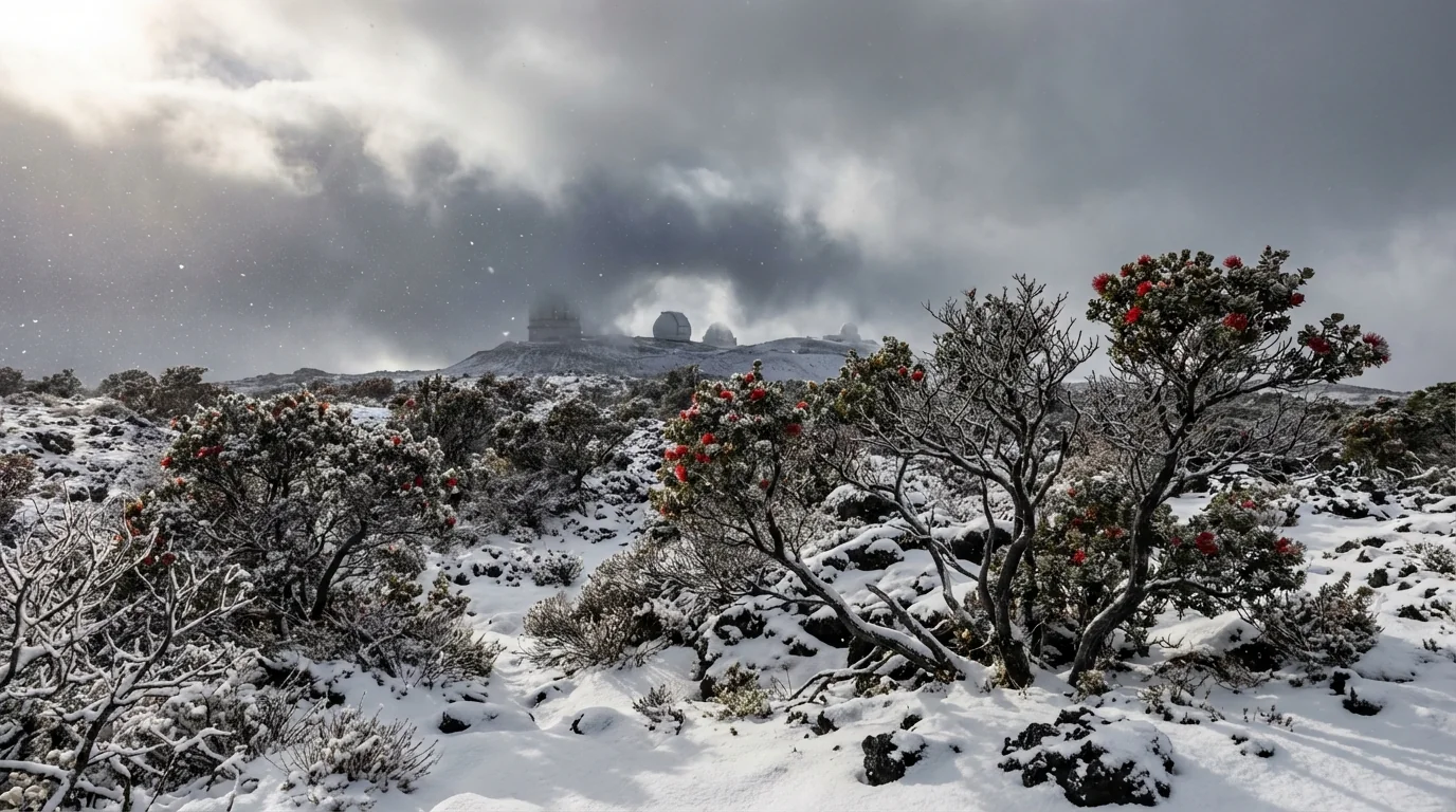
Snow in Hawaii, right now. A thick winter blast has turned the Big Island summits bright white, as a Kona Low funnels cold upper air and deep tropical moisture over Mauna Kea and Mauna Loa. Whiteout squalls and rime ice are wrapping the observatory ridge lines. Lower slopes are soaked. Beaches remain mild, but the weather is rough and changing fast.
The snow is locked to the highest terrain, generally above 11,000 to 13,000 feet. That sharp split is the story of Hawaii’s climate. Extreme elevation sits next to warm ocean. Today, that contrast is on full display.
What is driving this winter shot
A Kona Low has parked to the west of the islands. These systems are slow and stubborn. They tap moisture from the south, then aim it back at Hawaii. Air is forced up the volcanoes, it cools as it rises, and precipitation forms. Near the summits, it is cold enough for snow. Farther down, the same storm brings sheets of rain and gusty winds.
Summits and shorelines, two worlds
At the top, blowing snow and ice crust the cinder. At the coast, palm trees sway under heavy squalls. The freezing level hovers high in the sky, yet still below the mountain tops. It only takes a few degrees to flip rain to snow at those heights. That is why winter storms can paint the peaks white while surfers paddle out below.
Winter Storm Warnings are in effect for the Big Island summits. Whiteouts, ice, and severe gusts make travel dangerous. Summit roads may be closed.
Safety and travel impacts
Conditions on Mauna Kea and Mauna Loa are hazardous. Visibility drops to near zero in bursts. Gusts can topple hikers and slam car doors. Ice builds fast on any exposed metal. Access is often restricted during events like this to protect people and fragile summit soils.
Lower elevations face different risks. The Kona Low can unload inches of rain in a short time. That raises the chance of flash flooding, rockfall, and power interruptions. Thunderstorms may fire along the bands, with brief hail at higher slopes and dangerous lightning.
- Avoid summit travel. Wait for crews to reopen roads and post updates.
- Do not drive through flowing water. It is deeper and faster than it looks.
- Stay clear of streams, gulches, and drainage channels.
- Secure loose items. Wind gusts can turn debris into hazards.
- Boaters and surfers should check marine advisories before heading out.
Monitor statements from the National Weather Service and local officials. If you do not need to be on the road, delay travel.
Climate context and sustainability
Snow in Hawaii is not a myth. It shows up most winters on the tallest peaks. High elevation is the key. Even in the tropics, air thins and chills with height. That sets the stage for summit snow when a strong storm adds lift and moisture.
Climate change shapes the background. Warmer oceans feed more moisture into storms like this. That can boost extreme rain and flood risk, even if the number of Kona Lows shifts from year to year. At the same time, a warming atmosphere raises the freezing level. Over decades, that can trim the area that gets snow on the peaks. Snow will still happen, but the line that separates snow and rain will keep climbing.
This storm is a mixed bag for natural systems. Slow, steady rain helps recharge aquifers that feed wells and springs. Sudden deluges rush off hard lava and bare slopes, carrying mud into the ocean. That sediment can stress coral reefs and harm nearshore fish. High surf stirs coastal waters and can push debris into sensitive areas.
Communities have tools to manage these swings. Rain gardens, permeable pavements, and restored wetlands slow runoff and trap sediment. Better slope planting reduces erosion. Smart closures protect summit habitats that hold rare plants and insects. Early warnings and clear signs keep people out of harm’s way.
If you live on a slope or near a stream, have a go bag ready. Know two routes to higher ground in case water rises fast.
What to watch next
This Kona Low is slow to leave. Bands of rain will pivot over the same spots at times. That is how flooding builds. Winds can shift as the low wobbles, so expect quick changes.
- Periods of heavy rain that may trigger flash flooding and road closures.
- Isolated thunderstorms with lightning, brief small hail on higher slopes.
- High surf on south and west shores, strong currents near channels.
- Travel delays, especially for summit access and interisland flights.
Snow in Hawaii often surprises, yet it fits the islands’ sharp contrasts. Towering volcanoes meet a warm ocean, and the weather can flip within a few miles. Respect the mountains and the water today. Watch the sky, heed warnings, and give crews space to work. When the clouds lift, white peaks may sparkle above green valleys, a rare view in a warming world.


