BREAKING: Sleet Takes Control In Major Winter Storm, Road And Power Risks Rising
Sleet is now the headline hazard in a sweeping U.S. winter storm. Ice pellets are rattling windows, bouncing off roads, and turning commutes into a test of patience. Temperatures hover near freezing. A few degrees decide everything. Snow for some. Glaze ice for others. Sleet for many. I am tracking sharp transitions by the hour as the storm crosses state lines.
What Sleet Is, And Why It Matters Now
Sleet is not slush. It is not hail. It is snow that melts in a warm layer above us, then refreezes into small ice pellets before it hits the ground. The pellets bounce. They can sting your face in a gust. They layer up like sand and make roads slick in minutes.
Freezing rain is different. It stays liquid on the way down, then freezes on contact. That creates a hard glaze on pavement, cars, and power lines. With temperatures riding the 30 to 33 degree line, the storm is swapping between sleet and freezing rain across short distances. One exit sees pellets. The next town sees a sheet of ice. That tight gradient is driving today’s biggest risks.
[IMAGE_1]
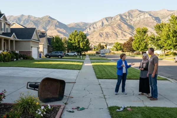
Travel can go from wet to a skating rink in one burst of sleet. Slow down, leave space, and avoid sudden braking.
How To Tell Sleet From Freezing Rain
Knowing the difference can help you make safer calls in real time. Listen, look, and feel.
- Sleet taps loudly on windows and bounces on pavement.
- Freezing rain is quiet and looks like normal rain at first.
- Sleet piles like coarse sand and crunches underfoot.
- Freezing rain coats everything in a clear, glassy sheen.
If your steps crunch, it is likely sleet. If your car door seals shut with a glaze, it is likely freezing rain. For power reliability, that difference matters. Sleet is heavy but tends to shed from wires. Freezing rain sticks to lines and trees, adds weight, and snaps limbs. Utilities know this. Crews stage differently when glaze ice is in the forecast.
The Setup: A Warm Layer Aloft, Arctic Air At The Surface
This storm is a classic winter sandwich. Shallow Arctic air hugs the ground. A thin warm layer sits above it, fed by southern moisture. Snowflakes fall from high clouds, melt in that warm slice, then either refreeze into sleet or stay liquid and become freezing rain. A change of only a couple degrees in that layer flips the outcome.
Climate science helps explain why this mixed bag is showing up more often. Winters are warming overall, yet cold snaps still punch south. A warmer atmosphere carries more moisture, which adds fuel to heavy events. That means bigger storm totals and more time near the freezing mark. The result is more zones of sleet and freezing rain around the edges of snow. These layers are thin and fickle, so the map can change street by street.
[IMAGE_2]
Impacts You Will Feel Today
Roads first. Sleet reduces traction fast. It hides black ice that forms under a fresh layer of pellets. Ramps, bridges, and untreated side streets are most at risk. Road salt works, but heavy sleet can overwhelm it. Plows may need repeated passes as bands reload.
Air travel is already strained. I expect more delays as crews deice aircraft and treat runways. Schools and events are shifting schedules where the sleet bands stall. For power, the bigger outages tend to occur in the deeper freezing rain zones. Still, a heavy sleet burst can weigh down small branches and stress weak limbs. It can also slow repair work, since footing for crews becomes risky and loud pellets keep falling.
Check the hourly forecast and temperature at your exact spot. A change from 31 to 33 degrees can switch sleet to freezing rain.
Smart Moves And Sustainable Choices
You can reduce risk and help your community at the same time. Drive only if you must. Combine trips. Fewer cars mean fewer crashes and less congestion for plows and ambulances. If you need to travel, go slow, keep a longer following distance, and brake gently. Clear your steps with a shovel first, then use a light touch of salt or sand. Over-salting harms streams and soil. Brine solutions and early shoveling work better and use less material.
At home, lower non essential power use during peak hours. That eases stress on the grid if ice knocks out lines nearby. Keep devices charged. Know where your flashlights are. If you see sagging limbs near wires, do not approach. Report them. Let trained crews handle it.
Cities and utilities have a role too. Stronger tree trimming programs, better cross arm designs, and insulated spacers can reduce ice damage. More renewable power with local storage improves resilience when lines fail. Sidewalk snow plans that favor plowing and brine over rock salt protect waterways. These choices add up over many storms.
Bottom Line
Sleet is the signal to take this storm seriously. Pellets may look small, but they change roads fast and complicate power restoration. If you hear tapping on the windows, plan for slower travel and possible delays. Watch the temperature and the type of precipitation where you are. The next burst could flip the script. Stay safe, stay patient, and give crews room to work.


