BREAKING: Winter storm warnings stretch across six states from Alaska to the Southeast tonight. The National Weather Service has issued urgent alerts for Alaska, Wyoming, Michigan, Illinois, South Carolina, and Virginia. Heavy snow, strong winds, and fast-changing conditions will make travel dangerous through Monday morning. The geographic spread is striking, from coastal Alaska to the Carolina midlands, and it signals a dynamic and unstable early winter pattern.
What to expect and when
Snow bands are already building along the storm’s long reach. Coastal Alaska is set for the biggest totals. Towns along the Panhandle should see 8 to 12 inches, with some communities picking up 3 to 5 inches. Winds could gust over 40 miles per hour near exposed coastlines and passes. That will cut visibility and pile drifts along roads.
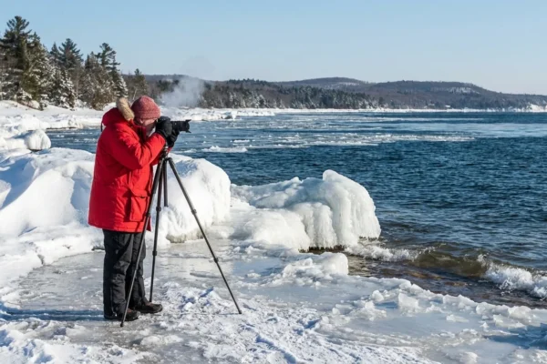
Farther south, the Teton and Gros Ventre ranges in Wyoming are targeted for near 10 inches. Michigan’s eastern Upper Peninsula could collect up to 6 inches, boosted by cold air moving over the lakes. Illinois, South Carolina, and Virginia face a messy 2 to 5 inches, with slush by day and a hard refreeze by night. Timing is tight. The core impacts arrive Sunday night and peak into the Monday commute.

Why this storm is so widespread
A strong Pacific low is feeding deep moisture into the West. At the same time, a sharp dip in the jet stream is dragging Arctic air south. Those two ingredients are linking up over a thousand miles of the country. In the Southeast, a wave along a coastal front is tapping that moisture and cold air. That is why snow is possible in places that do not usually see it in early December.
This pattern connects to a larger setup. A lobe of the polar vortex is forecast to sink toward the Midwest and East next week. That sets the stage for colder than normal air. When cold meets moisture, heavy snow can form, even at lower elevations and latitudes.
Hazardous travel is likely from Sunday night through Monday morning. Expect low visibility, drifting, black ice, and sudden closures. Delay nonessential trips.
Local impacts at a glance
In Alaska, strong winds and heavy snow will hinder coastal travel and marine operations. Power disruptions are possible where wet snow clings to lines. Avalanche danger will rise on leeward slopes as winds stack fresh snow.
Wyoming’s mountain zones will see quick loading on steep terrain. Backcountry travel is risky. Resorts and road crews should watch for rapid changes.
Michigan faces a classic lake enhanced setup. Bands could pivot and surprise nearby towns. Short bursts of heavy snow may drop an inch per hour at times.
Illinois, South Carolina, and Virginia will ride the temperature line. Expect slushy roads by afternoon that turn slick after sunset. Bridges and shaded stretches will glaze first. Shovel early to reduce ice bonding.

The climate signal behind the snow
A warmer atmosphere holds more water vapor. When cold air is present, that extra moisture falls as heavier snow. Ocean waters in the North Pacific and Gulf regions have been running warm, which can load storms with additional moisture. At the same time, rapid warming in the Arctic is linked to a wavier jet stream. That can pull cold air farther south, for longer. Not every storm is caused by climate change. Still, the background is changing, which can amplify extremes, winter storms included.
Preparedness, safety, and sustainability
Snow days strain power grids and supply lines. Smart prep keeps people safe and lowers stress on systems.
- Charge phones and backup batteries, and set weather alerts.
- Avoid unnecessary driving so plows and ambulances can move.
- Check heat, carbon monoxide alarms, and seal drafts to save energy.
- Clear storm drains and hydrants near your home.
- If you must drive, pack water, warm layers, and a scraper.
Make a simple storm kit. Include a flashlight, spare meds, basic snacks, and a paper list of contacts.
Using less energy during peak hours helps the grid ride out the storm. Lower the thermostat a couple of degrees, close doors to unused rooms, and layer up. If you have a heat pump, keep it on a steady setting. Frequent large swings waste power.
Watch for signs of hypothermia, confusion, shivering, and for carbon monoxide, headaches and nausea. Never run generators indoors.
Forecasting and capacity
This is a fast mover across many regions at once. Weather Service offices are coordinating closely. Short staffed or not, the warning process is active and ongoing. Expect frequent updates, radar nowcasts, and targeted advisories. Stay tuned to local alerts as the storm evolves hour by hour.


