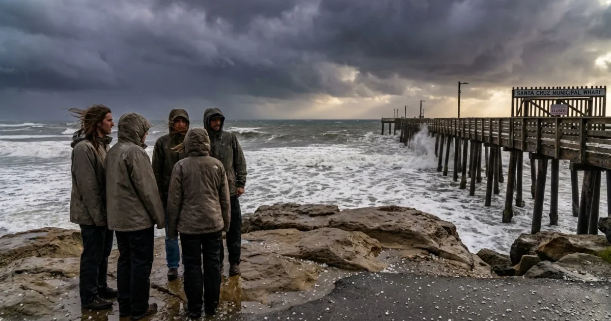
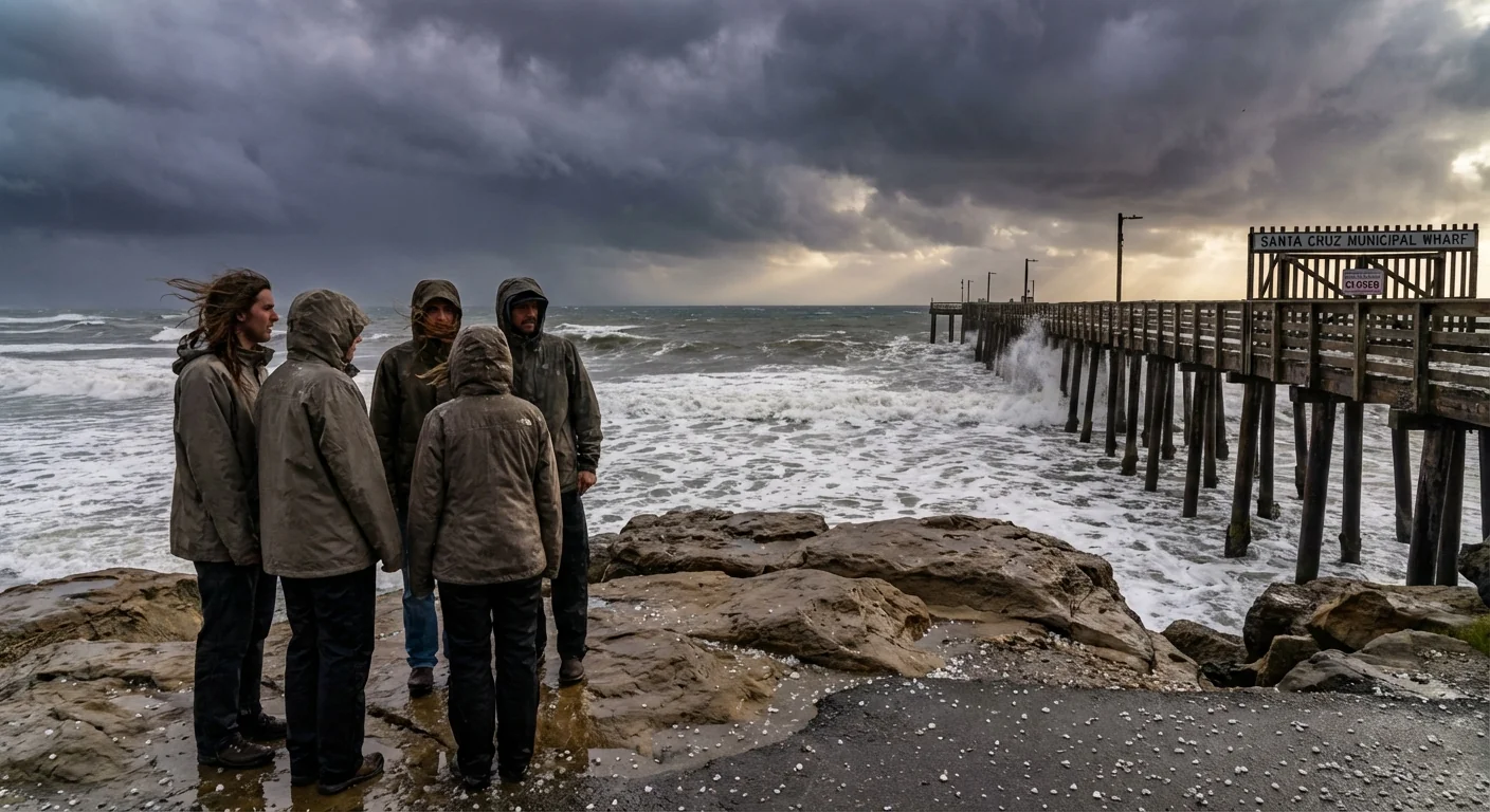
Sirens did not sound, but phones lit up. A tornado warning for Santa Cruz County was issued this afternoon as a fast moving storm spun north. Minutes felt long. Then, as quickly as it arrived, the warning was canceled. The skies have eased, but the atmosphere is still charged. Stay weather aware. 🌧️
Tornado warning issued, then canceled
The alert targeted storm cells moving from the Monterey Bay inland toward the foothills. Radar flagged a tight rotation signature, the telltale sign that a funnel could form or touch down. That trigger led to the warning. It pushed immediate shelter messages to homes, schools, and businesses.
As the cell raced north, the rotation weakened and drifted off the coast. Forecasters cleared the warning once the risk fell below the threshold. That decision means the short term tornado threat dropped. It does not mean the broader storm is over. Heavy rain, small hail, and gusty winds remain possible into the evening.
If a future Tornado Warning pops up on your phone, take shelter right away. Lowest floor, interior room, no windows.
Why the warning fired
Warnings are not guesses. They are based on a few key triggers. One is radar seeing rotation close to the ground. Another is a trained spotter report of a funnel or damage path. Today’s alert appears to have followed the radar route. The storm line had sharp wind shifts at low levels. Colder air aloft sat over a mild, moisture rich marine layer. That mix can give storms spin.
Cancellation follows the same rules. When the rotation separates from the strongest updraft, or when it weakens below set values, the danger drops. Forecasters also weigh spotter reports. No confirmed damage and a fading radar couplet are strong reasons to cancel. The goal is simple. Warn fast when risk is real, clear fast when it is not.
The climate signal behind today’s scare
Tornadoes in coastal California are rare, but not unheard of. Many are brief and weak by Great Plains standards. Yet the ingredients that feed them do visit here in winter. Strong cold fronts, powerful jet streams, and sharp wind shear can overlap along the coast.
Warmer oceans add fuel. The Pacific has been running warmer in recent years. Warmer water means more moisture and heat in the lower atmosphere. That can make storms stronger, with heavier downpours and more lightning. It can also increase the chance of rotating cells within squall lines. Climate change does not create storms from nothing. It loads the dice so the strongest storms can get a little stronger.
That is why days like today matter. They show how a coastal county better known for fog and surf can face short fuse severe weather. It is also a resilience test. Can alerts reach people in time. Can homes and schools move people into safe shelter quickly. Can runoff systems handle sudden bursts of rain.
Did alerts reach people
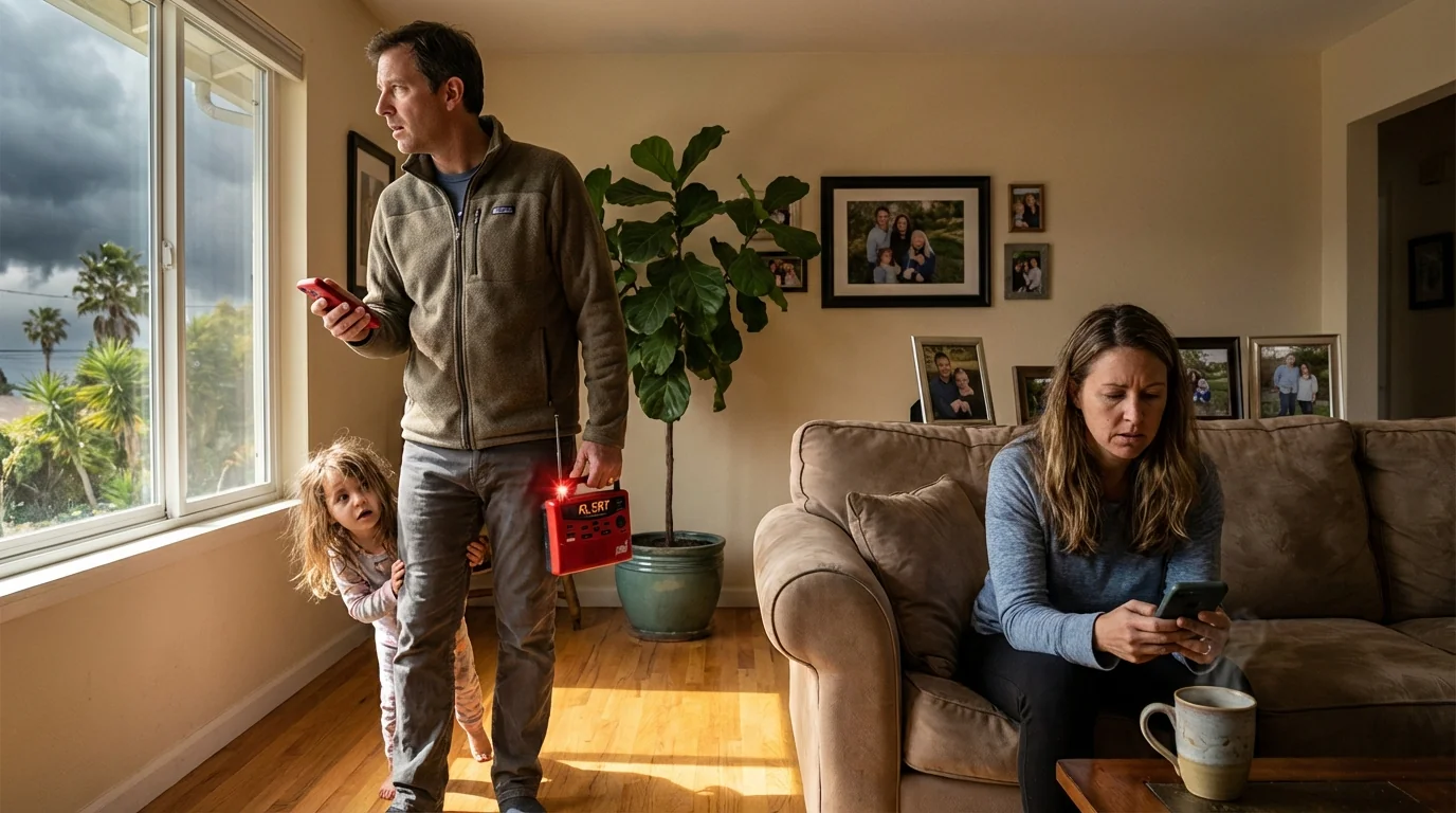
Phones across Santa Cruz County buzzed with Wireless Emergency Alerts during the warning. That system uses cell towers, not apps, and it is built for speed. Most carriers deliver the message in seconds. NOAA Weather Radio carried the same tone alerts for those with radios on. Local public safety systems also pushed notices.
These alerts work best when devices are set up. Many people mute them without meaning to. Others do not know where to find the settings. Take one minute now to check.
On your phone, keep Government Alerts on. Add a NOAA Weather Radio for back up. Redundancy saves minutes.
What to do right now
The warning is canceled, but more squalls are possible this evening. Treat the rest of the day like a severe weather watch. Stay ready. Here is a simple sequence if another warning hits:
- Move to the lowest level, in a small interior room. Bathrooms and closets work well.
- Stay away from windows. Put on sturdy shoes and a jacket.
- Protect your head with a pillow or bike helmet.
- Do not try to outrun a funnel. Do not shelter under overpasses. If driving, exit and seek a solid building.
- After the storm passes, avoid downed lines and flooded roads. Report damage to local officials.
A few steps now can cut risk later. Clear patio items that can become debris. Keep storm drains near your home free of leaves. Charge phones and flashlights. Review your family plan. Small actions, big payoff.
Strong conclusion
Today’s quick warning and quick all clear is a preview of our new normal. Short fuse hazards, powered by rich moisture and sharp wind shear, will test our coastal counties more often. The best defense is speed. Fast forecasts, fast alerts, fast action. The sky has relaxed for now. Stay alert tonight, and keep your shelter plan ready. I will continue to track the cells and update if conditions change.


