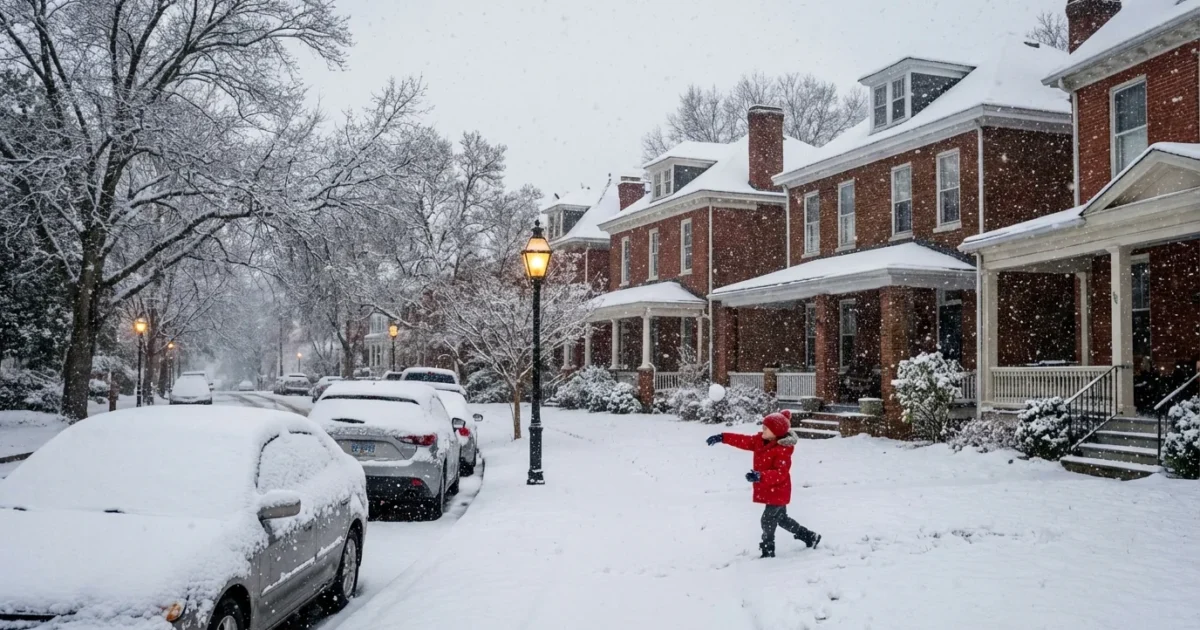
BREAKING: Snow Is Overtaking Richmond, With A Risky Commute Ahead
Snow is falling across Richmond this morning, and it is sticking. I am tracking steady, light snow at about 32°F, with a Winter Storm Warning active from 6 AM to 6 PM EST today. Expect 3 to 5 inches in much of central and south‑central Virginia, with a few spots seeing more. Roads are already slick. The morning and evening drive will be slow, and some services may pause as crews work the routes.

What’s Happening Right Now
The air is just at freezing, which is the worst temperature for travel. Snow compacts into slush, then turns to ice where traffic is heaviest. Snow will continue through the day, with the most steady bands late morning into afternoon. Plows and salt trucks are rolling, but road chemicals work less efficiently at this temperature.
Winter Storm Warning, 6 AM to 6 PM EST. Snow 3 to 5 inches. Plan for slippery roads, slower transit, and delays.
This event follows a recent advisory earlier this month, part of a cold snap with back‑to‑back systems. Today’s storm has more moisture to work with, so totals will be higher, and the snow is wetter and heavier.
How This Will Affect Your Day
The morning rush is already messy. Expect delays on I‑95, I‑64, and key city arterials. GRTC buses will run slower as stops get slushy. Side streets will be the last to improve. If you can delay travel until crews make a few passes, do it. If you must go, reduce speed, leave space, and brake early.
Air travel at Richmond International may see deicing delays. Check flight status before you leave home. Schools and offices are making calls hour by hour. Many will move to remote options to cut risk.
Quick steps that help right now:
- Clear snow off your car, including lights and roof.
- Use low, steady throttle. Avoid hard braking.
- Keep washer fluid topped up, blades clear, and headlights on.
- Carry a blanket, water, and a phone charger.
The Science Behind Today’s Storm
This is a classic Mid‑Atlantic setup. A wave of low pressure tapped Gulf and Atlantic moisture, then slid along a sharp temperature boundary. Cold air pooled at the surface overnight, which kept the storm snow for Richmond. Bands are forming where lift is strongest, so totals will vary by neighborhood. Near‑freezing snow is wetter, which adds weight to branches and makes shoveling harder.
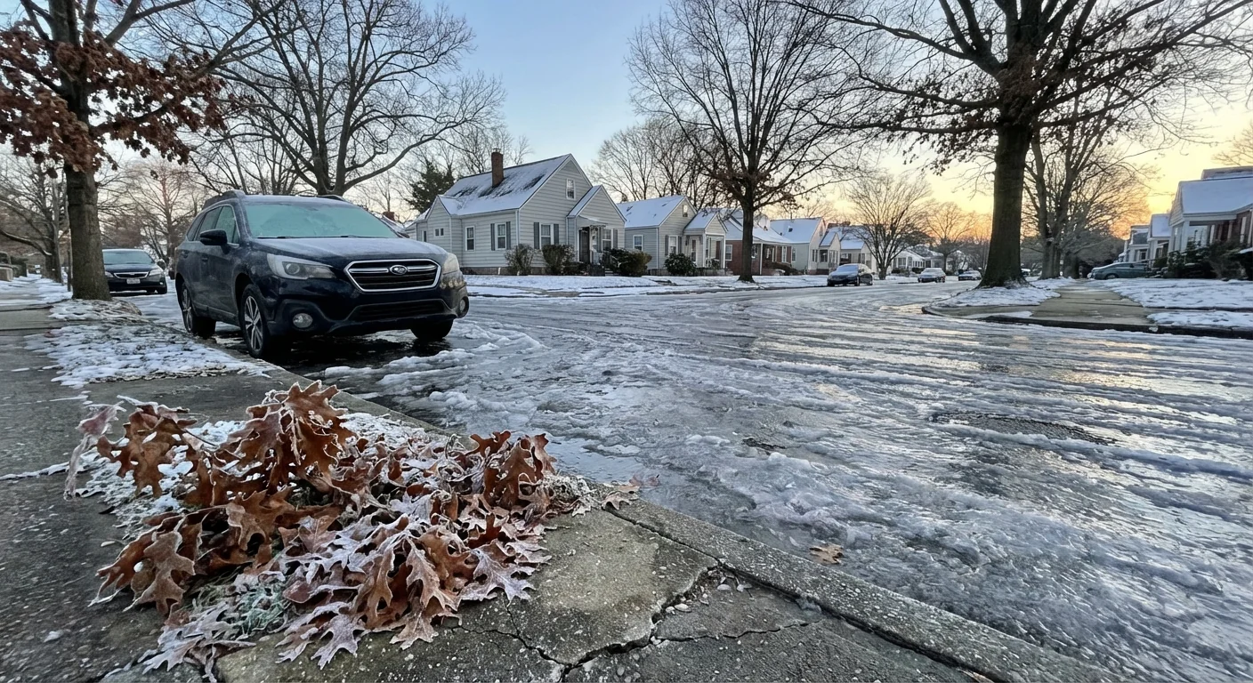
As the storm exits late day, winds will turn northerly and temperatures will dip. Untreated slush can refreeze tonight, even if totals taper off. Expect a crusty, icy surface by early Tuesday morning.
Shovel early and often to avoid heavy lifts. Use sand or calcium magnesium acetate instead of rock salt when you can, which is easier on rivers, pets, and sidewalks. Lower your thermostat a couple of degrees and seal drafts to trim energy use during peak demand.
Climate Context, Straight Talk
Winters in Richmond are warmer on average than they were a few decades ago. That does not remove snow from our future. Warmer air holds more moisture. When cold air slides in, storms can wring out heavier snow, even in short windows. That is what we are seeing this week, quick hits with meaningful impacts. Expect more swings, faster transitions, and tighter forecast windows as the season unfolds.
Where To Get Updates And What To Watch
I will keep tracking snow rates, road temps, and closures through the day. For live alerts, check the National Weather Service local office, Virginia 511 for road conditions, and city updates from GRTC and Richmond Public Schools. Richmond International Airport will post gate‑by‑gate changes. Keep an eye on your utility’s outage map as the wet snow adds weight to small limbs, especially south and east of the city.
If you work from home, today is the day. If you must drive, choose main routes, which get treated first. Finish errands before dusk to avoid the evening refreeze.
Conclusion: Richmond is in a real winter day, not a drill. Snow is steady, roads are slick, and timing hits both commutes. Stay off the roads if you can. If you must travel, go slow, think ahead, and finish early. I will update as the storm evolves, and so will city and state crews working to keep you safe. Stay warm, stay patient, and take care of your block. ❄️


