Redding is swamped tonight. Streets look like fast rivers. Sirens cut through steady rain. Families are moving to higher ground as crews race to reach flooded homes. At least one person has died in Northern California in storm related flooding. The threat is not over. More rain and mountain snow are lining up through the holiday period.
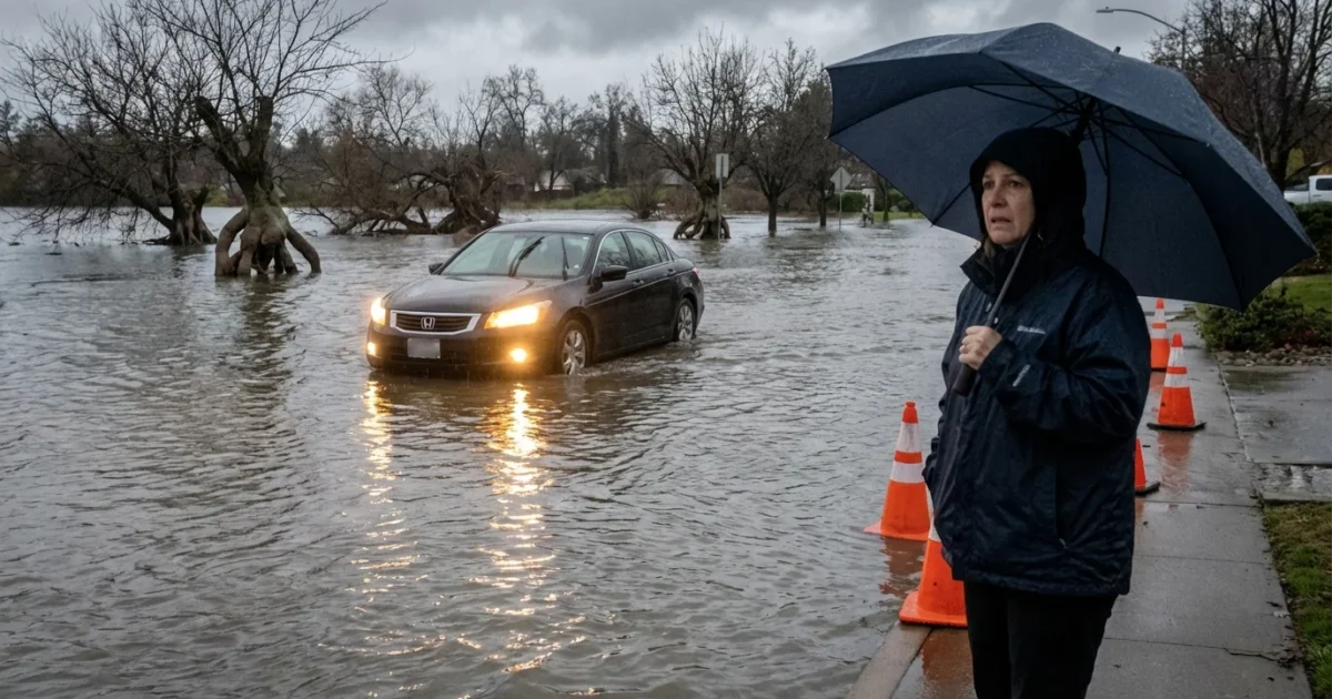
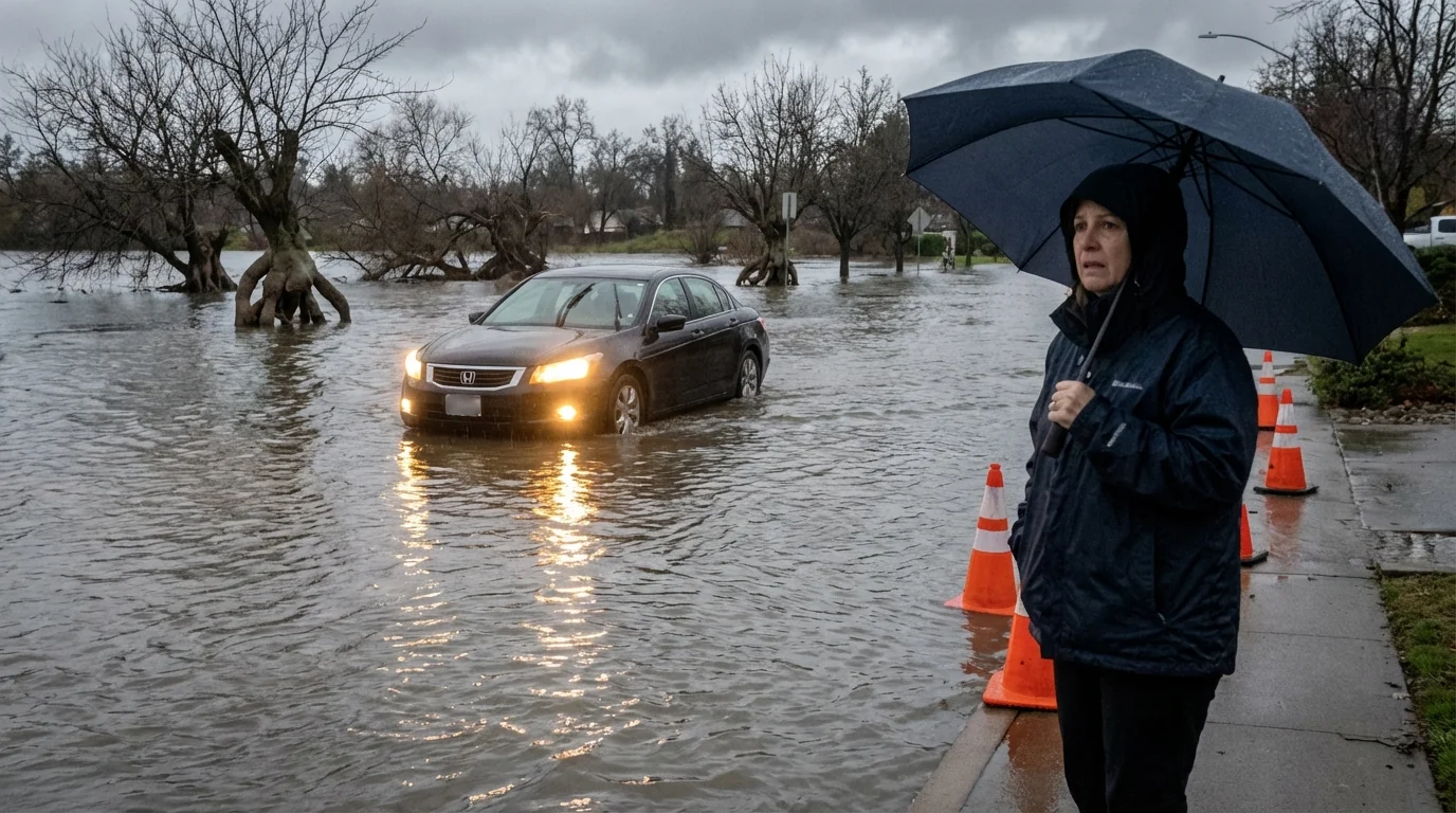
Latest conditions in Redding
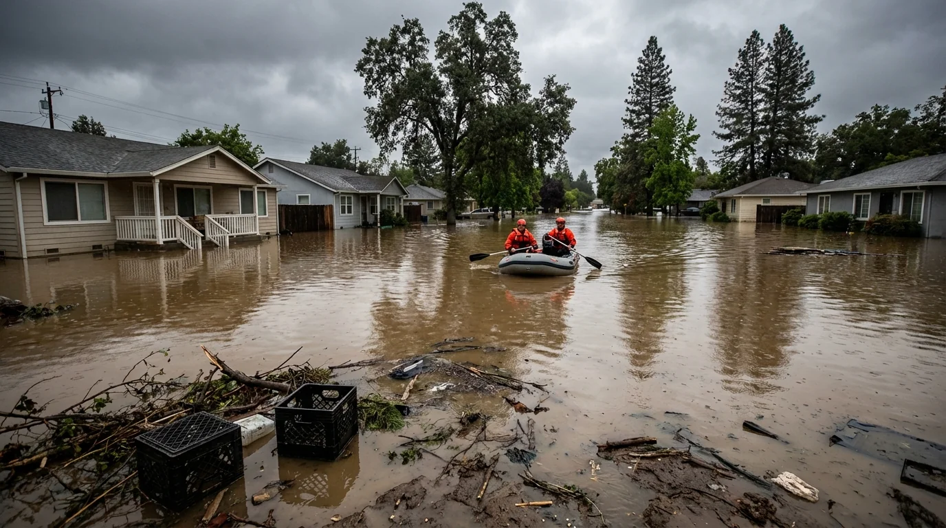
Heavy rain has hammered the north state since before dawn. Storm drains are overwhelmed. Small creeks have spilled into neighborhoods. Low spots on major roads are underwater. Emergency teams report high water rescues across parts of the city. Power flickers in several districts as wind and soaked soil bring trees down.
Forecasters warn of several more rounds of rain late tonight and into the next two days. The Sacramento River is running high and fast. Urban flooding will remain possible where water has nowhere to go. Rural areas with poor drainage face the same risk.
Do not drive through flooded roads. Just a few inches of moving water can sweep a car away. Turn around. ⚠️
Why this storm is so intense
This is a classic atmospheric river, a long band of Pacific moisture feeding right into Northern California. Warm air holds more water, so the clouds wring out heavy rain. Snow levels have jumped at times, then dropped as colder air moves in. That flip from rain to snow changes flood timing. Rain first runs off quickly, then later snowmelt can add another pulse.
A warmer climate loads the dice for events like this. The ocean is warmer than average, which juices the moisture pipeline. Our soils were already wet from recent storms, so they cannot absorb much. Burn scars from recent wildfires shed water even faster, which can trigger debris flows.
What to expect in the next 48 hours
Expect more heavy bands tonight and through the holiday weekend. Rain rates could spike under the strongest cells, which raises flash flood risk. Thunder is possible in the most unstable pockets. Winds will be gusty at times, which can bring more limbs down and cause new outages.
In the mountains, snow will pile up above the higher passes. Travel could slow to a crawl or close for periods. Chains, long delays, and whiteout conditions are all possible. Downstream rivers may keep rising even after the heaviest rain moves east. That lag matters for communities along creeks and the main stem of the Sacramento.
Safety and travel guidance
Stay put if you can. If you must travel, leave early and build in extra time. Never try to walk or drive across moving water. Keep phones charged and a flashlight handy. Check on neighbors who may need help, especially seniors.
- Pack a go bag with meds, water, chargers, and key papers
- Move cars to higher ground and clear street drains if safe
- Keep kids and pets away from creeks and canals
- Check road and transit alerts before you head out
If water starts rising indoors, kill power at the main breaker only if you can reach it without stepping in water. Safety first.
Infrastructure and environmental impacts
Stormwater systems are at their limits. Backed up drains are pushing water into intersections and parking lots. Short term power outages are likely as saturated trees fall. Landslides are possible on steep slopes, especially near recent burn areas. Rural wells near creeks may turn muddy for a time as sediment pulses move through.
Wastewater plants and pump stations may see spikes. That can lead to localized overflows, which is another reason to avoid floodwater. It often contains oil, sewage, and sharp debris. For the region, the surge of runoff will send a shot of water into Shasta Lake and downstream reservoirs. That helps long term storage, but the speed of inflow raises flood control challenges in the near term.
Building toward resilience
Days like this are a test. Green streets, rain gardens, and bigger culverts reduce urban flooding. Restoring wetlands along rivers gives stormwater room to spread out. Upgrading grids to handle wind and wet soils can keep the lights on. These are not abstract plans. They are the difference between a close call and a crisis in a warming world.
The bottom line
Redding is in the thick of it, and the next waves are coming. Tonight brings more rain, more flooding risk, and heavy mountain snow. Keep your family safe, check your routes, and avoid floodwater. We will track each band and update the outlook as the storm evolves. For now, stay alert, stay dry, and take care of each other. 🌧️


