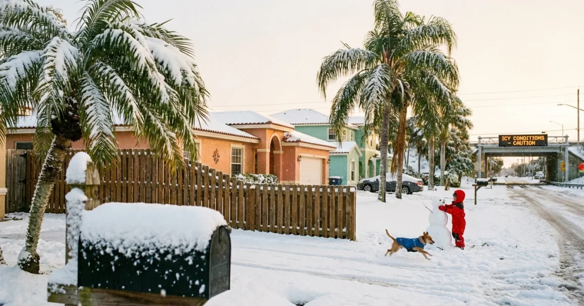
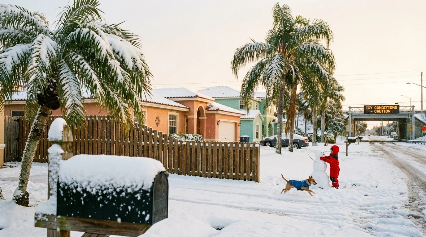
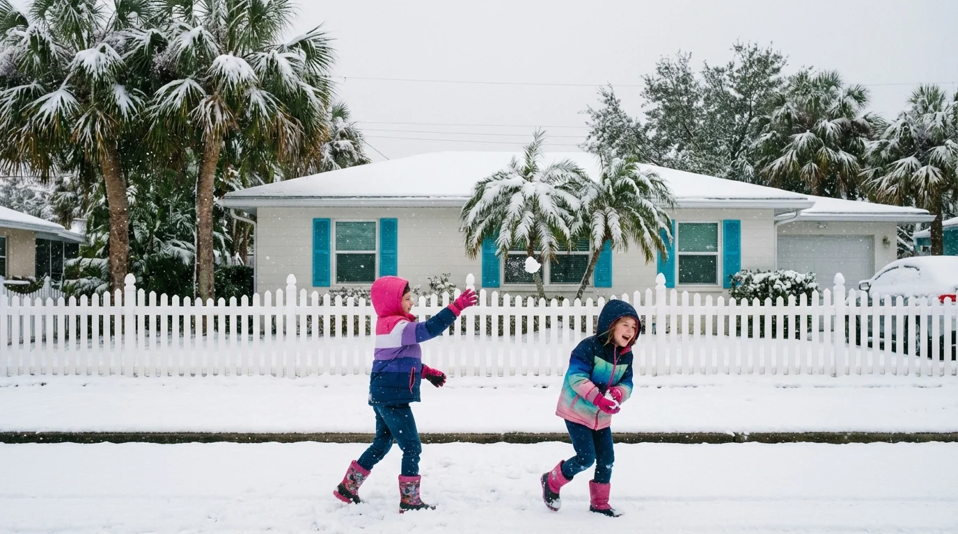
Snow is falling in Florida this morning. Yes, Florida. Light flurries are drifting across the western Panhandle, with a powdery coating on lawns and rooftops. I confirmed early snow near Fort Walton Beach, Chipley, Marianna, and even Pensacola, mainly along and north of I-10. Accumulation is patchy and shallow, but it is real, and it is rare.
Bridges and overpasses are the main concern. Elevated surfaces cool faster than the ground. That is where slick spots can form first, even when most roads look wet.
Use low speeds on bridges and ramps. Black ice can form with only a light dusting and subfreezing wind.
What I am seeing right now
I spoke with forecasters at the National Weather Service in Mobile before sunrise. They confirmed light snow in the western Panhandle. My review of I-10 traffic cameras showed a thin, white sheen on grassy medians and on some bridge decks. Temperatures hovered near freezing, which is just cold enough for flakes to survive the fall to the surface.
This is nothing like the 2025 blizzard that buried parts of the Panhandle. Last January, heavy bands parked over the same corridor and dropped up to 10 inches in the Milton area, with 8 to 9 inches in nearby towns. Today’s system is weaker. Moisture is thinner. Lift is brief. Most places will see flurries or a dusting, not deep snow.
Still, Florida snow two winters in a row is extraordinary. Many Panhandle winters pass with no flakes at all. Seeing back to back events highlights how powerful this morning’s cold blast is, and how timing with Gulf moisture can flip the script fast.
Why it is snowing today
A pocket of the polar vortex slid south this weekend. Think of it as a pool of deep Arctic air that sometimes spills into the United States. That icy air pushed over the Gulf Coast overnight. At the same time, a weak wave along the Gulf sent a narrow ribbon of moisture north into the Panhandle.
Cold air plus light Gulf moisture equals snow if the entire column of air stays below freezing. That happened for a few hours near and north of I-10. Surface temperatures hovered near 30 to 33 degrees, and the air just above the ground stayed cold enough for flakes to reach the surface intact. The snow is light because the lift is modest, and the moisture is limited. Once the upper wave passes, the flakes will fade.
The next 24 to 48 hours
Flurries taper from west to east by late morning, with stray flakes possible midday near Tallahassee’s western fringe. Skies turn partly sunny by afternoon for most of the Panhandle. Highs reach the upper 30s to low 40s. That will melt most of the coating on grass. Any water left on bridges will refreeze tonight.
- Tonight, lows in the low to mid 20s inland, upper 20s on the coast. Wind chills in the teens.
- Monday, sunny but cold. Highs near 40 to 45. Watch for morning ice on bridges.
- Monday night, another freeze. Lows 24 to 30. Inland spots are coldest.
- Tuesday, a slow warmup. Highs climb into the upper 40s to near 50, with dry air.
Protect pipes, pets, and people. Farmers should cover sensitive crops. Coastal areas may see freeze damage on tropical plants.
Heat your home safely and efficiently. Set thermostats to a steady temperature, close drapes at night, seal drafts with towels, and avoid using ovens for heat.
Climate context and sustainability
Snow in Florida is rare, even in the Panhandle. A warming climate does not erase cold snaps. It changes their shape. The Gulf is warmer on average. Warmer water loads the air with more moisture. When a strong burst of Arctic air arrives, that extra moisture can make brief winter weather more likely in places that rarely see it.
Scientists are studying links between rapid Arctic warming and polar vortex disruptions. The research is ongoing. What we know today is simple. Weather rides on top of climate. Long term warming continues, yet short bursts of severe cold still occur, and they can be sharp.
This second straight winter with snow is not a new normal for Florida. It is a reminder that the state must plan for swings. The grid needs capacity for cold mornings and hot summers. Homes need better insulation, even in the Panhandle. Cities should prepare deicing plans that protect waterways.
Use sand or kitty litter for traction on driveways near drains. Heavy salt use can wash into creeks and harm coastal marshes.
Bottom line
Florida woke up to flurries again. The snow is light, but the signal is strong. Rare winter weather in a warming world demands better planning and smart choices. Watch for slick bridges, prepare for a hard freeze tonight, and take care of neighbors who need help. The flakes will not last long, but the lessons will.


