BREAKING: Winter storm warnings blanket the map tonight. Heavy snow and fierce winds are rolling across mountains and cities. Travel will turn dangerous. Power could falter. I am tracking the system as it spreads from the Rockies to the Great Lakes and into the Mid-Atlantic.
What a Winter Storm Warning Means
This warning means a major winter event is happening or about to start. Expect heavy snow, ice, or sleet. It is a direct threat to life and property. Prepare fast. Stay off the roads when snowfall peaks and winds lift powder into the air. Visibility can drop in seconds.
Whiteouts are likely on high passes and open plains. If you cannot see, do not drive.
Region by Region: What to Expect
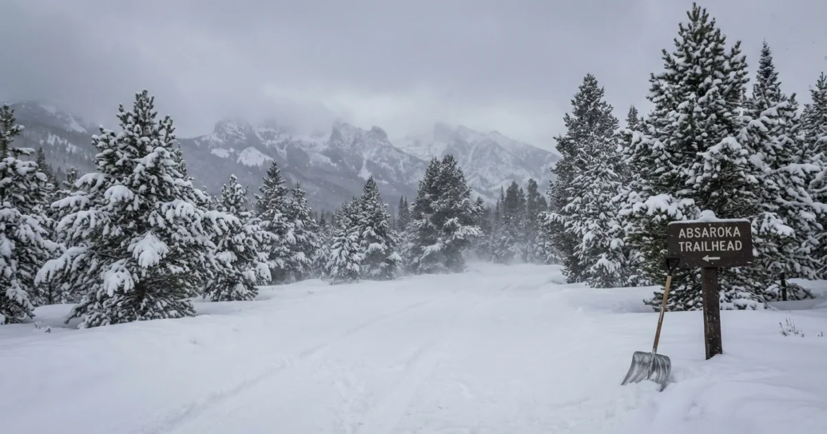
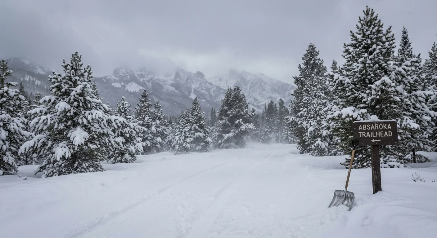
Northern Rockies and Yellowstone
The core of this storm is pounding the Absaroka Mountains and Yellowstone. Totals reach 10 to 20 inches through December 10. Gusts near ridge tops can hit 60 miles per hour. Blowing and drifting will bury roads and close corridors. Snow will stack even higher on favored west and northwest slopes.
Intermountain West
High terrain from Idaho to Montana and into Wyoming and northern Colorado sits in the bull’s eye. Snowfall ranges from 6 to 24 inches where banding locks in. Valleys see less, but travel will still be slick. Expect chain controls and rapid changes over a few miles.
Midwest and Great Lakes
A quick surge reaches Illinois with a burst of snow. Chicago is on track for 2 to 5 inches overnight. That is enough to ice bridges and ramps and slow the Monday commute. Lake effect will flare on the back side, adding fresh bursts and sharp visibility drops.
Mid-Atlantic and the South
Cold air presses south as moisture streams north. Parts of Virginia and even sections of South Carolina see a wintry mix. Roads may glaze after dark. Power lines face stress from heavy, wet snow where temperatures hover near freezing.
Alaska
A separate push hits coastal and interior zones with heavy snow and wind. Marine air adds moisture. Inland cold keeps snow light and powdery, which lifts easily in gusts. Travel off the road system will be tough.
Travel and Home Safety, When to Stay Put
Road impacts scale fast with this pattern. Snow bands form, stall, then redevelop. If you must travel, leave early and move slowly. If you can wait, do. Crews need time to plow and treat surfaces.
- Pack your car with water, snacks, blankets, a shovel, traction sand, phone chargers, and a flashlight.
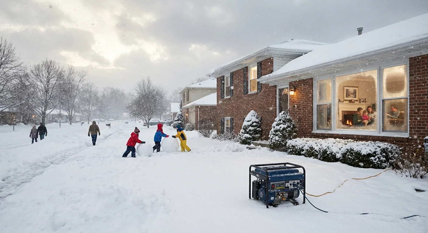
At home, test heat now. Close interior doors to hold warmth. Charge batteries. Plan for short power cuts. Heavy, wet snow near the coasts can load trees, which means branch breaks and local outages.
Delay trips until plows and salt trucks make a first pass. The first two hours after peak snowfall are the worst.
Never run a generator indoors. Keep it outside, 20 feet from doors and windows, to avoid carbon monoxide.
Why This Is Happening, The Climate Backdrop
This storm rides a sharp temperature contrast. Cold air dropped south. Moist air surged in from the Pacific and Gulf. When cold meets moisture, snow explodes. A warmer atmosphere holds more water vapor. That can feed heavier snow when the air at the ground is cold enough. We are seeing this pattern more often, quick thaws followed by sharp freezes, then high impact snow.
The jet stream is swinging widely this week. That guides storms into the Rockies, then curves them across the Plains and Great Lakes. Upslope flow boosts mountain totals. Lake effect kicks in as colder air passes over warmer water. All of this stacks up to widespread, multi-day risk.
Sustainability matters in events like this. Weatherproof homes cut heat loss and reduce strain on the grid. Shared snow clearing and neighbor checks save fuel and lives. If you use backup heat, choose cleaner options when you can, like heat pumps and induction stoves, and keep ventilation strong.
Timing and Next Updates
Many warnings are active through December 10. The heaviest mountain snow hits now through Monday morning. The Midwest wave peaks overnight. The Mid-Atlantic risk grows late Monday as temperatures wobble around freezing. Conditions can change quickly. Watch local alerts and be ready to adjust plans.


