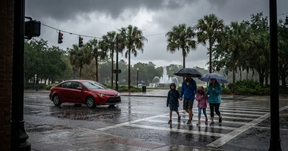
BREAKING: Gray skies, a sharp chill, and on-and-off rain are gripping Orlando right now. A strong cold front has pushed through Central Florida, and it is calling the shots. I am tracking thick clouds, a cool 64°F, and early showers in the metro, with the wettest burst already focused on Sunday. 🌧️

What is happening right now
Clouds are locked in across the city this morning, and light rain is still passing through in spots. Temperatures sit near 64°F, which feels cooler with a steady breeze. Gusts are reaching around 20 mph at times, and that will make it feel raw if you are outdoors.
Sunday delivered the heaviest rain, with brief downpours that soaked roads in minutes. Some bursts dropped around half an inch of rain, and ponding showed up fast in low spots. Earlier in this cool spell, many neighborhoods woke to the upper 40s and low 50s. Wind chills fell into the 30s for a few hours, which is unusual for early December here.
Rain will taper as we move through the day, and the region heads into a cooler and drier stretch. Expect highs in the low to mid 70s most afternoons this week, with cool, crisp nights.
Brief heavy rain can still reduce visibility and create slick roads. Leave extra space when driving, and watch for hydroplaning on I‑4 and area toll roads.
What this means for your plans
This pattern affects travel, theme parks, and outdoor events. Early showers will be hit or miss, then skies stay mostly cloudy. The breeze will keep it cool in the shade and on open walkways.
At the parks, plan for cooler lines and damp seats. Ponchos beat umbrellas in a breeze, and quick-dry layers will help you stay comfortable. If you are flying, low clouds and passing showers can slow operations for short periods, so allow buffer time.
- Quick plan for today: pack a light rain layer, wear closed shoes, bring a small towel, and keep a dry bag for phones
The science behind the chill
Here is what is driving it. The jet stream, a fast ribbon of wind high above, dipped south over the Gulf and Florida. That opened the door for cooler, drier air from the north. At the same time, the Gulf and Atlantic remain warmer than the air above them. Warm water adds moisture to the air, which can fuel brief heavy showers along and behind the front.
This is classic December in Florida, but with a modern twist. Winters here are trending milder overall, especially at night, yet strong fronts still punch through. When they do, the clash between warm seas and cool air can lead to short, intense rain. That is why we saw quick downpours on Sunday, even as cooler air moved in.

Sustainability and simple steps
Rain that falls fast runs off fast. On days like this, streets catch oil, fertilizer, and trash, and push it toward lakes and streams. Small choices help. Keep storm drains near your home clear, skip lawn treatments this week, and pick up any litter that might wash away. If you are heading across town, consider carpooling or transit during peak showers. Fewer cars mean safer roads and lower emissions on a wet day.
Home energy use usually rises on cool snaps. Try a light sweater first and set the thermostat a bit higher than usual for heating. Ceiling fans on low can move warm air down without using much power.
Headed to a theme park or outdoor game today, then tomorrow, plan layers, carry a refillable bottle, and stash a packable poncho. You will stay warm, cut plastic waste, and keep moving even if a shower pops.
Forecast at a glance
The front is moving away. Showers fade today, and the sky stays mostly cloudy. Through midweek, expect cooler, drier air with highs in the low to mid 70s and nights in the 50s. A light breeze persists, and mornings will feel crisp. Sunshine increases after today, with low humidity and good air quality returning.


