BREAKING: Ohio sheriffs escalate snow emergency levels as lake-effect snow slams Northeast Ohio. Travel is rough. School leaders in Cleveland, Akron, and Canton are canceling and delaying classes as bands keep parking over the region. An arctic blast trails this system, locking in bitter wind chills through the end of the week. This is a fast, messy setup, and conditions will change by the hour. ❄️
What is happening right now
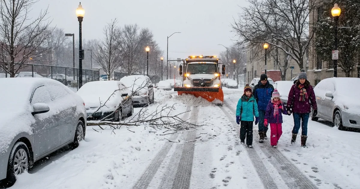
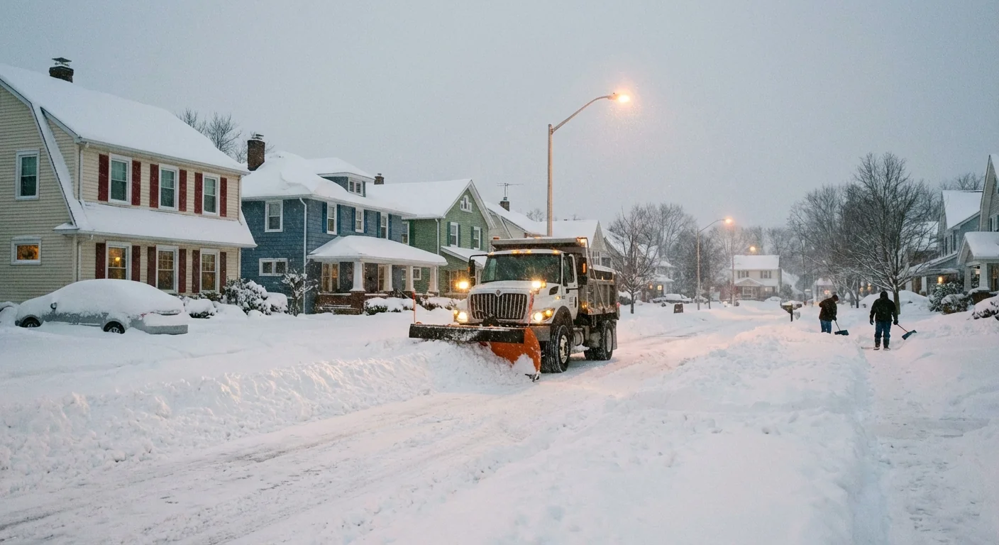
Lake-effect snow is firing off the open waters of Lake Erie and pouring into the primary snowbelt. Visibility drops in seconds inside the heaviest bands. Slick pavement, drifting snow, and sudden whiteouts are slowing the morning commute from the I-90 corridor into the hillier inland counties. I am tracking fresh sheriff declarations and updates this morning. Levels are moving quickly as bands wobble and intensify, especially from the lakeshore into higher terrain.
Expect rapid changes. A clean road can turn icy two miles later. Crews are out, but heavy bursts outpace salt and plows. Winds are stiff, and temperatures are falling as arctic air presses in. That means refreeze on treated roads and a growing risk of black ice this afternoon and tonight.
Know your county snow emergency level
Ohio sheriffs set Snow Emergency Levels by county. Know them, respect them, and plan your day around them.
- Level 1, Roads are hazardous. Drive with caution.
- Level 2, Only necessary travel. Expect very poor roads.
- Level 3, Roads closed to non emergency travel. You can be cited for driving.
Levels are county specific and can change fast. Check your county sheriff or EMA page for the latest. Use ODOT’s OHGO to see live crashes, closures, and travel speeds.
If your county is at Level 3, stay off the roads unless it is a true emergency. First responders need clear lanes, and stranded cars slow plows.
Why this is happening, the pattern behind the punch
Cold air is sweeping over a relatively warm Lake Erie. That temperature contrast fuels rising air, cloud towers, and intense snow bands. Winds from the northwest and north aim those bands at the snowbelt, then inland into Summit and Stark as bands pivot. The lake adds moisture, so flakes are fluffy and pile up fast. Gusts move the light snow around and drop visibility to near zero inside the band core.
The arctic blast tightening behind the snow will make road salt less effective, especially tonight. Air temperatures will tumble. Wind chills will bite. Any slush left on side streets and rural routes will freeze hard.
Climate context
Great Lakes water stays warmer deeper into fall and early winter now. That extra warmth can supercharge early season lake-effect events like this one. It loads storms with more moisture and can make the most intense bands more intense. At the same time, our winters are trending more variable. We swing from mild spells to sudden arctic shots. That volatility stresses road systems, schools, and the grid. Planning for these swings is now part of winter life in Ohio.
Travel and school day decisions
School districts across the snowbelt are pulling back today because band placement is unpredictable and harsh on buses and walkers. Families should build in extra time or shift to remote plans if possible. Employers should allow flexible schedules where they can. The safest trip is the one you do not take during the peak bands.
- Check your county sheriff or EMA page for your current snow emergency level.
- Open ODOT’s OHGO for real time crashes, speeds, and cameras on your route.
- Watch for alerts from your school district or university before heading out.
- If you must drive, top off the tank, slow down, and increase following distance.
Pack a winter kit. Include a charged phone, blankets, water, snacks, gloves, a scraper, jumper cables, and a small shovel.
Think sustainability while staying safe. Combine trips to cut mileage. Avoid long idling that burns fuel and adds pollution. Use transit if it is operating and your route is clear. Remote work reduces risk and emissions during peak snowfall. These small choices help your safety today and our shared air over time.
The bottom line
Lake-effect snow is disrupting Northeast Ohio now, and the cold behind it will make things worse before they improve. Respect the snow emergency levels in your county. Watch the radar and the wind. Conditions will jump from passable to treacherous in minutes inside the bands. I will keep tracking sheriff updates and the changing setup. Check back often, stay warm, and stay off the roads when Level 3 is in place. The safest choice today protects you, your neighbors, and the crews working to keep Ohio moving.


