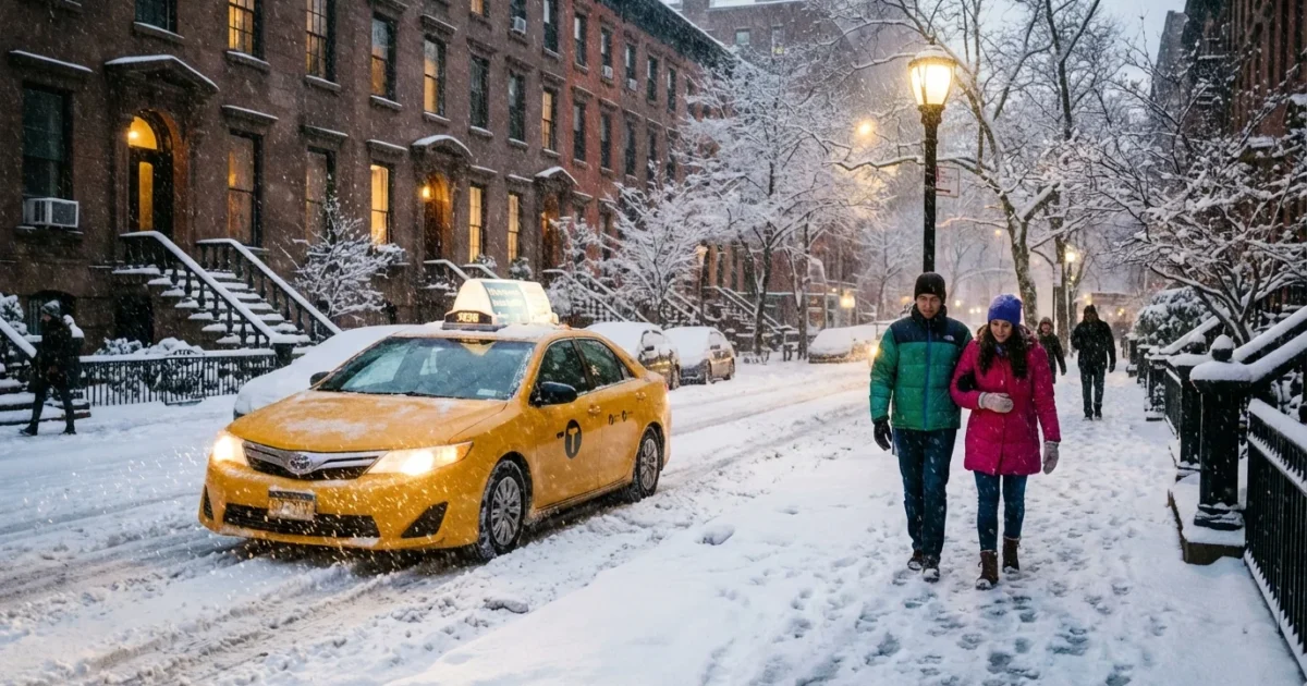
Snow returned to New York with force today. Heavy bursts turned streets slick, quieted the city soundscape, and pushed plows into nonstop rotations. The storm hit fast, then lingered, with the sharpest impacts felt from late morning into the afternoon. Travel slowed, flights stacked up in queues, and sidewalks vanished under a fresh, wet pack. This was winter, loud and clear, riding in on Atlantic moisture and locked in by just enough cold air.
What hit New York today
A coastal low formed off the Mid-Atlantic and tracked north into the tri-state. It pulled in mild ocean air near the surface and colder air aloft. That mix set up a classic New York snow event. Bands pivoted over the city and shifted east through the afternoon. The heaviest snow fell in short, intense waves that dropped quick inches and cut visibility to a few blocks.
By evening, most of New York City saw between 3 and 7 inches. Totals ran higher where bands parked, especially in eastern Queens and along the Long Island Expressway. Western zones, closer to New Jersey, saw more variability with sleet mixing at times.

Expect black ice tonight on untreated sidewalks, bridges, and elevated tracks. Temperatures will dip below freezing and refreeze will be widespread.
Snow totals and the neighborhood split
Snow did not fall evenly. It rarely does here. The city sat under a sharp gradient that produced notable differences over a few miles.
- Manhattan and the Bronx, 3 to 5 inches, highest uptown and near park elevations.
- Brooklyn and Queens, 4 to 8 inches, highest from Jamaica to the North Shore.
- Staten Island, 2 to 4 inches, with mix and compaction on the south shore.
- Long Island, 5 to 9 inches, with local 10 inch pockets under persistent bands.
North Jersey and the lower Hudson Valley ranged from 2 to 6 inches, with hills near Route 202 seeing more. Coastal Connecticut picked up 4 to 8 inches, highest from Stamford to Norwalk where banding held longer.
These ranges tell the story of a storm fueled by a warm ocean and cold inland air. When that clash lines up over us, snowfall rates spike fast, then slide just as quickly.
Salt use adds up. It washes into rivers and bays, harming fish and plants. Use only what you need and sweep up extra.
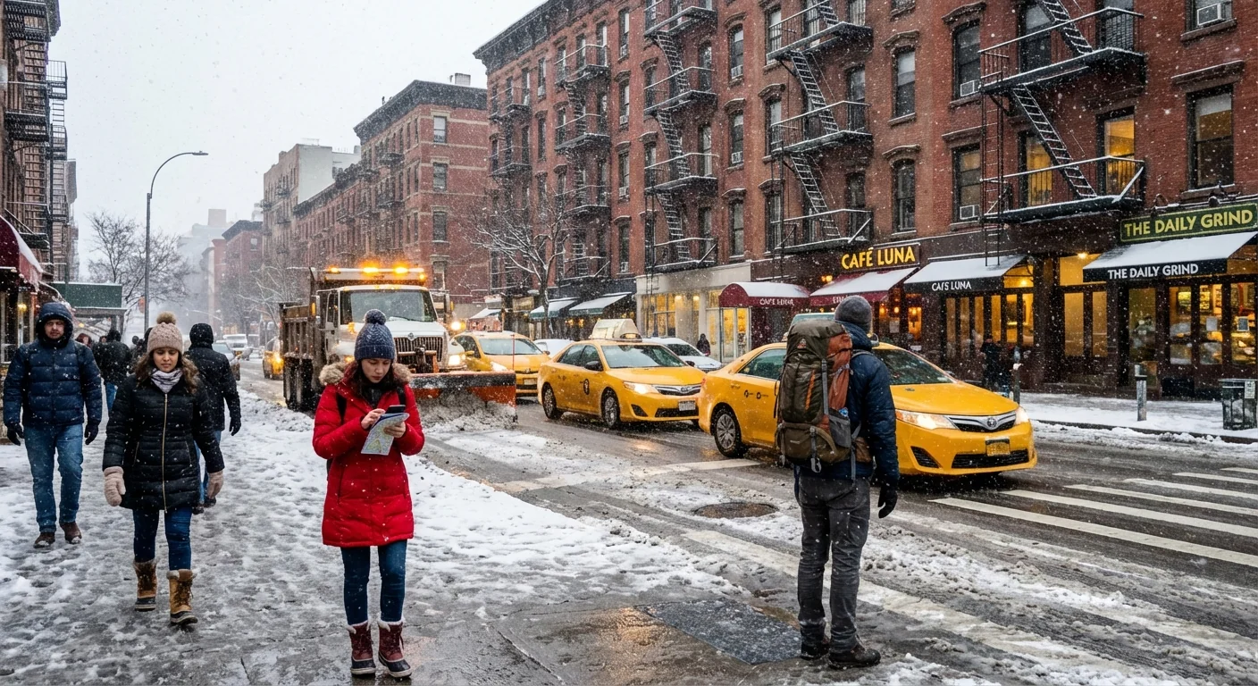
Transit, schools, and roads
City plows focused on primary routes first, then pushed into side streets as the snow eased. Above ground subway service slowed where ice formed on third rails. Bus routes lagged with slushy curbs and blocked turns. Major airports added deicing holds and saw rolling delays as snow bands returned midday.
If you must travel, build in extra time. Wear shoes with grip. Keep your phone charged. Give plows room to work and do not pass them. If you can delay nonessential trips until crews finish curb cuts and crosswalks, you will help the whole system move.
Shovel early, then again. Lifting smaller loads reduces strain and keeps slush from freezing into hardpack overnight.
What comes next
Light snow showers will fade, but cold air stays in place. Roads that looked wet at dusk will turn icy. Wind will turn northwest and gust at 20 to 30 miles per hour. That will drift snow back onto freshly cleared corners and push wind chills into the teens by morning.
Watch for roof ice and cornices near building edges. Clear hydrants if you can. Check storm drains so meltwater has somewhere to go when the sun returns. The next 24 hours are about refreeze and recovery, not new accumulation.
Climate context and sustainability
This storm tapped a warm Atlantic that is running above average. Warmer water adds moisture to the air. More moisture means heavier bursts when cold air is available. Our winters are swinging more wildly, with quick flips from rain to heavy snow, then back to rain. That makes the city’s job harder and raises the risk of flooding when snowpacks melt fast.
We can respond in ways that protect our neighborhoods and our waterways:
- Use a shovel and sand first, then a light touch of salt.
- Clear curb cuts and catch basins to prevent ice ponds.
- Keep sidewalks passable for strollers, wheelchairs, and delivery workers.
- Check on older neighbors and share extra supplies.


