
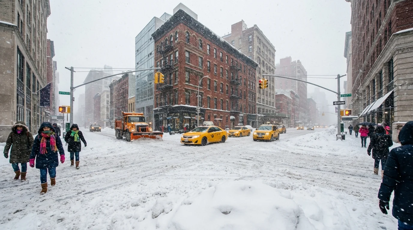
New York City is staring down a fast-building winter storm, and the snow is already piling up. Our forecast calls for up to 8 inches across the five boroughs by tonight, with higher pockets north and west of the city. States of emergency are active in New York and New Jersey, which means travel advisories and a rapid push to keep roads and rails moving. Expect slick commutes, scattered delays, and wet, heavy snow that clings to trees and power lines.
Storm at a glance
Snow is spreading across the tri-state as colder air locks in over the city. Bands will pulse in and out, which means snowfall rates will spike at times. When a band parks, streets turn white in minutes. The city sits near the freezing line, so this will be a wetter snow. That lowers totals a bit along the coast, but it raises the risk for slushy roads and heavy sidewalks.
Most of New York City should finish in the 4 to 8 inch range, with the higher end in northern neighborhoods and interior Queens and the Bronx. Coastal parts of Staten Island and southern Brooklyn can see a mix for a time, which trims numbers there. Just north and west of the city, snow could stack higher where cold air is deeper and bands are stronger.
Timing and neighborhood impacts
Snow intensifies through the afternoon and evening, then eases overnight as the storm slides northeast. The worst travel window runs during the evening commute. Visibility will drop fast under the heaviest bursts.
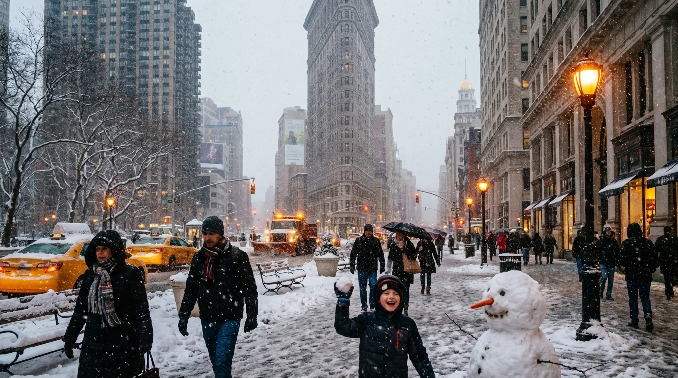
Manhattan and the Bronx sit in the path of steadier bands, especially north of 96th Street and into Riverdale. Queens sees a sharp gradient, with heavier snow inland and more mixing near the Rockaways. Brooklyn trends slushier near the water, with firmer accumulations in Park Slope, Bed-Stuy, and Midwood. Staten Island starts sticky near the shore, then turns more powdery inland and at higher spots like Todt Hill. Long Island leans wetter near the South Shore, while the North Shore collects more. North Jersey and the Lower Hudson Valley are lined up for localized jackpots where bands stall.
Street flooding is also a risk where ice clogs drains. Clear corner grates when it is safe to do so. It keeps roads passable and reduces ponding at crosswalks.
Travel and transit
States of emergency are in effect, and nonessential travel is discouraged as bands intensify. Plows and salt crews are active across the region. Above ground rail lines, bus routes, and airport operations are vulnerable to rapid change in heavy snow. Expect rolling delays, reduced speeds, and possible short-term suspensions if visibility collapses.
- Check your route before you go, and allow extra time for transfers.
- Watch for bus detours on hills and narrow streets.
- Give plows and spreaders space, they create their own snow clouds.
- Keep sidewalks clear for neighbors with mobility needs.
If you must drive, clear the entire car, go slow, use low beams, and leave plenty of room. Black ice forms quickly after plows pass.
The climate signal behind this storm
This storm is classic Northeast winter, but it carries a modern edge. The Atlantic is warmer than it used to be. Warmer water feeds storms more moisture, which helps build thicker clouds and heavier snow when surface temperatures hover near freezing. That is exactly the setup over the city today.
We are also riding a sharper temperature contrast. Cold air aloft sits over mild coastal air. That tight gradient helps storms intensify faster. In a warming climate, rain and snow lines wobble closer to the city, which makes forecasts trickier. It also favors heavy, pasty snow that sticks to branches and wires. Urban heat adds another twist. Buildings and roads hold warmth, so inner cores can run a degree or two higher. That can cut totals block by block, while neighborhoods with more trees and parks stay colder and collect more.
How to prepare and stay safe
Treat tonight like a classic winter hit, short and intense. Small steps now reduce risk and help the city keep moving.
- Charge phones and backup batteries, and gather flashlights, not candles.
- Shovel early and often, lighter passes are safer for your back.
- Clear hydrants and curb cuts, and uncover storm drains for runoff.
- Keep a small kit by the door, hat, gloves, traction, and a face covering.
- Check on neighbors who may need help, especially seniors.
Heavy, wet snow can pull down limbs and lines. Prepare for spotty outages, keep devices charged, and avoid downed wires.
Go easy on salt. Shovel and use a small amount of sand or calcium chloride. Excess salt harms pets, trees, and our waterways.
City crews pre-treated major routes with brine, which cuts salt use and speeds the first melt. Residents and businesses can help by clearing sidewalks promptly and pushing snow to the curb, not into bike lanes or into the street. That keeps sightlines clear for pedestrians, cyclists, and plows.
The bottom line is simple. This storm is here, it is manageable, and it demands respect. The city will see up to 8 inches in spots, with slick roads and shifting conditions into the night. Move only if you must, help each other, and keep an eye on official advisories as the bands evolve. Tonight’s cleanup is tomorrow’s head start.


