BREAKING: National Weather Service issues widespread winter storm alerts for South and East
A high impact winter storm is locking on to the Southern U.S., then pushing into the East from Friday into the weekend. I am tracking a dangerous mix of heavy snow and damaging ice. Travel will turn risky fast. Power lines and trees are at real risk. This one will test roads, grids, and patience.
What the National Weather Service is signaling
The National Weather Service has posted winter storm watches and advisories across multiple states. The first targets include North Texas and parts of the Southern Plains. The alert footprint then arcs through the Lower Mississippi and Tennessee Valleys, into the Appalachians and Mid Atlantic.
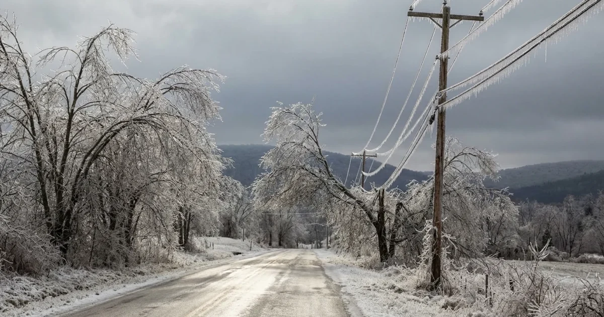
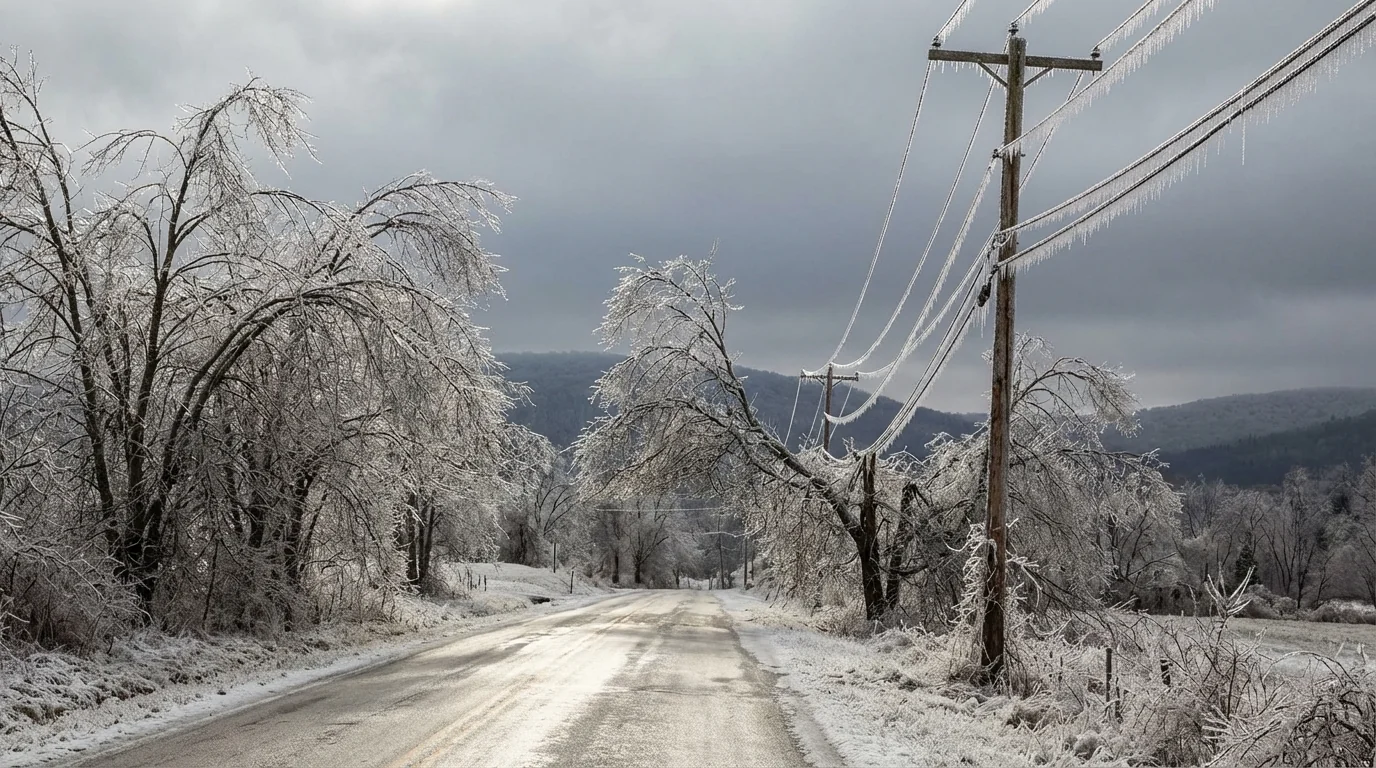
The message is clear. Expect heavy, wet snow in the colder zones. Expect a glaze to a half inch of ice where warm air rides over subfreezing ground. That ice can snap limbs and drop lines. Flights will face delays and cancellations. Roads will be slick, then worse after dark as black ice takes hold.
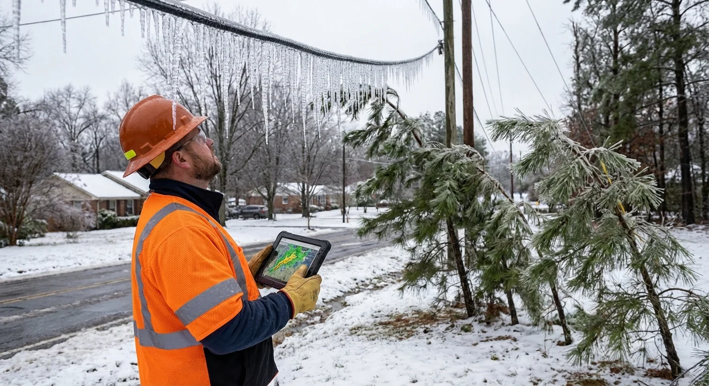
Ice accretion on trees and lines can cause power outages that last longer than the storm. Avoid unnecessary travel during icing. If you must drive, go slow, leave space, and watch bridges and overpasses.
Timing by region
Arctic air is already bleeding south. Gulf moisture is racing north. Where they meet decides who gets snow, who gets sleet, and who gets ice.
- North Texas and the Southern Plains: Friday through Friday night, a wintry mix turns to periods of snow. I expect hazardous roads by Friday afternoon, with the worst after sunset.
- Lower Mississippi and Tennessee Valleys: Friday night into Saturday, a broad swath of sleet and freezing rain develops. Localized heavy ice is possible where temperatures hover near 30 to 31.
- Southern Appalachians and Mid Atlantic: Saturday into Sunday, snow bands set up on the cold side, with a corridor of ice south of the snow line. Elevation will matter. Cold air sticks in valleys.
Behind the storm, winds pick up and temperatures plunge. Wind chills will bite through layers. Refreeze will extend impacts through Sunday morning.
How to decode NWS alerts for your county
Watches, warnings, and advisories are not the same. Here is how to read them for this storm.
- Winter Storm Watch, conditions are likely within 24 to 48 hours. Make your plan now.
- Winter Storm Warning, dangerous snow or ice is imminent or occurring. Delay travel and shelter in place if possible.
- Ice Storm Warning, damaging ice is expected. Prepare for power outages.
- Winter Weather Advisory, lower impacts, but roads can still be slick and risky.
Check your local National Weather Service office for exact timing and amounts. County lines can split impacts in a single metro. Elevation and urban heat can shift the mix few miles at a time.
Why this storm is packing so much water
This setup is classic for high impact Southern winter weather. Cold, dense air near the ground undercuts a surge of warm, moist air from the Gulf. That creates a warm layer aloft, a recipe for sleet and freezing rain. Where the entire column stays below freezing, heavy snow stacks up fast.
In a warming climate, the air often holds more moisture. When it is cold enough, that extra water falls as heavier snow. When it is not, it freezes on contact and builds ice. The South is especially vulnerable, since trees keep more weight and power grids are less winterized. This is why smart resilience matters. Weatherizing equipment, managing trees near lines, and improving efficiency all cut risk during storms like this.
What to do now
I recommend moving before the first drops freeze. Small steps now prevent emergencies later.
- Charge phones and backup batteries. Keep them plugged in until the storm passes.
- Limit travel from the first advisory through 12 hours after the storm. Give crews room to work.
- Protect pipes, pets, and neighbors. Drip faucets, bring animals inside, and check on seniors.
- Stock simple supplies, water, ready to eat food, blankets, and medications for 72 hours.
Park off the street if you can. Downed limbs and plows need clear routes. Turn your fridge to a colder setting before the storm to buy time if power fails.
After the front passes
Do not assume the danger is over. Gusty winds and single digit wind chills are likely in the cold sector. Melt by day, refreeze by night will create black ice through the weekend. If the power goes out, avoid carbon monoxide risks. Never run generators indoors. Keep vents clear of snow and ice.
The bottom line
This is a high confidence winter storm with broad impacts from North Texas into the South and up the East. The mix of heavy snow and damaging ice will disrupt roads, flights, and power. Read your local NWS alerts, watch for upgrades from watches to warnings, and act early. Smart preparation, plus patience, will help your family and your community ride out the storm safely.


