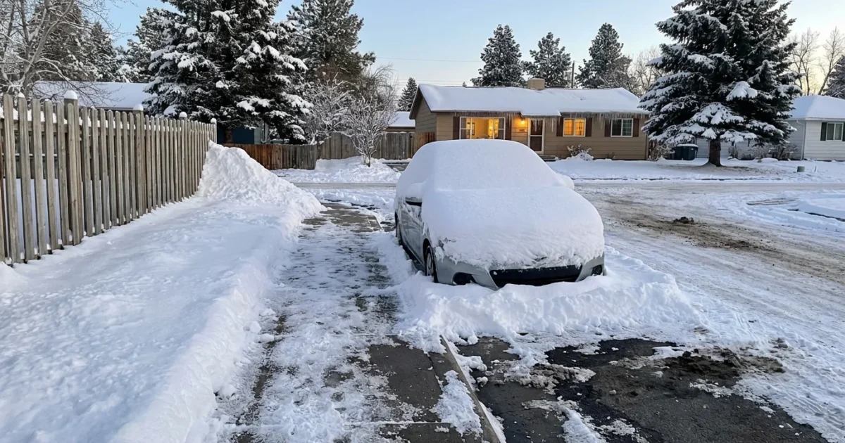
Snow buried parts of New Jersey this weekend, and the numbers are now clear. North Jersey took the brunt, with totals climbing to a season high. Plows carved narrow canyons through neighborhoods. Side streets vanished under deep drifts. This was a classic, high impact winter storm, and the town by town snowfall shows it.
What fell, where
Bands of heavy snow set up over the northern half of the state. The storm tapped rich Atlantic moisture and met a pocket of cold air over the region. That mix created intense snowfall rates. Two to three inches per hour hit at times. Visibility dropped to near zero during peak bursts.
Preliminary measurements show wide variation over short distances. Elevation and band placement played a big role. North and west saw the deepest totals. South and along the coast saw less, with more mixing near the ocean.
Town by town snapshot
These are early measurements from trained observers and public works crews. We will refine as more reports arrive.
- Mahwah, Bergen County, 16 to 17 inches
- West Milford, Passaic County, 14 to 16 inches
- Morristown, Morris County, 12 to 14 inches
- Wayne, Passaic County, 10 to 12 inches
- Newark, Essex County, 6 to 9 inches
Remember, drifts can run higher, and compacted snow reads lower by morning.

Why this storm packed a punch
This setup was textbook for a heavy New Jersey snow. A coastal low tracked just offshore, close enough to feed deep moisture into a cold inland dome. Strong lift focused narrow snow bands. That is why some towns jumped past a foot, while others stayed near half that.
Climate plays into this too. Our winters are warming on average. That means more winter storms carry higher moisture. When the air is cold enough, that extra moisture falls as heavy snow. We are seeing fewer light events and more high impact swings. Big thaws, then big snows, then quick melts. That volatility stresses roads, budgets, and ecosystems.
Sea surface temperatures off the Mid Atlantic have also trended warm in recent years. Warm ocean water is an energy source. It can supercharge coastal systems that pass close to shore. The result is what we saw, a short, intense burst, with high snowfall rates and sharp gradients.
Travel and transit recovery
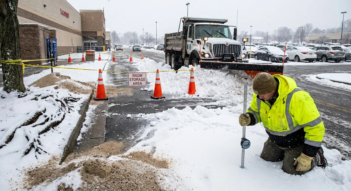
Road crews made progress overnight, but recovery will take time. Major highways are mostly passable. Ramps, shoulders, and secondary roads remain rough. Expect plow berms at intersections and reduced lane widths in many towns. Transit service was paused during the height of the storm for safety. Limited service is returning in stages as rails and platforms are cleared.
If you must travel, go slow. Give plows plenty of room. Watch for wind driven drifts across open stretches. Parking rules are in effect for snow removal in many communities. Move cars off emergency routes where posted.
Black ice is widespread tonight. Meltwater will refreeze quickly on untreated surfaces. Assume shaded roads and bridges are slick.
Air travel is improving, but delays will linger as crews deice and reposition aircraft. Check status before you head out. School districts are announcing delayed openings and remote options. That helps crews finish curb to curb clearing.
Cleanup and sustainability
Snow removal is not just about speed. It is also about smart choices. Salt use climbs during major storms, but too much salt harms streams and soil. Brine and targeted applications work better than heavy rock salt dumps when temperatures support it. Store salt piles under cover to prevent runoff. Keep plow blades raised slightly over new asphalt to reduce damage.
Residents can help. Clear sidewalks for neighbors and bus stops. Keep fire hydrants and crosswalks open. Do not throw snow back into the street. Pile it on lawns where melt can soak into the ground. That reduces drains clogging and lowers flood risk.
Adopt a storm drain on your block. Clear snow and ice from the grate. It speeds meltwater and prevents street flooding.
Commercial lots should push snow to low impact areas, away from wetlands and stream banks. Mark plow routes to avoid scraping tree roots. Consider sand blends for traction in extreme cold, then sweep up later to protect waterways. Small changes add up across a metro area.
What to watch next
Temperatures fall tonight. Refreeze will be quick and sharp. Sun returns, and daytime melt begins, but nights will lock it back in. Roof loads are within normal limits for most homes, yet flat roofs and older structures should be checked. Clear light, reachable areas safely. Hire pros for heavy or high jobs.
As the snowpack settles, storm drains will carry meltwater toward rivers. Ice along river edges can slow flow. That can back up water into low spots. We are watching those pinch points closely. The next system looks weaker, with a small chance for midweek flurries. The bigger story is the melt and refreeze cycle through midweek.
The next 48 hours bring the highest risk for black ice and minor meltwater flooding. Plan commutes with extra time and caution.
This was winter at full force. A fast mover, a deep hit, and a clear map of who saw the worst of it. North Jersey took the crown this time. The cleanup is underway. The lesson is simple. Warmer oceans and a moisture rich sky can still deliver big snow when the air cooperates. Prepare for the swings, protect your neighbors, and keep an eye on the drains. Winter is not done yet. ❄️


