Breaking now, a Red Flag Warning is in effect across central North Carolina, with alerts extending into parts of western North Carolina and the Upstate. Very dry air, strong gusty winds, and parched vegetation will turn small sparks into fast-moving fire. If a fire starts, it can spread quickly and become hard to control. Outdoor burning is strongly discouraged and may be prohibited by local order.
Red Flag Warning, what it means right now
A Red Flag Warning signals critical fire weather. Humidity will drop into the 20s this afternoon. Winds will increase behind a sharp cold front. Gusts will peak from midday into early evening. Dry grasses and leaf litter are the fuel. Put that together and flames can outrun a hose line in minutes.
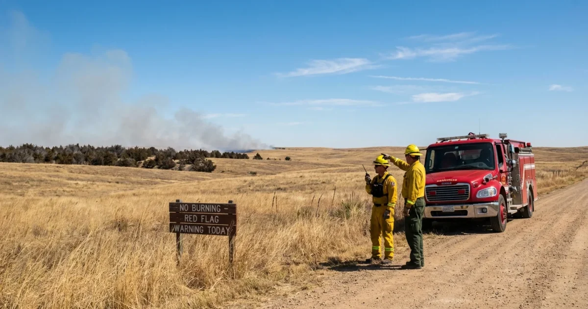
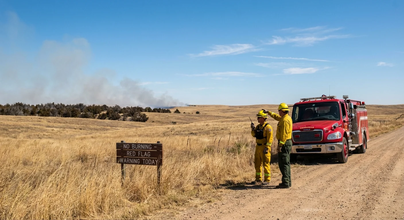
Expect the highest risk in the Sandhills, the central Piedmont, and along the eastern slopes. Downsloping winds off the Blue Ridge will dry the air even more. Any ignition along roadways, in fields, or near wooded edges could spread fast. Many counties are enforcing burn bans. Heed those restrictions, they are there to save lives and homes.
The setup, cold front, dry air, and wind
A powerful cold front is sweeping through. It is pulling in a very dry continental air mass. As the sun warms the boundary layer, that dry air mixes to the surface. Relative humidity falls, fine fuels cure, and the wind accelerates. Gusts can reach 25 to 35 miles per hour, locally higher on ridges and in gaps.
This pattern is a classic fire weather recipe. The air is dry. The fuels are dry. The wind is ready to push flames. The leaf drop has loaded the forest floor. Recent spotty rain left little moisture in the top few inches of soil. In grasslands and along roadsides, a single spark can race with the wind.
Do not burn today. Postpone campfires, yard debris burning, and welding. Do not park hot vehicles on dry grass. If you see a fire, call 911 immediately and move away upwind.
What you should do today
Your best tool is prevention. Take simple steps now to reduce risk around your home and community.
- Suspend all outdoor burning and use of fire pits
- Avoid tasks that throw sparks, including grinders and chainsaws, during peak wind
- Secure propane tanks, fuel cans, and outdoor grills
- Clear leaves from gutters and from a 5 foot buffer around your home
- Check your county emergency alerts and follow any burn bans
If you live near wildland areas, create a quick go kit. Pack medications, IDs, chargers, and a change of clothes. Park vehicles facing out. Keep gates unlocked for fire crews. Know two ways out of your neighborhood.
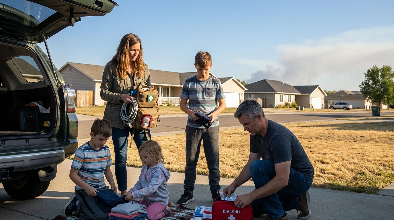
Hydrate your defensible space. Water bark mulch next to structures. Keep a charged hose and shovel ready. Store firewood at least 30 feet from buildings.
Crews poised, and the bigger climate picture
Wildland teams are already staging for fast initial attack. State forestry units have brush engines and bulldozers pre-positioned along high risk corridors. Many burn permits are suspended. Air operations are limited when winds get strong, which makes prevention even more important. Expect extra patrols along major highways, where dragging chains and cigarette butts often start fires.
This warning lands in a warming climate. Warmer temperatures and erratic rainfall dry fuels faster. Fall now brings longer stretches of low humidity mixed with windy fronts. That stretches the fire season beyond summer. The science is clear, hotter air pulls more moisture from soils and vegetation. That increases the number of days like today, when one mistake can spark a large fire. Reducing ignitions is climate action too. Every avoided wildfire keeps carbon in forests, protects habitat, and spares communities the health toll of smoke.
The bottom line
Treat today like a high stakes day, because it is. One spark, one gust, and grass or leaf litter can flash. Hold off on any flames. Watch your work and your wheels. Check on neighbors who may need a hand. Conditions should ease after sunset as humidity recovers, but breezy, dry weather can linger. Stay alert, follow local orders, and keep it safe.


