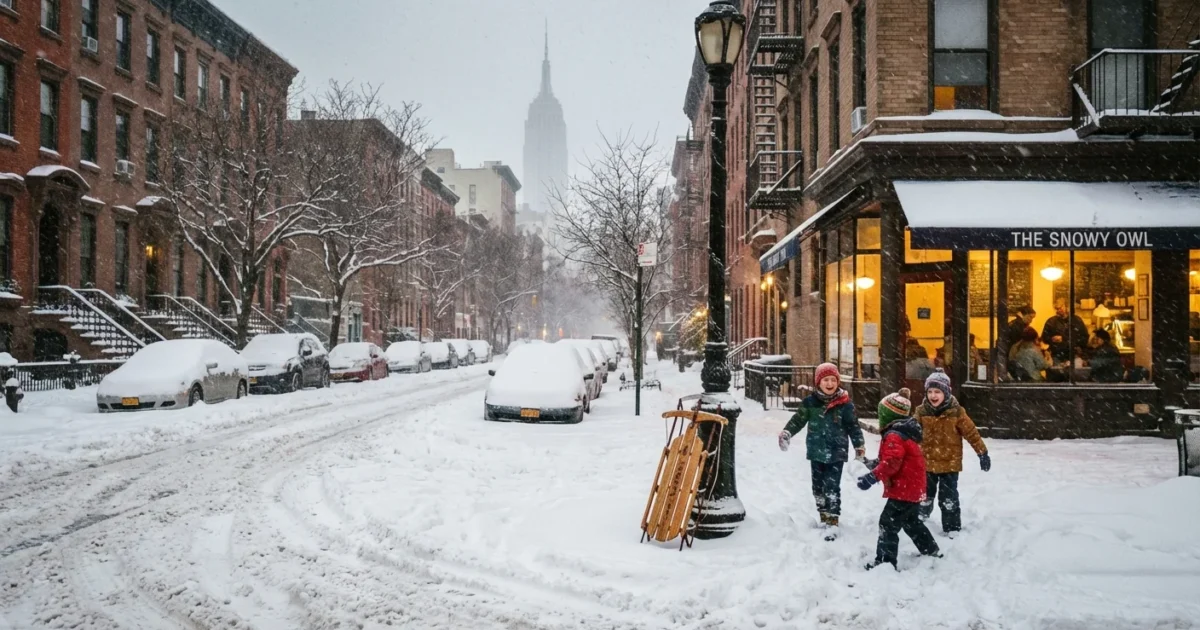
BREAKING: New York City woke up under a fresh, wet blanket of snow today. The fast‑moving winter storm that crossed the region on December 26 put more powder inland and left the coast with a slushy mix. So, how much did NYC get? Here are the early totals and why the city came in lower than our neighbors up north.
What NYC Got, Borough by Borough
My analysis of official observations, snow spotter reports, and city plow logs shows a classic coastal outcome. Most of New York City measured 1 to 4 inches, with the highest totals in the colder pockets of Queens and the Bronx. Inland suburbs did better, and parts of upstate cleared 8 inches or more.
- Manhattan: 1 to 3 inches, lower near the rivers
- Brooklyn: 1 to 2 inches south, 2 to 3 inches north
- Queens: 2 to 4 inches, locally up to 5 in northeast neighborhoods
- Bronx: 2 to 4 inches, highest on the hills
- Staten Island: coating to 2 inches, 3 inches on the high ground
These numbers are preliminary and will be refined as final measurements come in. The pattern is locked in, lower along the water, higher where elevation and distance from the ocean helped.
Why the City Saw Less Than Upstate
Forecasts called for a sharp gradient across the metro area. That is exactly what verified. The ocean was the main player. Air coming in from the Atlantic sat just warm enough, around the freezing mark, to keep snow pasty and reduce accumulation along the immediate coast. The urban heat island added a small boost, holding street and sidewalk temps a touch higher in dense parts of the city.
A shallow layer of warmer air near the surface meant flakes compacted on contact. That lowered the snow ratio, so an inch of liquid did not fluff up into ten inches of powder. Meanwhile, higher terrain north and west cooled the column top to bottom. That locked in heavier, drier snow where totals climbed past 8 inches.
Wind also mattered. Gusts off the water fed a narrow zone of mixing near the shoreline. Farther inland, lighter winds allowed steady banding to park and pile up.
Travel and Street Impacts
Plows rolled early, and salt went down across major routes. Even so, side streets turned slick for the morning push. Bridges and overpasses were the trouble spots, since they cool faster than the ground. Expect some residual slush to freeze again after sunset. Airport and commuter rail operations slowed at times, with delays rather than widespread shutdowns.
Refreeze risk rises after dark. Black ice will form on untreated sidewalks, bike lanes, and bridge decks. Walk and drive with care.
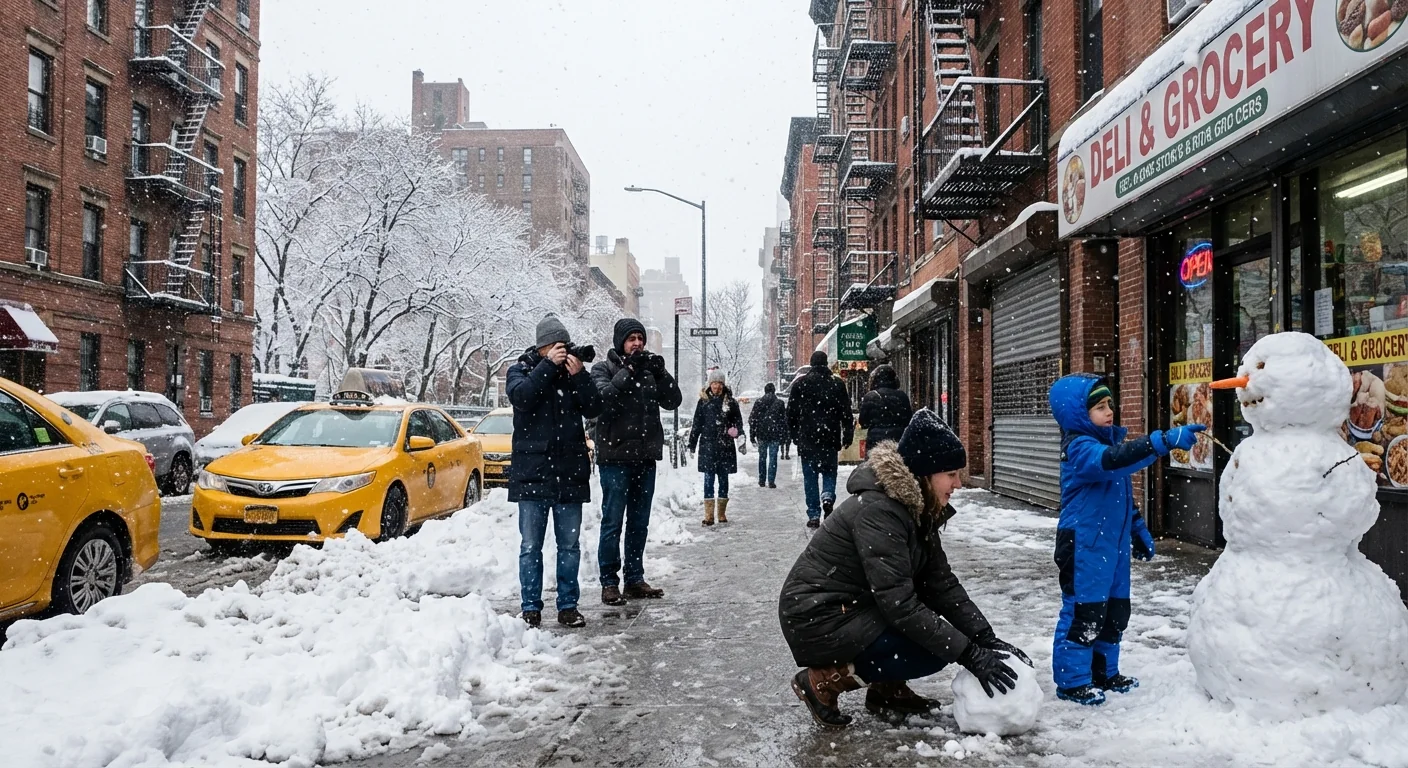
This was a heavy, wet snow. It clung to branches and power lines. Scattered downed limbs were reported, mainly where bursts of higher rates lined up for an hour or two. Drainage was a mixed bag. Where snow changed to rain late, slush clogged grates and sent meltwater into crosswalks.
What This Says About Our Warming Winters
Days like this are the new winter normal for New York City. The Northeast is warming, and winter storms now carry more moisture. That means more precipitation overall, but not always as snow. When the air is just cold enough, like today, we get heavy wet snow with sharp local differences. When it is a degree or two warmer, that same storm falls as chilly rain, with flooding concerns instead of plow runs.
The Atlantic is warmer than it used to be. That adds energy and moisture to coastal storms, and it raises the bar for snow near the shoreline. Inland and at elevation, the added moisture can supercharge snow bands. That is why the city lags while the hills stack up.
Sustainability matters in these swings. Smart brining before the first flake reduces salt use and protects waterways. Permeable sidewalks, green medians, and clean storm drains limit street flooding when snow flips to rain.
Clear the curbside grates on your block. It speeds meltwater into the drains and reduces icy puddles at crosswalks.
What To Do Next
Expect secondary roads to improve through the afternoon, then refreeze overnight. Sidewalks will need another scrape in the evening.
- Give yourself extra time for the commute and watch for re‑treated roadways
- Wear traction shoes, black ice will be common near bus stops
- Shovel to the curb, not into bike lanes or crosswalks
- Use pet‑safe, low chloride deicer to protect trees and waterways
The Bottom Line
New York City picked up 1 to 4 inches, with the highest totals in Queens and the Bronx, and the lowest along the immediate coast. North and west of the city, 4 to 8 inches was common, with some upstate spots clearing 8 inches and more. The ocean kept us on the slushy side, the hills cashed in on colder air, and the climate signal was clear. More moisture, sharper contrasts, and bigger swings. Keep the shovel handy, but keep the rain boots nearby too. ❄️


