Snow is back, and it is widespread. From the Plains to the Mid Atlantic, a broad winter system is laying down fresh powder and slushy mixes today. The big question is simple, how much snow are we getting? I am tracking the bands, the temperatures, and the timing. Here is what to expect region by region, and why the totals may shift right up to the first flakes. ❄️
Where it is falling, and how much
Iowa has already cashed in. Several spots picked up more than 3 inches, with steady light snow still filling in on the backside of the low. In eastern Nebraska, the Omaha metro sits near a sharp gradient. Up to 1 inch is likely in the city, with 3 inches or more northeast of town where the snow band is tighter.
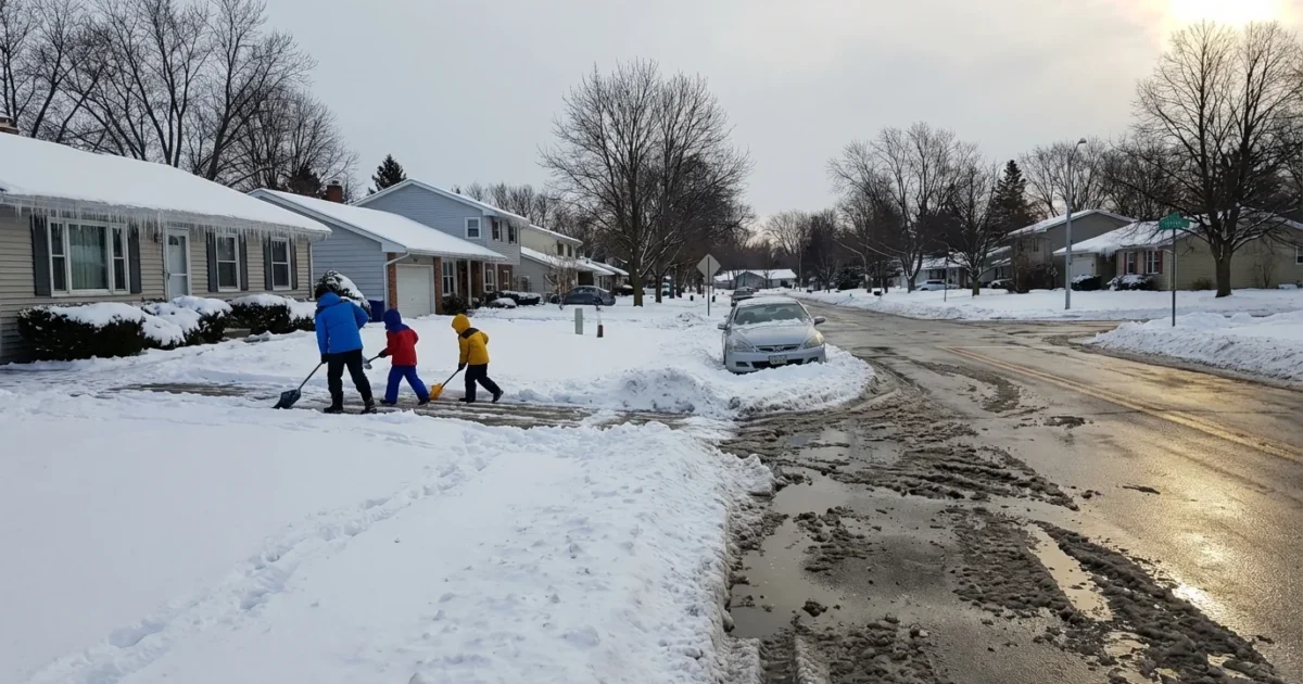
Central Ohio and east central Indiana are next in line for the heaviest swath, with 3 to 5 inches favored where snow stays pure and temperatures hover below freezing. Farther southwest, the Cincinnati region saw an early clipper, and another 2 to 4 inches can stack on this afternoon into evening.
Illinois sits in the crosshairs as well. Springfield is on track for 2 to 4 inches, falling on cold ground that will help accumulation. Along the Mid Atlantic, the D.C. area is set for 1 to 3 inches by Sunday morning, especially north and west of the Beltway. The Baltimore region turns snowy after evening temperatures dip below freezing, which is when roads will start to slick up. South Jersey could flip to a winter scene overnight with a light, plowable coating where the cold air holds.
Travel will be slow in these zones. The sharp cutoff between rain, sleet, and snow will decide who measures inches and who just gets wet roads.
Why this storm is delivering snow now
This setup is classic December. A surge of cold, dense air slid south earlier this week, then a quick moving low pressure system tapped that chill and pulled in moisture from the south. Where the cold air is deep, the flakes stay fluffy and build fast. Where a warm layer sneaks in a thousand feet up, snow changes to sleet or rain, and totals drop.
There is also a climate story here. Winters are warming on average, which raises the floor on many storms. Warmer air holds more moisture, so when cold lines up just right, these systems can wring out intense snow in narrow bands. That is what we are seeing today, a tight gradient, big differences over short distances, and fast changing conditions as the storm pivots east.
What could change before the last flake
A small wobble in the storm track can shift the snow axis by 30 to 50 miles. A one or two degree rise at the surface can turn snow into a mix for an hour, and that could cut totals by an inch or two. Conversely, if the cold air deepens this evening, expect a quick burst that overperforms, especially on the northwest flank of the low.
Treat any early map as guidance, not a promise. Check updates every few hours, especially if you plan to travel.
Road crews should plan for variable snow ratios. Fluffy snow will need more passes with plows, while wetter, compact snow will pack fast and freeze harder overnight.
Safety first, with sustainability in mind
Expect slick roads, falling temperatures, and scattered power issues where heavy bursts hit trees and lines. If you must drive, slow down and leave extra room. If you can avoid peak snowfall, do so.
Black ice is likely this evening and overnight, especially on bridges, ramps, and untreated neighborhood streets.
You can stay safe and lower your environmental impact at the same time. Salt and sand runoff harms streams, soils, and pets. Use less, use it smarter, and choose safer products when you can.
Shovel early and often, then use a light hand with deicer. Try calcium magnesium acetate or pet safe blends, and sweep up excess.
A quick plan helps:
- Charge phones and portable batteries, and gather flashlights.
- Set home heat a bit steady, not high, to ease strain on the grid.
- Check on neighbors who may need help with shoveling or heat.
- If you commute, consider transit once roads improve.
In short, many of us will measure today. Iowa has already done so, the Midwest is building, and the Mid Atlantic is next. Totals will hinge on the cold, the track, and the timing. Keep plans flexible, clear your walk in waves, and let crews do their work. Winter arrived on schedule, and it means business.


