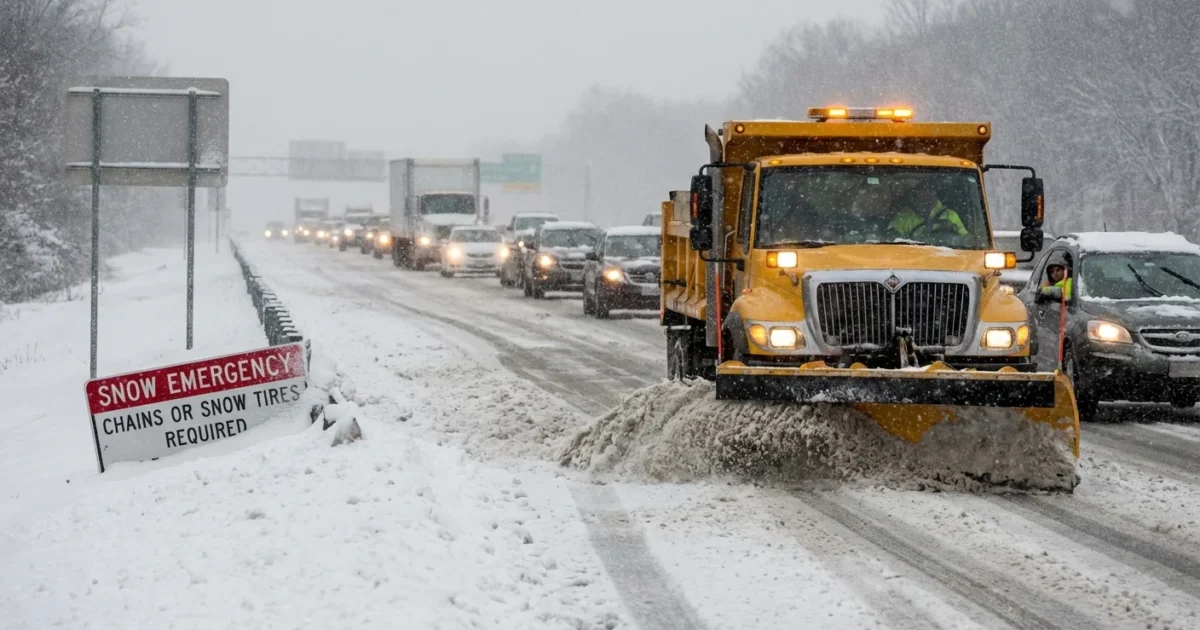
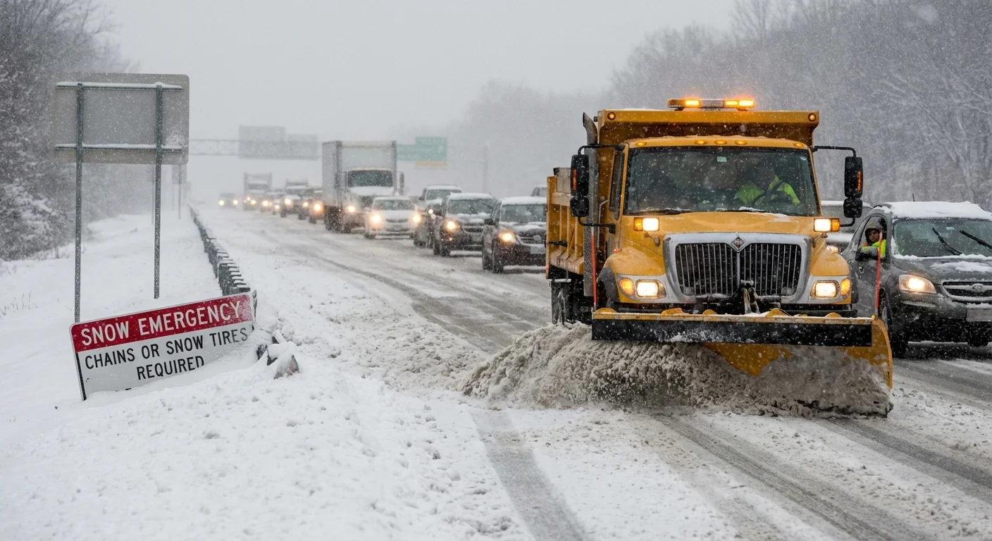
BREAKING: Montgomery County under snow emergency as Winter Storm Fern blankets Ohio
Montgomery County is now under a snow emergency as Winter Storm Fern sweeps across central Ohio. Heavy, wind driven snow has covered freeways, ramps, and bridges. Plow crews are out, but the snowfall and gusts are rebuilding drifts minutes after a pass. I am tracking conditions across the county. The snow emergency is active and can change levels as roads improve or worsen.
What today’s snow emergency means
Officials use three levels to guide travel and services. Level 1 means roads are icy or snow covered. Use caution. Level 2 means hazardous travel. Only drive if it is essential. Level 3 means roads are closed to non emergency travel. You can be cited if you drive without a true emergency.
Statuses can move up or down through the day. A quick burst of snow on top of compacted ice can push conditions from manageable to dangerous. Blowing snow is adding to the challenge, especially on open stretches and rural routes.
Check the Montgomery County Sheriff’s Office and county alerts for the current snow emergency level. Conditions can change quickly.
Schools, government offices, and many events may delay or close today. Remote work and virtual classes help keep traffic light while crews catch up. If you must head out, tell someone your route and expected arrival time. Keep your tank at least half full to prevent fuel line freeze.
If the county reaches Level 3, roads are closed to non emergency travel. Stay home unless you are emergency or essential staff.
Plows, salt, and timing you should expect
Crews are prioritizing interstates, state routes, and major arterials first. Neighborhood streets and cul de sacs come later. Expect staggered clearing, not a clean sweep all at once. The bitter air is also working against the salt. Most road salt loses power as temperatures drop, so crews are mixing in brine and grit to improve traction.
On and off ramps, bridges, and overpasses will ice first. They cool faster than the ground. Fresh snow can hide old ruts and black ice, so do not trust a surface just because it looks white and even. Drifting is worst along north south roads that cut through fields. Plows may clear a lane, then watch it fill again within an hour.
The climate signal behind Fern
Fern is a classic setup for big Midwest snow. A deep low tapped Gulf moisture, then ran into a sharp drop of Arctic air. The air we breathe is warmer on average than it was decades ago. Warmer air can hold more water. When storms form in this kind of pattern, that extra moisture can fall as heavier snow if the air is cold enough.
We are seeing more winter swings, from thaw to flash freeze, and then to intense snow. A wavier jet stream can lock in these sharp contrasts. One storm is weather. The rising odds of extreme events is climate. That matters for how we plan. Cities now budget more for salt, brine, and equipment. They also invest in trees, green space, and storm drains to handle slush and melt without flooding.
Deicing salt helps us move, but it can stress streams and soils. Using only what you need protects roads, pets, and waterways. Shovel early and often to reduce how much salt you lay down later.
How to travel safer and help the system
Slow down. Leave extra space. Aim for gentle moves, not sudden stops. If you do not have to drive, do not. You will help plows work faster and cut crash risk for everyone.
Pack an emergency kit in case you get stuck. A few basics go a long way.
– Warm layers and blankets
– Phone charger and power bank
– Small shovel and traction material
– Snacks and water
– A basic first aid kit
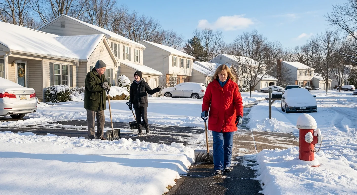
Clear sidewalks and hydrants near your home if you can do so safely. Keep storm drains open to prevent ponding when the sun returns. Do not push snow back into the street. Park off snow routes so plows can clear curb to curb. Check on neighbors who may need help, especially seniors and people with limited mobility.
What I am watching next
Light snow and blowing snow may continue to reduce visibility. That can keep road conditions poor even after the main band moves out. Temperatures tonight will refreeze slush into hard ice. The morning commute could be slick again if we do not get enough drying. Watch for updated levels through the afternoon and evening.
Conclusion
We are in the thick of a high impact winter day. Montgomery County’s snow emergency remains in effect as crews fight to gain ground. The science is clear. A warming climate is adding fuel to intense winter storms like Fern. Today, patience and caution are public safety tools. I will keep updating as conditions shift. Stay warm, stay put if you can, and give the plows room to work. ❄️


