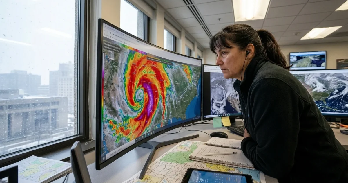
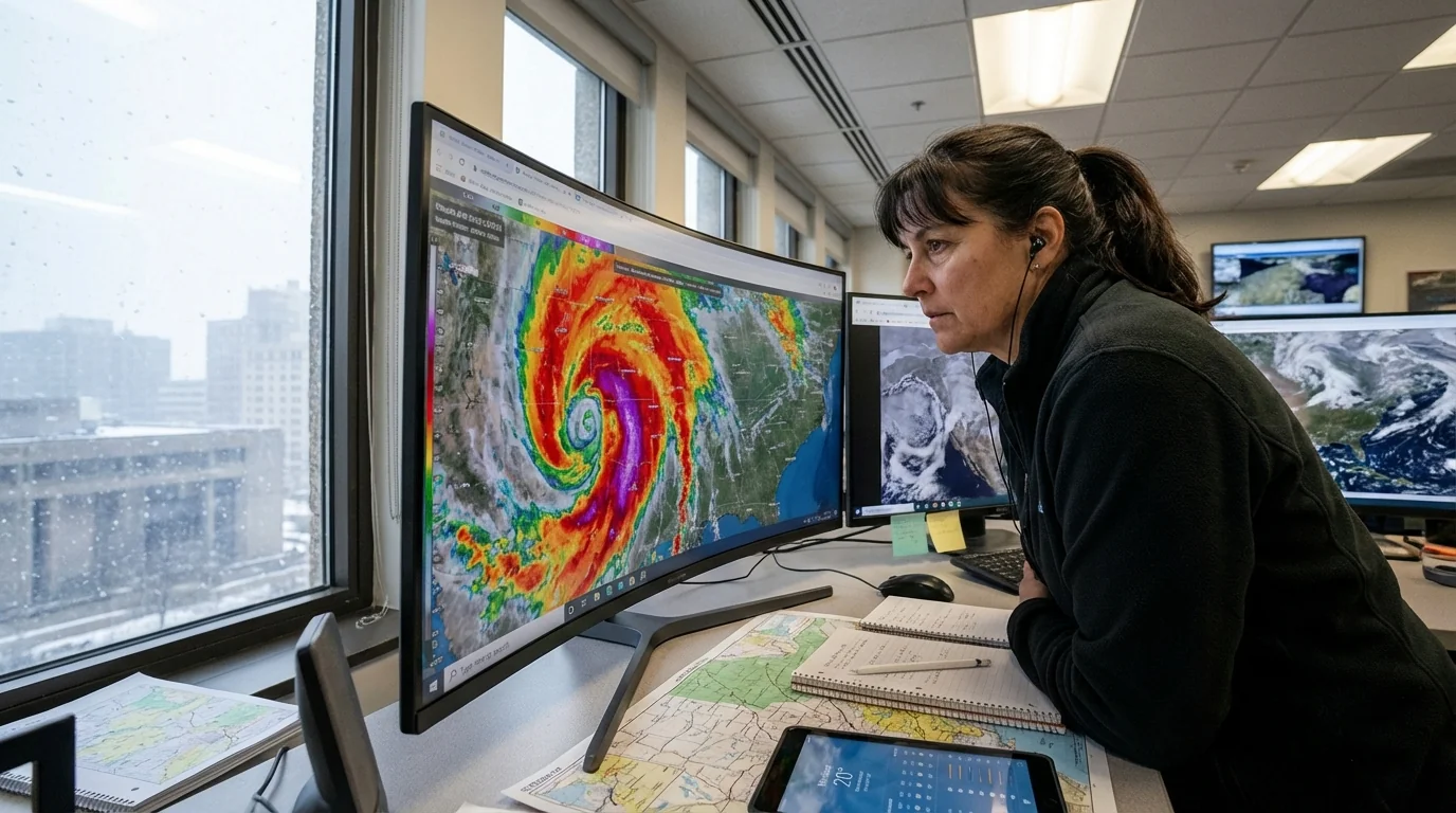
Breaking now: live weather radar is lighting up across Ohio as a powerful winter storm surges in. I am tracking narrow snow bands that pulse, pivot, and stall. These bands will create sharp gradients in snowfall, street by street. Visibility drops fast in the heaviest cores. Gusty winds are already lifting snow off the ground, which means drifting and sudden whiteouts. Travel can shift from manageable to dangerous in minutes. ❄️
What the radar shows right now
As of this hour, returns are strengthening across the Ohio Valley. The most intense bands are forming in tight lines, then pivoting north and east into central and northern counties. In between these bands, lighter snow or lulls appear, but they rarely last. Wind gusts are pushing snow across open roads, especially along higher terrain and west to east corridors.
Expect the heaviest totals where bands remain parked. If a band sits over you for an hour, you can pick up several inches fast. I am also watching a mixed zone near the southern edge of the storm. A brief period of sleet or freezing drizzle could glaze roads before the deeper cold locks in.
How to read live radar tonight
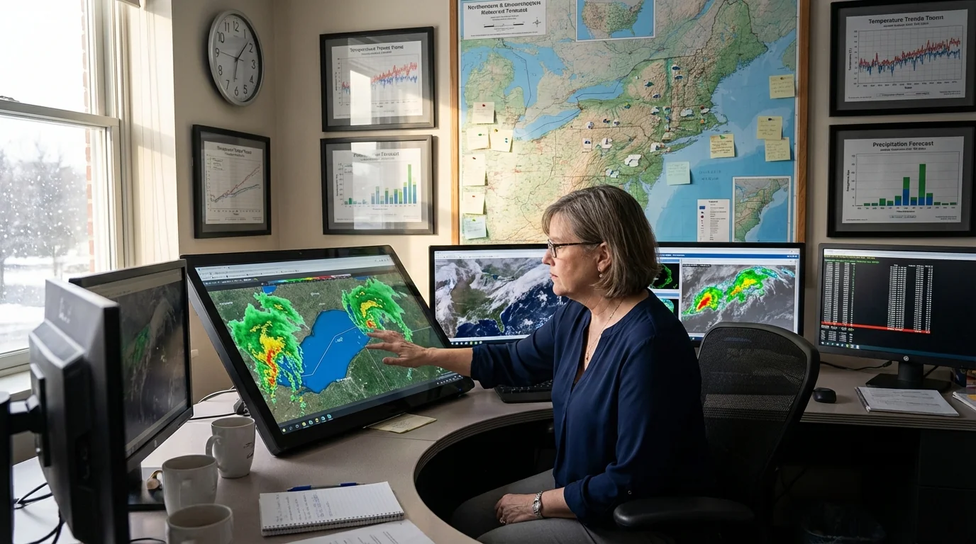
Live radar is your best tool for timing and intensity. Use it like a safety gauge, not a static picture. Weather changes fast in this setup.
Base vs composite reflectivity
Base reflectivity shows the lowest radar slice. That slice is closest to what reaches the ground. Composite reflectivity stacks several slices. It can look more intense, because it includes echoes aloft. If composite shows heavy returns, but base is lighter, the snow may be not as fierce at ground level yet.
Loops, speed, and direction
Loop the last 30 to 60 minutes. Watch how bands move, stop, and flare. A band that keeps hitting the same spot is a red flag. Movement from southwest to northeast suggests a feed of moisture riding up the Ohio River valley. Any pivot to a west to east crawl can lock in heavy totals for cities in its line.
Set your radar to loop, then check base and composite side by side. That simple habit reveals real intensity and trend.
Band color and precipitation type
Green shades mean light snow. Yellow or orange cores show heavier rates, often one inch per hour or more. Many apps use pink for mixed sleet or freezing rain. If you see a narrow pink ribbon under strong returns, roads can ice up fast, then flip back to snow as colder air deepens.
Quick radar checklist
- Loop base reflectivity for 30 to 60 minutes
- Compare with composite for a fuller picture
- Look for bands that stall over your route
- Check wind gust forecasts for blowing snow risk
Avoid travel when a heavy band targets your area. Whiteouts form suddenly, and drifts can block rural roads. If you must drive, go slow, leave space, and keep lights on. ⚠️
The climate signal inside this storm
This is classic winter weather supercharged by a warmer climate. Warmer air holds more water vapor. Even when surface temperatures are below freezing, the atmosphere above can carry extra moisture. That boosts snow rates when lift is strong, like it is tonight.
Lake Erie is also part of this story. Late fall warmth and open water can add moisture to passing storms. That feed helps narrow bands grow taller and stronger. The jet stream is waving more, which sets up sharp temperature contrasts. Those contrasts, combined with deep moisture, lead to rapid bursts of heavy snow. Climate change does not create snow by itself, but it loads the dice for bigger swings and higher precipitation extremes, even in winter.
Safety and sustainability, right now
Plan for disruptions. Charge phones and backup batteries for emergency alerts. Heavy, wet snow on trees and lines can cause power outages. If you lose heat, head to a safe warming location. Never run a gas generator indoors, even in a garage.
Limit trips during peak bands. Fewer cars on the road means fewer crashes, and plows can work faster. Clear sidewalks early and often to avoid ice layers. Use only the salt you need, and add sand for traction. Extra salt washes into streams and harms fish and plants. Sweep leftover salt after the storm to protect waterways.
At home, lower thermostats a notch to ease grid demand during the height of the storm. Close curtains at night to keep heat in. Check on neighbors who may need help. Small steps reduce strain on emergency services and energy systems when it matters most.
What I am watching next
I am watching for band pivots and any new bursts forming on the southwest flank. Expect the worst travel when multiple bands overlap or stall. Drifting will increase overnight as winds peak. I will monitor radar loops for any mix line creeping north, then a full change back to snow as colder air deepens through Sunday.
Keep live radar open. Pair it with official warnings from the National Weather Service and your local meteorologists. Follow road advisories closely. Smart steps now will keep you safer, and they will help your community weather this storm with less harm.
Conclusion: The storm is here, and the radar is your map. Read it with care. Time your moves. Respect the bands. I will stay on the data and update as the picture evolves.


