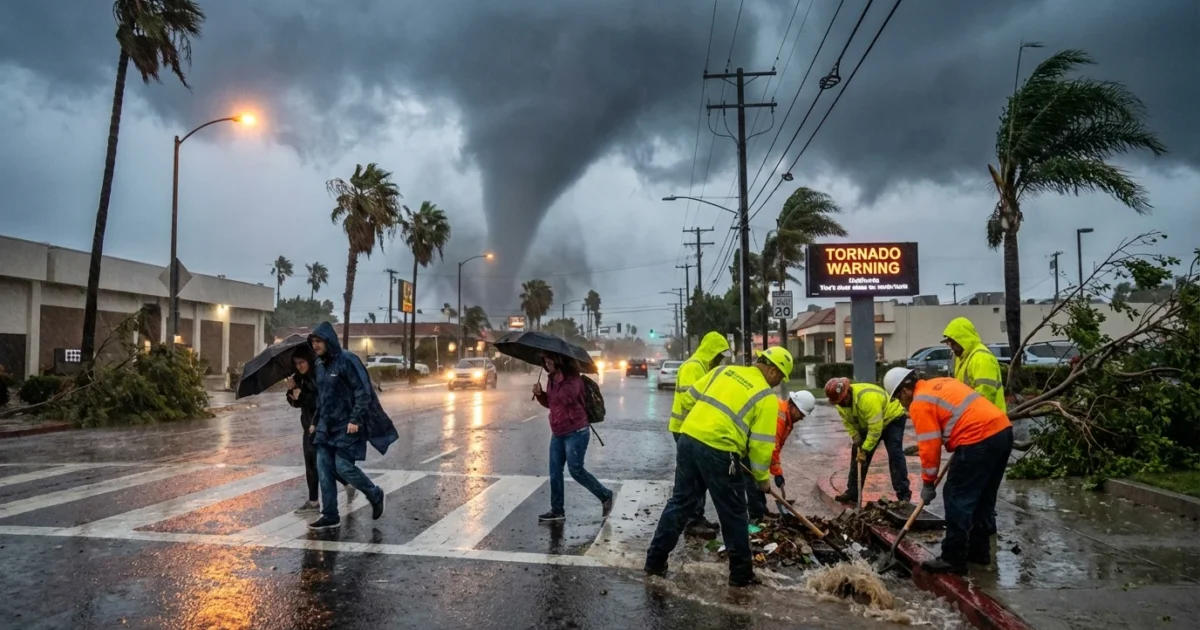
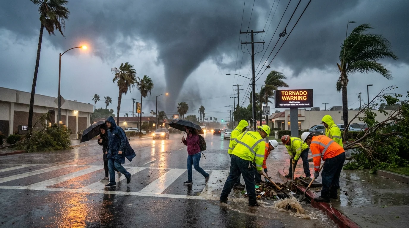
Breaking now. A tornado warning lit up parts of Los Angeles County this afternoon, then cleared as the storm cell weakened. The Christmas week system is still hitting Southern California with loud thunder, sheets of rain, and damaging wind. I am tracking gusts near 60 miles per hour in exposed spots. The immediate tornado threat dipped, but the storm is not over. ⚠️
What just happened
A fast moving thunderstorm showed rotation as it crossed the Los Angeles Basin. That triggered a brief tornado warning. The cell lost its spin as it moved and the warning was canceled. That is good news. Still, the same storm line is driving strong straight line winds and pockets of small hail.
Road spray is heavy. Visibility drops fast in these downpours. Urban streets are already ponding. Crews are clearing drains in real time. I am also seeing scattered power flickers where wind hit tree limbs and old lines.
Why a low risk still sparked a warning
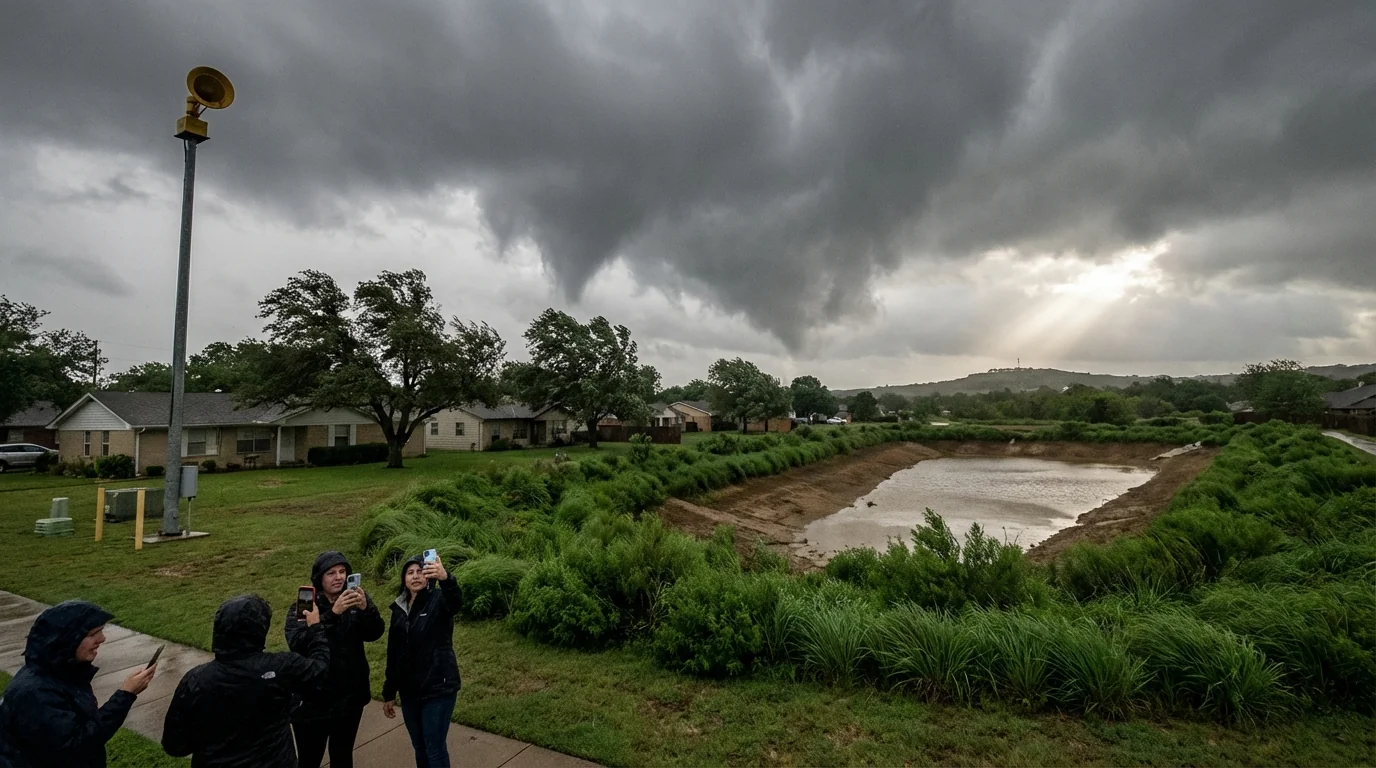
Tornadoes are uncommon here, but not impossible. This winter style Pacific storm pulled cold air aloft over mild, moist surface air. That set up narrow bands of strong lift. A few cells tapped spin near the surface as winds changed direction with height. That is enough for a quick, weak tornado, or a waterspout near the coast.
Forecasters kept the overall tornado risk low for a reason. Instability is limited today. Cloud tops are not towering like a spring outbreak in the Plains. Our storms are shallow and fast. That makes any tornado brief and small. The bigger threat is severe thunderstorm wind, up to about 60 miles per hour, along the leading edge of the rain. Those winds can topple branches, peel back light roofing, and push high profile vehicles.
Brief tornadoes can spin up inside heavy rain where you cannot see them. Do not wait to confirm. Move to an interior room if a new warning is issued.
The climate picture behind the wind and water
Southern California sits at the edge of powerful Pacific storm tracks. Warmer oceans and a warmer atmosphere hold more water. That loads the dice for heavier downpours when storms arrive. We are seeing that today. Moisture streams in, then cold air over the top turns showers into noisy thunderstorms. Even with a low tornado risk, the rain rate and wind make a high impact day.
Research is still sorting out how climate change is affecting tornado behavior in the West. Clear signals already stand out for rain. A wetter atmosphere means more intense bursts, more runoff, and more flood stress on paved cities. That has a sustainability angle. Stormwater capture basins, green streets, and restored wetlands help turn today’s deluge into tomorrow’s supply. This storm is a reminder to invest in that work, especially near flood prone neighborhoods and wildfire burn scars.
What to do right now
Travel and holiday plans are in the path of this weather. If you have to be on the road, give yourself extra time. Expect sudden slowdowns under the heaviest cells. Mountain passes can see fog, slick pavement, and gusty crosswinds. Coastal areas can see waterspouts and rough surf.
- Secure loose outdoor items, patio heaters, and decorations.
- Charge phones and flashlights in case of outages.
- Never drive through flooded roads, even if the water looks shallow.
- Keep your weather alerts on and stay indoors during lightning.
Have an interior room ready. Store shoes, a flashlight, and a small go bag there. If a warning is issued again, go there fast and stay put until 10 minutes after the storm passes.
How warnings work here
A watch means conditions can support severe weather. A warning means a storm with rotation or damage is happening and is moving toward you. Today’s alert came from radar that detected tight spin inside one cell. Spotter reports can confirm what radar sees at low levels. In winter storms like this one, tornadoes tend to be brief. They can still cause serious harm on a single street.
Keep your plan simple. Know your safe room. Stay off flood prone routes. Check on neighbors who may not get alerts, especially elders and those without cell service.
Waterspouts can move onshore as weak tornadoes. If you are near the coast and a warning sounds, treat it the same way. Go inside and stay away from windows.
The bottom line
The tornado warning for parts of Los Angeles County has been canceled. The storm that caused it is still punching the region with thunderstorms, heavy rain, and wind near 60 miles per hour. The risk of a tornado stays low, but not zero, as more cells sweep through. Keep your alerts on, stay weather aware, and make smart choices on the roads. This week’s storm is a clear signal. Our changing climate is loading California’s winter skies with more energy and more water. Safety today, resilience tomorrow. ☔


