Whiteout bands are firing off the Great Lakes right now, and they are hitting hard. I am tracking narrow lake‑effect snow swaths that are burying neighborhoods while towns just a few miles away stay mostly dry. This is a classic high‑impact setup for Lakes Erie and Ontario, and it is unfolding fast. Travel is dangerous in the snowbelts, and conditions will keep changing through tonight.
Breaking Now
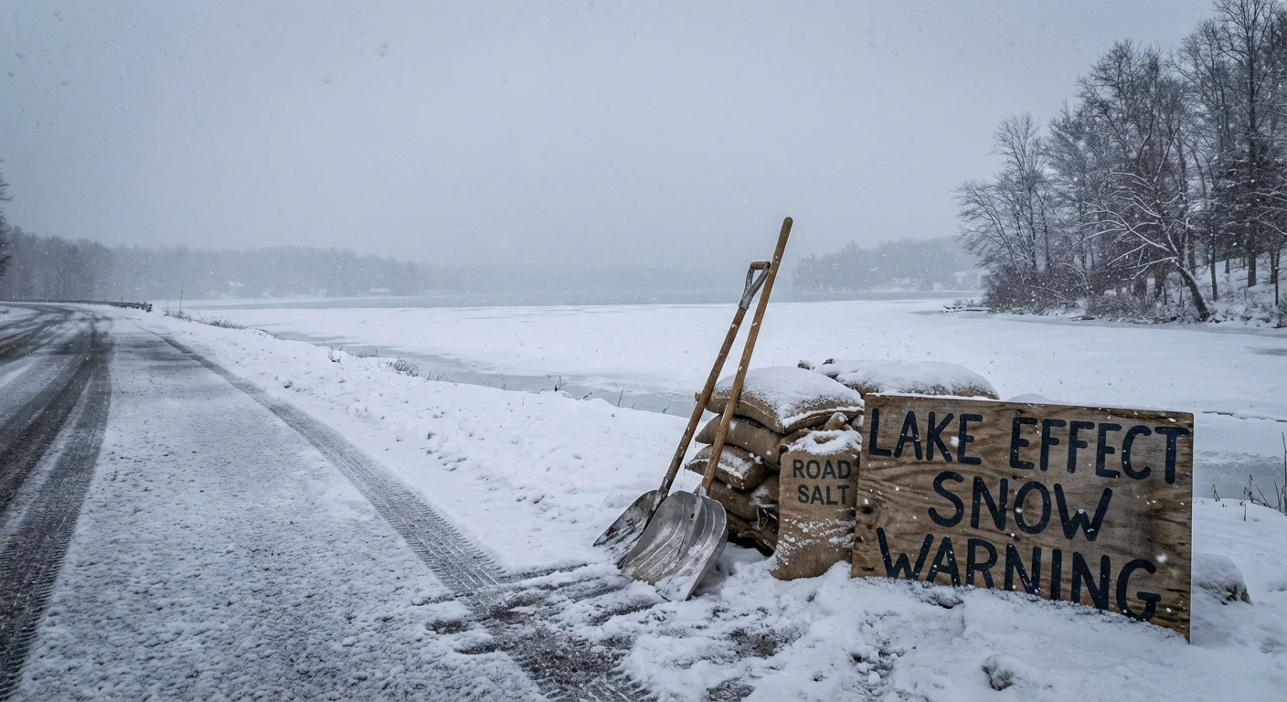
Lake‑Effect Snow Warnings are in effect across parts of northeast Ohio, northwestern Pennsylvania, and western and northern New York. The most intense bands are arcing into Ashtabula, Lake, Geauga, and Cuyahoga counties in Ohio, the Chautauqua Ridge and Erie County in Pennsylvania, and from Buffalo east toward the Tug Hill Plateau in New York. Snowfall rates are peaking at 1 to 2 inches per hour, at times higher in the core of the bands.
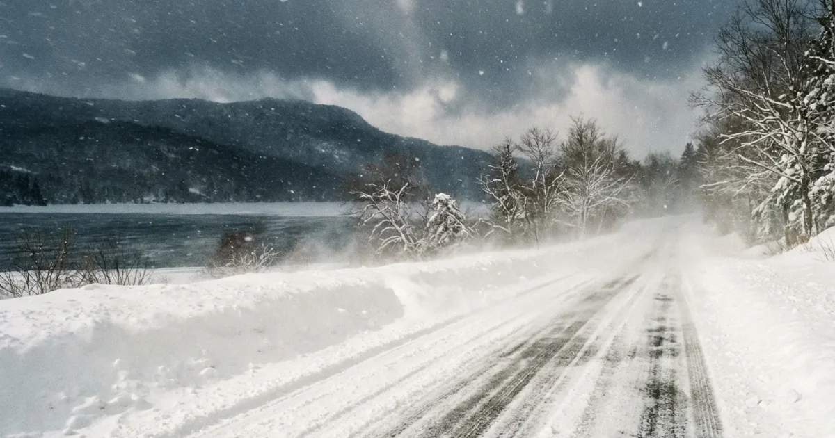
Gusty winds are pushing these bands inland, dropping visibility to near zero on short notice. Totals of 10 to 20 inches are likely in the most persistent bands, with localized higher amounts on the ridges. This is pure lake‑effect, not a broad storm, which means abrupt gradients. One exit along the thruway can be clear, the next can be shut down by a wall of snow.
If you are under a Lake‑Effect Snow Warning, expect rapid whiteouts, drifting, and slick roads. Postpone non‑essential travel.
Why This Snow Is Different
Lake‑effect snow happens when very cold air passes over warmer, open lake water. The lakes heat and moisten the air, which rises, cools, and forms tight snow bands. Today, the wind is aligned over long stretches of open water, called the fetch, which helps the bands grow and persist. A slight wind shift can move the bullseye by a few blocks.
Lake‑effect warnings were brought back in recent seasons to call out this unique hazard. A Winter Storm Warning may cover a wide area, but lake‑effect bands are surgical and fierce. They demand a different kind of readiness and a quicker response.
Who Is In The Path
Expect the most intense impacts downwind of Lakes Erie and Ontario. In Ohio, snowbelts east and southeast of Cleveland are favored. In Pennsylvania, the corridor from Erie inland to higher terrain is a hotspot. In New York, focus on the Buffalo southtowns and later the Tug Hill, where terrain squeezes extra snowfall out of the clouds.
Timing matters. Overnight cooling often strengthens bands. Daytime mixing can break them up, then they regroup after sunset. Watch for band pivots as winds veer from west to northwest.
Travel and Safety
If you must drive, plan for sudden changes. Roads can shift from wet to ice‑covered in one minute. Plow crews are out in force, but narrow bands can overwhelm even the best operations for short bursts.
- Delay trips if you are in a warning area
- Slow down and leave extra room to stop
- Keep headlights on and clear snow from sensors and lights
- Carry a winter kit with warm layers, water, and a phone charger
Stuck in a whiteout, do not slam the brakes. Ease off the gas, keep the wheel straight, and find a safe place to pull off.
Climate Context and Sustainability
The lakes are staying open longer into early winter, and water temperatures have trended warmer in recent years. That extra warmth adds fuel for lake‑effect events, especially before the lakes freeze over. A warmer background climate can increase moisture in early season outbreaks, which helps bands hit harder, even as total winter snowfall varies year to year.
Resilience is also about how we respond. Cities can cut crash risk and protect water quality at the same time. Smarter salting, better forecasts on short time scales, and targeted plow runs save money and reduce harm to streams.
- Use brine pre‑treatments to reduce rock salt use
- Focus on high‑risk corridors during peak band hours
- Clear storm drains to prevent ice jams and street flooding
- Support tree cover that blocks drifting on open roads
Heavy road salt stresses lakes and rivers. Brine, beet‑juice blends, and tight application rates keep roads safe while protecting watersheds.