Breaking now: Indiana’s county travel advisory map is lighting up as a powerful winter storm spreads across the state. Heavy snow and strong winds are knocking down visibility and pushing drifts across open roads. Plows are struggling to keep lanes clear as bands refill minutes after a pass. I am monitoring the county statuses closely as restrictions tighten and expand. ❄️
Indiana’s travel advisory map, explained
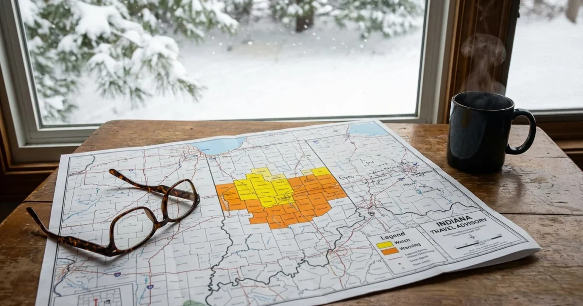
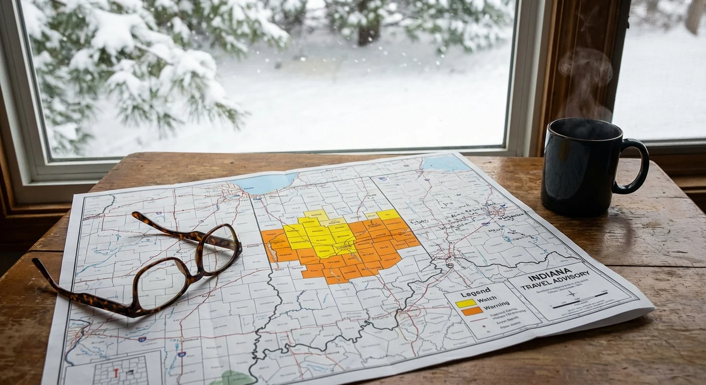
Indiana’s Department of Homeland Security runs the statewide Travel Status Map. It shows county-by-county limits in real time. Local emergency managers set these levels and can change them fast as conditions shift. Here is what the colors mean:
- Yellow Advisory, use caution. Roads are slick. Travel with care.
- Orange Watch, essential travel only. Work, medical needs, and emergencies.
- Red Warning, travel restricted to emergency workers. The public should not drive.
Several counties are already at Watch or Warning as snow piles up and wind gusts increase. State highways can remain open while local roads face limits. Follow both state and county guidance. Never assume an open highway means safe travel if your local area is under limits.
How to use it for smart, real time choices
The map is more than colors. It is a live safety tool. Use it before you turn the key, then keep checking as you go.
- Refresh the official state map before leaving. Do not rely on old screenshots.
- Tap your county, then tap along your route in neighboring counties.
- Compare county status with INDOT highway alerts, and check wind forecasts.
- If you see Watch or Warning, delay nonessential trips. Rebook and replan.
Refresh often. County statuses can change in minutes as plows, crashes, and whiteouts shift road risk. Use the live map, not screenshots.
The storm setup and what comes next
This system is classic midwinter Indiana. A strong low is pulling Gulf moisture into cold air. Snow is widespread and efficient. The powder is light, so wind moves it easily. That means drifts build fast on county roads and rural stretches. Blowing and drifting reduce visibility to a few car lengths. Even main routes can ice over between plow runs.
North of Indianapolis, lake effect bands may flare as colder air crosses Lake Michigan. Warmer lake water adds energy and moisture to the air. That can boost snowfall rates in narrow stripes. If a band parks over a county, the map can shift from Advisory to Watch in one hour.
This is also the climate signal we track each winter. A warmer atmosphere holds more moisture. When temperatures sit below freezing, that extra moisture can fall as heavier snow. Storms like this carry bigger snow loads, then wind turns that snow into ground blizzards. Expect more whiplash events, with intense bursts separated by lulls.
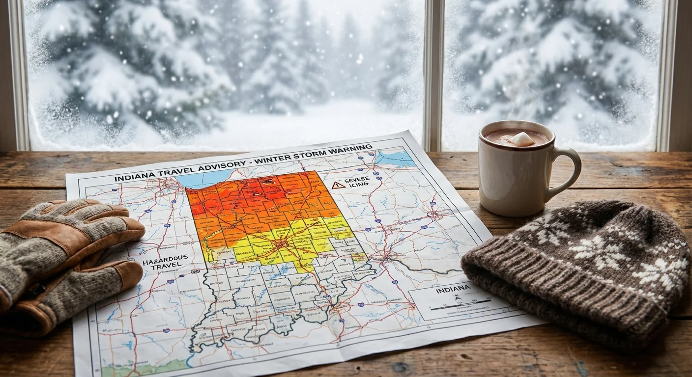
Red means stop. Under a Warning, travel is restricted to emergency workers. Staying off the roads protects you, plow crews, and first responders. ⚠️
Safety and sustainability on the roads
If you must travel, slow down and give plows room. Keep your lights on. Never use cruise control on slick pavement. Pack a winter kit with blankets, water, and a phone charger. Tell someone your route and arrival time. If you lose visibility, pull off safely and wait for a break.
Your choices also matter for the environment. Road salt saves lives, but it also washes into streams and soils. Staying home during peak whiteouts reduces the need for repeat salting and plow passes. If you maintain a driveway or sidewalk, shovel early and often to cut salt use. Use only what you need. Sand can add grip without adding as much chloride to waterways.
Telework if possible. Combine errands once the storm eases. Carpool tomorrow if local roads return to Advisory. These small steps lighten traffic during cleanup and help crews restore safe travel sooner.
The bottom line
Indiana’s travel advisory map is the clearest signal of road risk right now. Yellow means caution, orange means essential travel only, red means stay off the roads. Conditions are changing fast as snow and wind reshape the landscape. I will continue tracking county changes as the storm evolves. Check the official map and your county emergency channels, and delay nonessential trips until crews bring the network back under control. Stay safe, stay patient, and let the plows win the race today.


