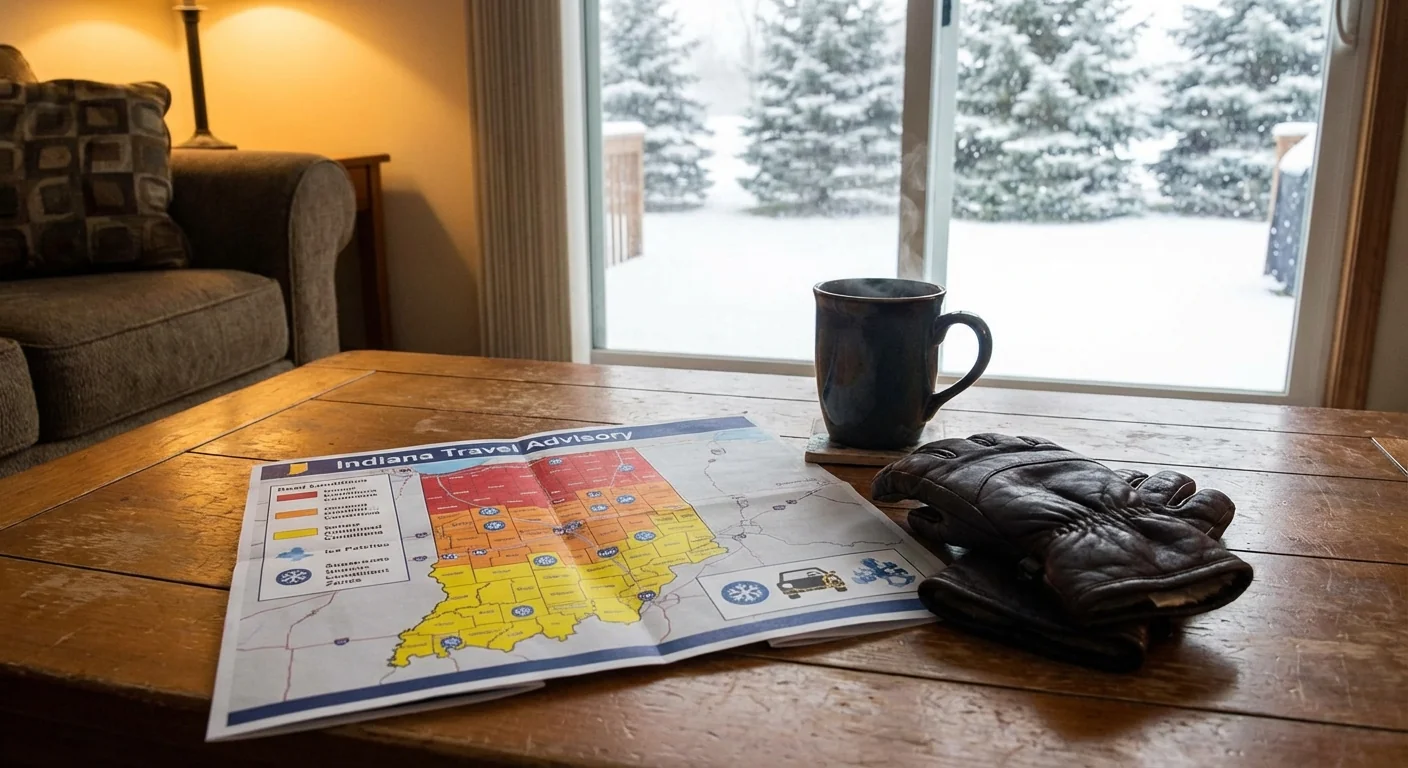
BREAKING: Indiana’s travel advisory map has lit up tonight as a powerful winter storm slams the state. Heavy snow, whiteout gusts, and rapid icing are disrupting travel on interstates and county roads. I am tracking the county by county map in real time. More counties are moving into higher restriction levels as conditions worsen. Gov. Mike Braun has issued a statewide disaster declaration. President Trump has approved a federal emergency declaration to support the response. This is a life safety storm, not a routine winter day. ❄️
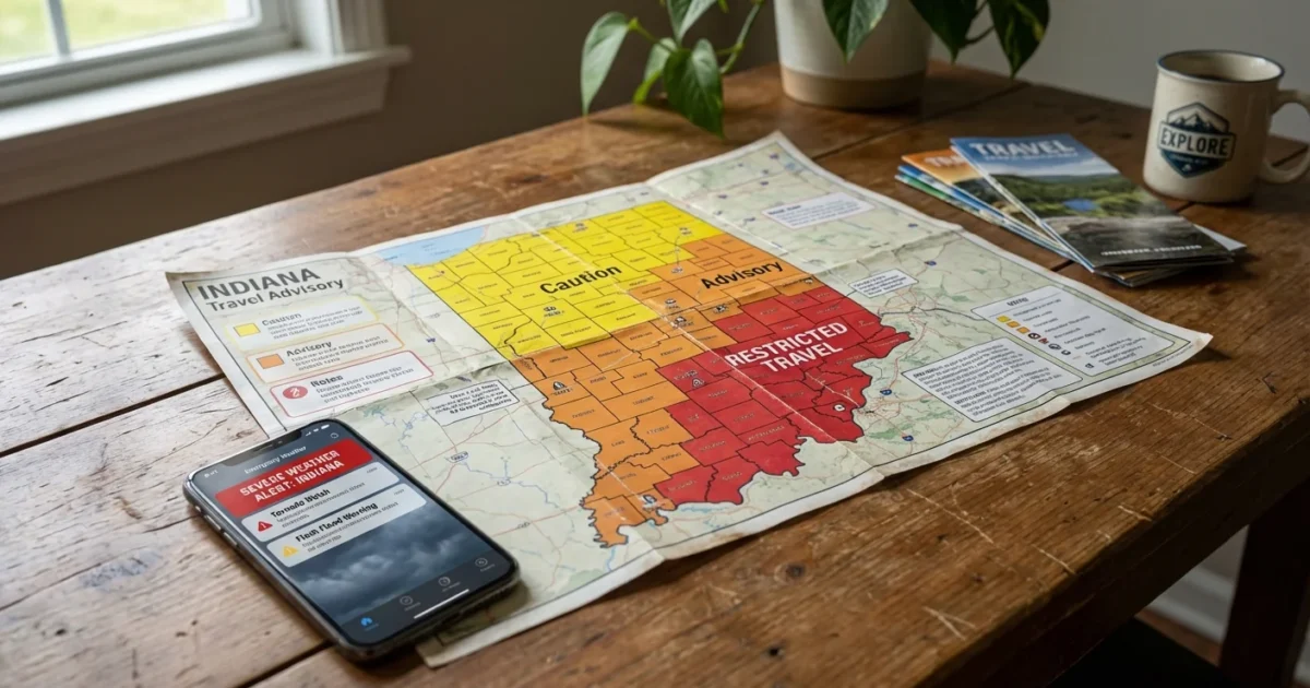
How to read Indiana’s Travel Advisory Map
The Indiana Department of Homeland Security maintains a color coded Travel Status Map that local emergency managers update. The colors are simple, and the rules matter. If your county turns orange or red, your choices should change fast.
- Yellow Advisory, roads are hazardous, use extra caution and expect delays
- Orange Watch, limit travel to essential needs such as work, medical, or safety
- Red Warning, travel restricted to emergency personnel as ordered by local officials
If you must drive in a yellow county, slow down and widen your following distance. In orange counties, ask if the trip truly cannot wait. Red means stop. Emergency crews need clear roads to save lives.
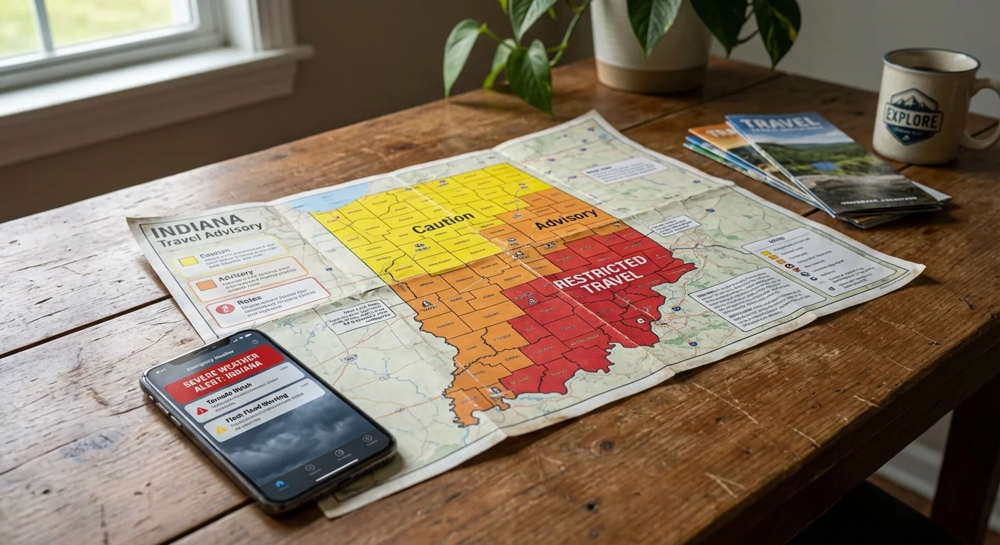
Check the IDHS Travel Status Map and INDOT TrafficWise before you move. Conditions change by the minute. Keep your phone charged and alerts on.
What the storm is doing right now
Snow bands are pulsing across the state, dropping quick bursts that reduce visibility to near zero. Wind gusts are lofting powder into drifts that can trap vehicles. Temperatures are sliding, so slush is freezing on bridges and ramps. Along and north of Interstate 70, lake effect snow is adding fresh bursts behind the main front. South of Bloomington, a heavier wet snow is weighing down tree limbs and lines.
This setup fits a classic midwinter pattern. A sharp dip in the jet stream opened the door to Arctic air. A moist low pressure system tapped Gulf moisture, which supercharged snowfall rates. The timing is ruthless, hitting during peak evening travel and persisting into the early morning hours.
The climate signal behind the flakes
A warmer climate can still deliver fierce snow when cold air and moisture meet. Warmer air holds more water, which can load winter storms with heavier precipitation. The Great Lakes are also warmer on average in recent years. That adds fuel for lake effect snow, since open water feeds heat and moisture into cold air. The result is fewer snow events some winters, but more intense ones when the ingredients lock in. Tonight is one of those times.
Heavier bursts mean faster road icing and deeper drifts. The jump from manageable to dangerous can happen in minutes.
What the declarations mean for your drive
The governor’s disaster declaration streamlines logistics. It frees up funding, brings in extra resources, and supports state coordination with counties. The federal emergency declaration unlocks support for supplies and crews. These actions do not close every road. County leaders set the travel status, and they can tighten rules as local conditions change.
If your county posts a red Warning, law enforcement may block non emergency travel. In an orange Watch, employers should be flexible and reduce on site staffing. Essential workers should carry identification and a simple travel plan. Everyone should keep vehicles off plow routes when possible. Clear lanes let salt trucks and graders do their work.
Safety and sustainability on the roads
Staying put is the safest, most sustainable choice in a high level advisory. Fewer cars mean fewer crashes, fewer emissions from idling in gridlock, and faster snow removal. Road salt helps, but it also stresses streams and soils. Every unnecessary mile spread today adds to that load tomorrow.
If you must go, travel smart and travel light on the environment:
- Combine trips and carpool if you are essential staff
- Drive slow and steady to cut fuel use and avoid skids
- Keep tires properly inflated for grip and efficiency
- Pack a short emergency kit, water, snacks, and warm layers
Red counties restrict travel to emergency use. Do not risk it. Blocking a plow or ambulance can cost a life.
What I am watching next
I expect additional counties to escalate from yellow to orange, and some from orange to red in the overnight hours. Blowing snow will remain a problem long after the radar quiets down. Temperatures will lag behind the storm, so melt and refreeze will turn to black ice near sunrise. I will update as county statuses change and crews make progress.
The bottom line
Tonight is about smart choices. Read the map. Respect the color in your county. If it is not essential, do not drive. This storm is a strong reminder that a warming world can still deliver intense winter weather. Protect yourself, your neighbors, and the crews working through the night. Keep the load off the roads, and let the plows clear a safer tomorrow. Stay tuned and stay safe. 🌨️


