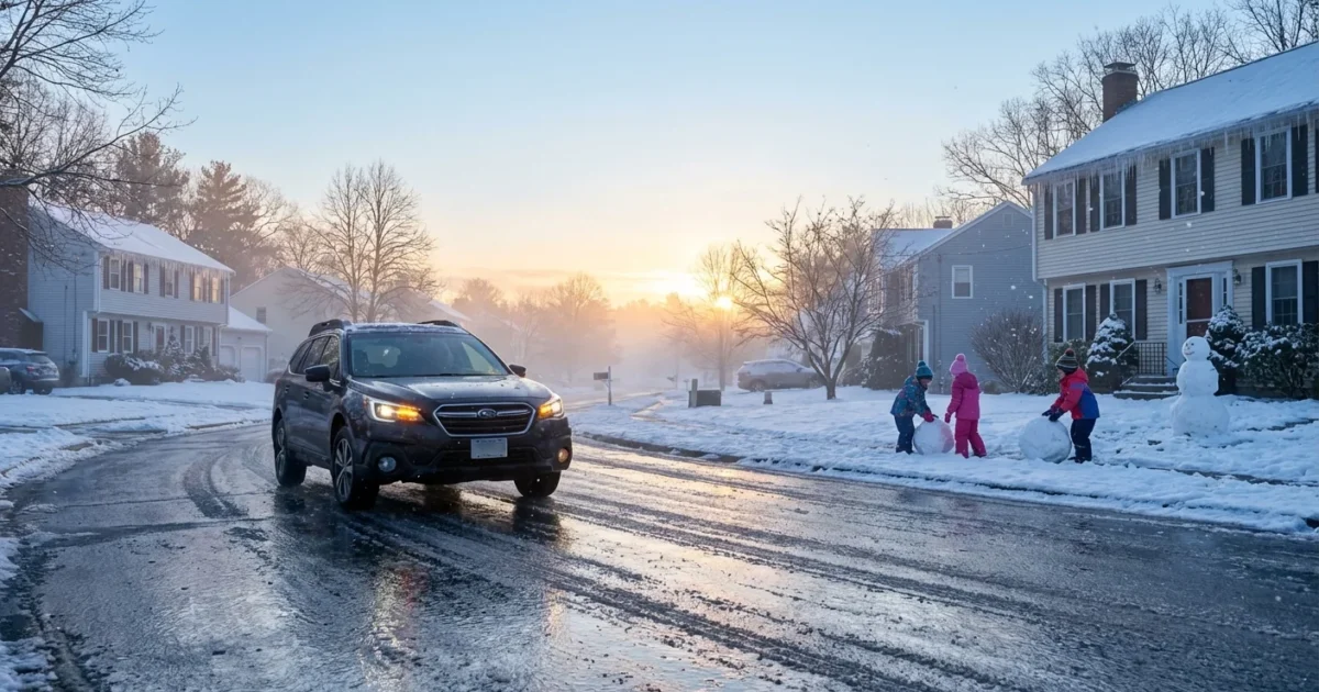
BREAKING: Massachusetts schools are closing or delaying start times this morning as a swath of freezing rain ices roads, sidewalks, and bus routes. I am tracking conditions across the state and can confirm a patchwork of decisions, with inland and higher elevation districts facing the worst ice. Eastern areas see heavy rain and slick commutes. If you are a parent or commuter, plan for a slow, careful morning. ❄️
Icy morning, uneven impacts
A warm layer of air is riding over cold ground level air. That is classic freezing rain setup. Droplets fall as rain, then glaze on contact. The result is a thin sheet of ice on untreated surfaces. Temperatures are hovering near the freezing mark in many towns, so conditions can shift by a few miles.
Central hills and parts of western Massachusetts are taking the brunt, where cold air pools in valleys. Expect more ice on side streets and shaded roads. Along the coast and in Boston’s inner suburbs, heavier plain rain is dominating, but ramps and bridges can still flash freeze. Keep an eye out for shiny patches. That is black ice.

Black ice is invisible, but it is there. Slow down, leave extra space, and do not trust wet pavement at intersections.
How schools decide, and what to expect
District leaders started their calls before dawn. They are watching live road reports, bus yard conditions, and timing of the last freezing rain band. If the glaze lifts by late morning, some districts will opt for a delay. If crews cannot treat secondary roads in time, full closures are more likely. Before and after school activities are widely canceled. Some districts may switch to remote learning for the day.
Bus routes may be adjusted to avoid steep hills. Expect salt and brine trucks to focus on priority corridors first, then neighborhood streets. Walkers should use main sidewalks when possible, not cut through alleys or unplowed paths.
Where to get official updates
Use your district’s channels first, then cross check with regional outlets. Do not rely on third hand posts.
- District website alerts or mobile apps
- Robocalls and texts from your superintendent
- Local TV and radio closure boards
- Municipal social media for road and parking updates
If you have not already, sign up for your district’s text alerts. Add the bus company number to your contacts for quick updates.
Road and power risks this morning
A glaze as thin as a quarter inch can stress small limbs. Tree branches will collect ice fastest in higher terrain and wind exposed areas. That raises a low, but real, risk of scattered outages. Crews are also watching salt effectiveness. When temperatures sit near freezing, treated roads can refreeze in pockets, especially on bridges.
Sidewalks and school steps are slick. Give custodians time to salt entrances. If you must drive, clear all windows and lights fully. Ice sheets can slide off your roof and endanger others.

The climate signal behind this storm
This morning fits a pattern that scientists have flagged for New England. Winters are warming, and the mix of rain and snow is changing. More storms now feature a warm layer aloft, plus near freezing ground temperatures. That combo boosts the odds of freezing rain and sleet, not just snow. It also means greater swings, rain one hour, ice the next.
These mixed storms carry real costs. Ice events strain trees and lines, jam roads, and eat into school days. They also push more salt into rivers and bays. Smarter responses can help. Districts are refining remote day plans, which keep kids safe and cut emissions from thousands of car trips. Public works is leaning on brine, applied ahead of storms, which reduces total salt use. Towns are trimming street trees strategically, and some are exploring microgrids at schools to keep heat and lights on during outages. Small steps add up in a warming winter.
What parents should do now
- Check your district alert, then verify bus pickup changes.
- If you must travel, leave early and avoid hills and back roads.
- Walk slowly, use handrails, and send kids with dry shoes.
- Keep devices charged in case an outage delays remote plans.
Conclusion
This is a fast moving, high impact morning for Massachusetts. Ice is the top hazard inland, with slick rain along the coast. Districts are acting out of caution, and the science backs that call. I will continue monitoring road treatments, temperature shifts, and school decisions through late morning. Plan for patience, protect your footing, and watch for rapid changes as this storm winds down. Stay safe. ⚠️


