
Central Texas schools close or delay Tuesday as ice grips the morning commute
What is happening right now
School districts across Central Texas are closing or starting late on Tuesday, January 27. A thin but dangerous glaze of ice is forming on roads, bridges, and sidewalks. Bus routes that roll before dawn face the worst risk. Many superintendents pulled the plug late tonight to protect students and staff.
Road crews have treated main highways, but side streets and elevated ramps are still slick. Temperatures hover near freezing. That is enough for freezing rain to lock up the early commute. Expect a patchwork of full closures and two hour delays across the Austin metro, the Hill Country, and parts of the I-35 corridor.
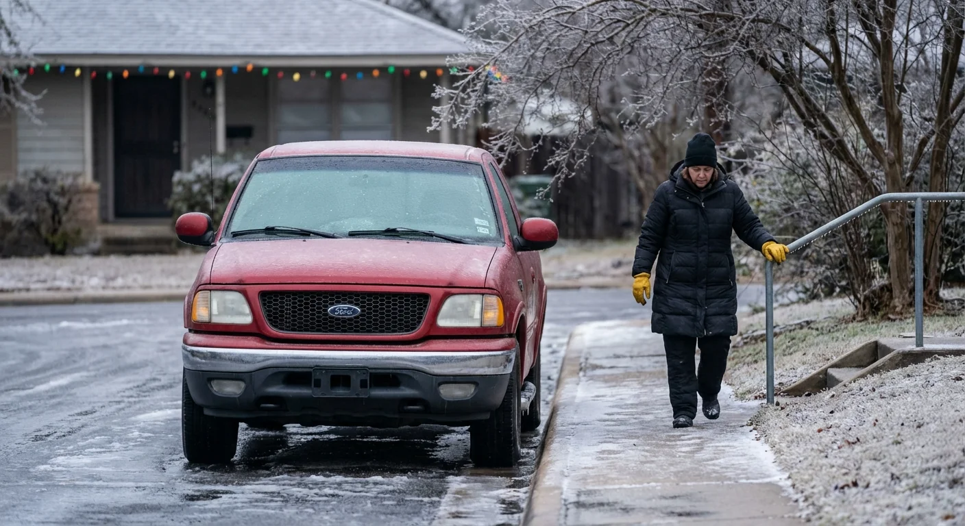
Black ice forms with a thin glaze, invisible at night. Assume bridges and overpasses are slick.
Families should expect updates before sunrise. Some districts will make final calls after fresh road checks at 4 to 5 a.m. If you must travel, slow down and leave extra space. If you can stay home, do it. This ice snaps fast and melts slow.
Why the ice formed
This is a classic Central Texas setup. A shallow pool of arctic air hugs the ground. A few thousand feet above, air stays just above freezing. Raindrops fall through that warm layer, then hit the cold surface and freeze on contact. That is freezing rain.
Bridges cool faster than the ground. So they ice first. Hills and shaded areas follow. Light wind keeps cold air pooled in low spots. Even a tenth of an inch of ice can shut down a district. Buses, school parking lots, and drop off zones all turn into skating rinks.
This pattern fits a broader climate signal. Winters are warming overall, yet we still get sharp cold snaps. A warmer atmosphere carries more moisture. When cold air undercuts that moisture, ice risk can spike. More marginal days mean more events just like this, when the temperature is 31 to 33, not 20. That narrow range is the danger zone for freezing rain in our region.
What your district’s notice means
Look closely at the wording. A full closure means no classes on campus. That may include virtual learning, or it may not. A two hour delay usually shifts first bell and bus pickups by two hours. Breakfast and before school programs often shift too. Athletics and field trips are usually canceled or delayed.
A two hour delay usually shifts first bell and bus pickups by two hours. Breakfast service often moves too.
Expect different plans across neighboring districts. Terrain, bridges, and microclimates vary. A hilltop neighborhood can glaze while a nearby valley stays wet, not icy. Districts also weigh bus yard conditions and staff commutes, not only main roads.
Verify your district status directly on its website or official alerts before you head out.
Your early morning plan
Here is a simple plan to get through the morning safely and with less stress.
- Check your district’s website or alert system at 5 a.m. for any change.
- Peek at a nearby bridge or porch railing for glaze. If it is icy, roads are worse.
- If school is delayed, reset alarms and resist the urge to drive. Let road crews work.
- If you must travel, use low speeds, gentle braking, and avoid elevated ramps.
- Dress kids in layers, with shoes that grip, since sidewalks may be slick.
Sustainability and the grid
Cold mornings test the grid, even short ones. Small choices help. Set thermostats to the lowest comfortable setting. Close blinds and doors to hold heat. Avoid running the dryer and oven at the same time. If your school moved to remote work, use LED lights and power strips to cut idle load. Every bit reduces peak demand and lowers stress on power lines weighed down by ice.
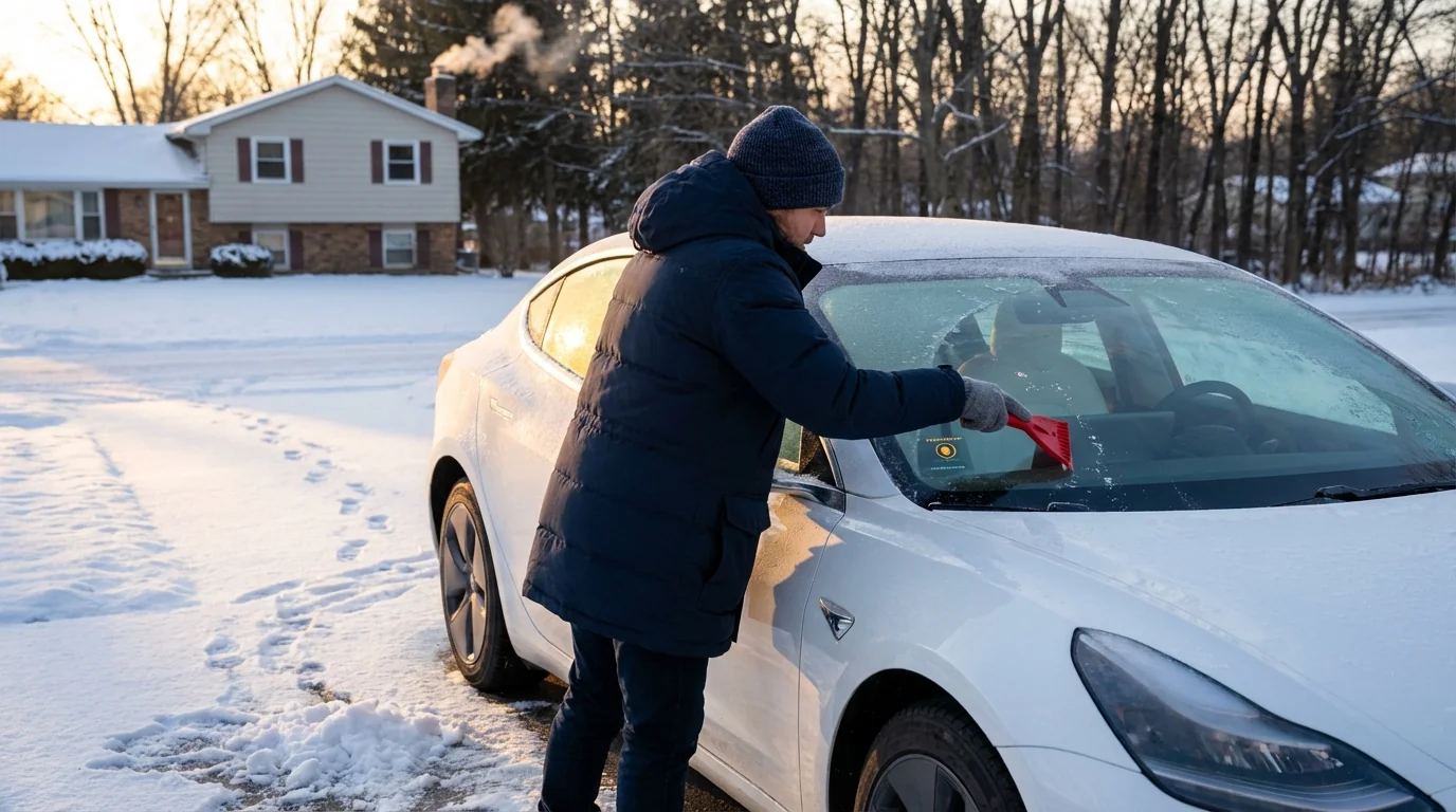
Car prep matters too. Clear all windows fully, not just a porthole. Idling wastes fuel and adds pollution near schools. Start the car, scrape, then go. If you own an EV, preheat while plugged in. That warms the cabin using grid power, protecting range and lowering morning draw later.
The climate lens
Central Texas sits at a crossroads. Dry lines, Gulf moisture, and cold fronts meet here. In a warming climate, we expect fewer deep freezes, but not zero. We also expect more moisture when storm tracks line up. That increases the odds of mixed winter events, not heavy snow. Ice is the most disruptive of all. It takes little, and it hits what we use most, roads and power.
Better design can blunt the blow. Schools can add covered walkways with grit surfaces. Cities can pre stage brine for neighborhood hills, not just highways. Parents can plan carpools or remote check ins to cut miles on marginal mornings. Small moves scale up fast across a metro area.
Bottom line
Tuesday will start icy for many Central Texas families. Districts are closing or delaying to keep buses, staff, and students safe. The setup is textbook freezing rain, with shallow cold air and warm air above. Expect updates before dawn, plan a slower morning, and conserve energy where you can. Winter here is changing, but smart choices can keep us moving, and keep us safe. ❄️


