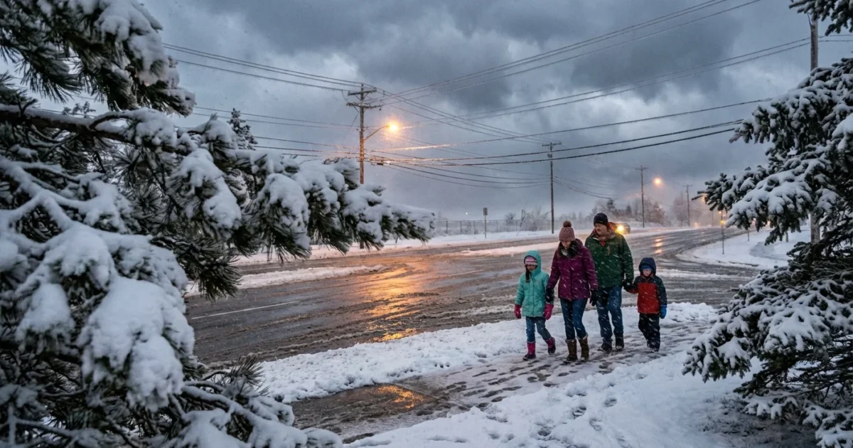
BREAKING: Blizzard conditions sweep Midwest and push into Northeast, snarling holiday travel ❄️
A powerful winter storm is roaring from the Upper Midwest toward the Northeast right now. Heavy snow, wind driven whiteouts, and a glaze of ice are turning roads into hazard zones. Flights are delayed. Some are canceled. Our weather desk confirms double digit snowfall totals in parts of Minnesota, with the highest drifts along open country roads. This system is not done. It will intensify as it moves east, pulling in deep Gulf moisture and sharp Arctic air.
Storm path and timing
The storm center is tracking from the Plains into the Great Lakes, then into interior New England. It strengthens as cold air wraps around the back side. That tight gradient drives strong winds. Gusts are topping 35 to 45 miles per hour in open areas. That is enough to bury lanes with blowing snow and to meet blizzard criteria at times.
Snow is heavy from Minnesota and Wisconsin into Michigan and upstate New York. The rain snow line sits near the I 95 corridor, then wobbles with each burst of energy. Near that line, the snow is wet and heavy. It sticks to trees and wires. In southern zones, a layer of ice may form and then get packed by sleet.

Whiteout bursts are reducing visibility to near zero in bands. If you cannot see the road, do not drive.
Why this storm is so intense
This storm is tapping two key ingredients. There is deep moisture from the south. There is deep cold from the north. Where they meet, lift is strong, and snow rates spike. Two to three inches per hour are possible in the core bands. Roads go from wet to impassable in minutes.
A warmer atmosphere can hold more water. That means when it is cold enough to snow, storms can wring out heavier bursts. We are also seeing more mixed precipitation near the rain snow line. That is where small changes in temperature, even one or two degrees, shift snow to sleet or freezing rain. The result is higher ice risk for suburbs and smaller cities that used to see mostly snow. Climate change is tilting the odds toward wetter, heavier winter storms in many regions.
Travel and safety right now ⚠️
Winter storm and blizzard warnings blanket much of the Upper Midwest and interior Northeast. Advisories stretch beyond that. The message is simple. Delay nonessential travel until crews can catch up. If you must go, slow down, leave space, and keep your lights on. Do not blind yourself with high beams in heavy snow. Watch for black ice on bridges and ramps.
If you have to drive, pack a storm kit. Tell someone your route and arrival time. Keep your phone charged.
- Warm layers, hat, gloves, boots
- Ice scraper, shovel, sand or kitty litter
- Flashlight and external battery
- Water, snacks, basic first aid
Freezing rain is adding weight to branches along the transition zone. That can snap trees and drop lines.
Treat any downed wire as live. Stay back, and report it. Never run a generator indoors, even in a garage.
Power, streets, and sustainability
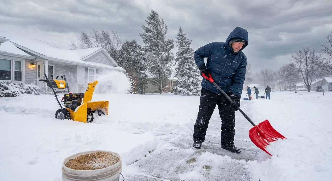
Icing and wind will cause scattered power outages. Utilities are staging crews, but access is slow in whiteouts. Expect spotty cell service where towers ice up. City plows are focusing on main routes first. Side streets will take longer. Please keep hydrants and sidewalk corners clear. Fire crews need access in a crisis.
Clear your walk with a shovel first, then use salt only where ice remains. Over salting harms rivers and lakes, and it does not speed melting at very low temperatures. A sand mix improves traction without the extra chloride. If you use a snow blower, check the chute direction so you do not bury a neighbor’s walkway.
After the storm, the hazards shift
When the snow ends, the wind continues. Drifts refill cleared lanes. Temperatures dip overnight, turning slush to glare ice. As skies brighten, meltwater can pool near storm drains. Clear those grates to reduce street flooding during the thaw. Take breaks while shoveling. Wet, cement like snow is heavy and can strain your back and heart.
Air quality can also slip around wood stoves and generators. Vent them well. If you smell exhaust, move to fresh air and call for help. Check on older neighbors and anyone who relies on medical devices.
What to watch next
As the low passes the Great Lakes, snow bands will blossom on west and northwest winds. These narrow bands can dump quick, local jackpots downwind of Superior, Michigan, Erie, and Ontario. The interior Northeast will see wraparound snow and blowing snow into tomorrow. Coastal communities face minor coastal flooding at high tide where onshore winds pile up water.
Behind the storm, colder air filters in, then a brief midweek moderation is likely. Another disturbance may ride the same track later this week. We will update timing and impacts as new data arrives.
Conclusion
This is a high impact winter storm at the worst possible time for travel. Respect the warnings, keep plans flexible, and let crews do their work. Smart choices now reduce injuries, protect waterways, and speed recovery. We are tracking every shift in the rain snow line and every surge of wind. Stay tuned, stay prepared, and stay safe.


