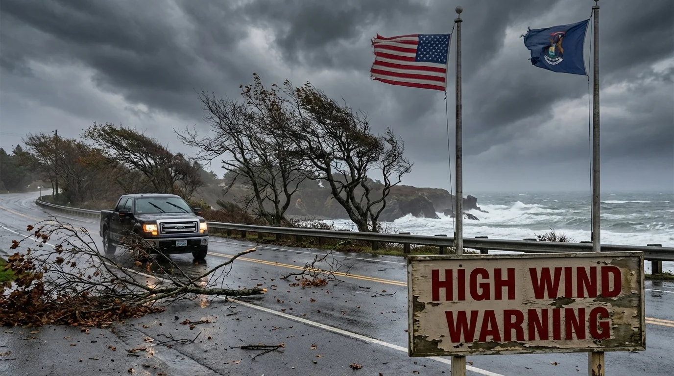
BREAKING: High Wind Warnings grip the Pacific Northwest as a long atmospheric river drives damaging gusts from the coast to the interior. Heavy rain, mountain snow, and saturated soils are setting the stage for downed trees, power outages, and dangerous travel from Washington and Oregon into Idaho, Montana, and parts of British Columbia. Peak impacts arrive from Tuesday night into Wednesday, with wind hazards rising fast alongside flooding concerns.
This storm is not a one‑note event. It is a loaded system stretching thousands of miles across the Pacific, feeding on warm ocean air and a strong jet stream. The result is a broad swath of high, non‑thunderstorm winds that meet High Wind Warning criteria. That means sustained winds near 40 mph for an hour, or gusts of 58 mph or higher. Those numbers are not abstract. They snap limbs, push trucks, and topple power lines on soaked ground.
What a High Wind Warning means
A High Wind Warning is the strongest wind alert most communities see outside landfalling cyclones. It sits above a Wind Advisory, and below an Extreme Wind Warning reserved for the most violent events. When this warning is posted, damage is likely. Not possible, likely. Secure property, plan for outages, and be ready to change travel plans.
Gusts will vary by location. Coastal headlands, exposed ridges, and mountain passes will feel the highest speeds. Valleys and urban corridors will see bursts, especially near gaps and along river channels.
Why the winds are so strong
An atmospheric river is a conveyor belt of moisture and momentum. A deep Pacific low is drawing energy from warm waters, then sending that energy toward the West Coast. The pressure difference between ocean and land, plus a strong jet stream overhead, is translating into widespread damaging winds at the surface.
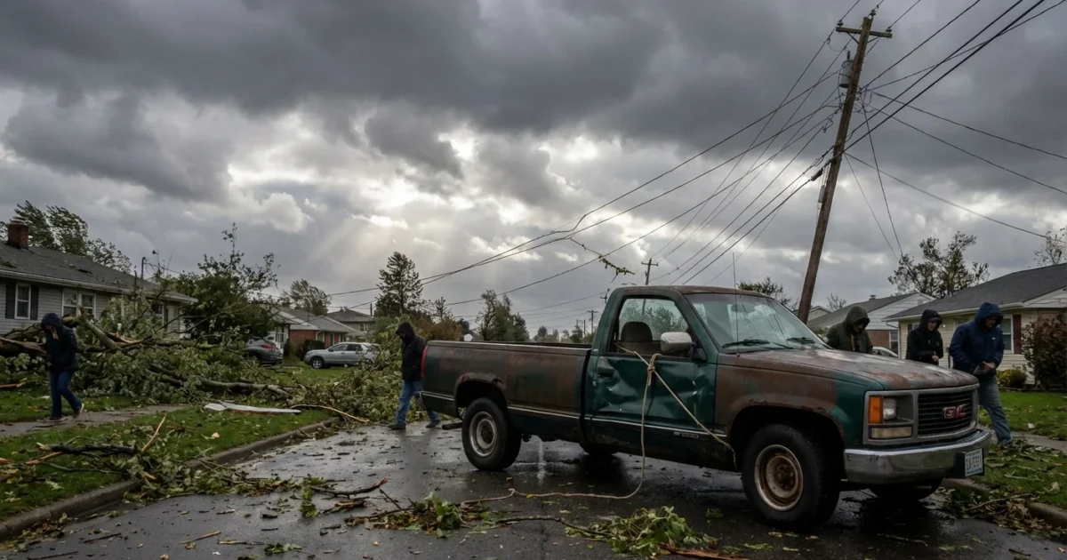
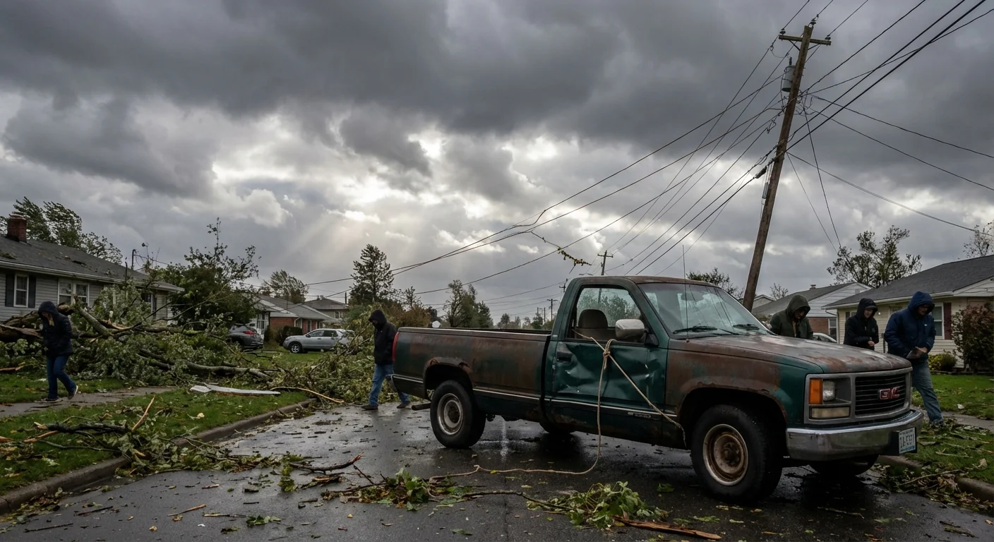
Soils across the region are already soaked. That matters. Wet roots hold less firmly, so trees give way faster in wind. High snow levels mean more rain lower on the slopes, which keeps the ground saturated and raises rivers. In short, the system is stacked for wind damage and flood stress at the same time.
Research shows a warmer atmosphere can carry more water vapor. That can make atmospheric rivers wetter, with heavier rain and higher snow levels. The wind field depends on storm track and pressure patterns, but more moisture can also deepen storms and sharpen gradients. Those gradients are the engine of wind.
Use this window to prepare. Charge phones, top up batteries, and park vehicles away from large trees.
Who is at risk, and when
High Wind Warnings cover wide areas of Washington and Oregon, with extensions into Idaho and Montana. Parts of coastal and southern British Columbia are also in the zone. The peak risk arrives from Tuesday night into Wednesday, fading from west to east late Wednesday.
Coastal zones, the Columbia River Gorge, Cascade passes, and high ridgelines are primed for the strongest gusts. High profile vehicles will struggle on exposed bridges and open interstates. Urban neighborhoods with mature trees on saturated lawns face the greatest outage threat.
How to get ready, fast
Quick steps now will pay off when the gusts hit.
- Bring in or tie down loose items like patio furniture and trash bins.
- Charge devices, and set flashlights and a battery radio in one spot.
- Avoid travel during peak winds, especially with trailers or tall vans.
- Clear storm drains and check on neighbors who may need help.
- Keep generators outside, well away from windows to prevent carbon monoxide.
Assume any downed line is live. Do not touch it. Call your utility or 911. Falling limbs can arrive with no warning when soils are saturated.
The sustainability angle
This is a resilience test. Stronger wind and water together push a stressed grid and aging trees to failure. Better outcomes are possible. Cities can expand urban forestry with climate‑tough species, trim hazard limbs at the right time of year, and invest in insulated lines and undergrounding where practical. Homes can add battery backups, surge protection, and weather‑ready roofing. These steps cut outage time, reduce wildfire and flood risk, and lower carbon pollution from emergency generators.


