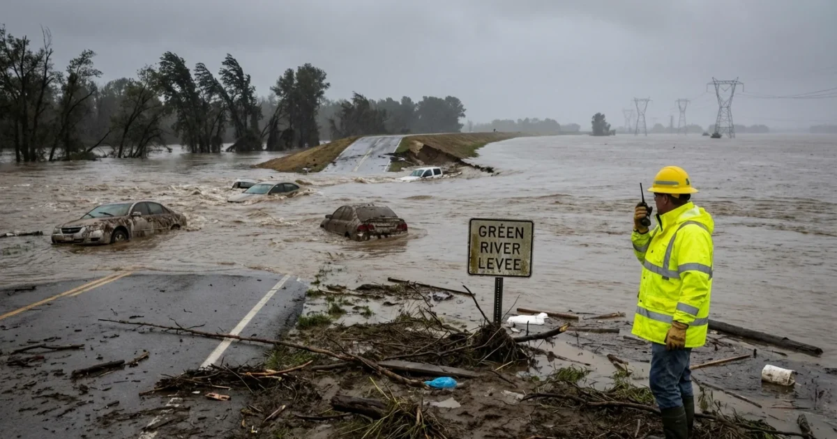
Breaking now, a levee on the Green River has failed, unleashing fast, rising water toward Seattle suburbs. Life-threatening flash flooding is possible within minutes in low-lying areas. Immediate evacuation orders are in effect for parts of Tukwila and nearby communities. I am on this story as crews move to protect people and critical infrastructure.
What Happened
The levee breach was reported within the last few hours along the Green River corridor. River water is now moving into areas that are normally protected. Officials have issued urgent alerts and told residents in at-risk zones to leave now. The water is cold, fast, and carries debris. Visibility is low. Travel is slow. These are dangerous conditions.
Emergency managers are tracking impacts downstream from the breach. They are watching road crossings, bridges, and power and transit lines near the river. If you live or work near the Green River, treat every alert as urgent. Floodwater can reach streets and homes much faster than expected.
Who Is At Risk
The highest risk is in neighborhoods and business parks close to the river. That includes parts of Tukwila and communities along the Green River valley. Ground floors, basements, and mobile homes are especially vulnerable. Industrial zones and warehouse districts near the riverbanks could flood quickly.
Crews are sounding sirens and going door to door in some areas. If you hear a knock or a loudspeaker message, act at once. Avoid underpasses and low bridges. Keep away from river trails and levee tops. The soil is saturated. Banks can collapse.
If you are in an evacuation zone, leave now. Do not drive through water. Turn around, do not drown.
The Weather Setup
A powerful band of Pacific moisture soaked the region for days. This type of storm is often called an atmospheric river. It brings warm air, deep moisture, and steady, heavy rain. Soils are already soaked. The Green River has been running high. That extra stress can expose weak points in levees.
Climate change is a force multiplier here. Warmer air holds more water. That makes heavy downpours more intense. Winter storms now deliver more rain in shorter bursts. Flood risks rise when those bursts hit back-to-back. Aging levees were built for a cooler, different climate. Today’s rainfall rates push them harder.
The Response On The Ground
State and local emergency operations centers are active. Fire, police, and public works teams are in the floodplain with high-water vehicles and rescue boats. Engineers are assessing the breach and scouting for secondary failures. Sandbag lines are being placed to steer water away from key roads and to protect critical sites. These are temporary moves, not a repair.
Shelter sites are opening for evacuees. Transportation officials are closing threatened roads and rerouting transit lines as needed. Utilities are preparing to shut off power in flooded blocks to prevent fires and electrocution. Check official alerts for routes and shelter locations. Keep your phone charged and your car fueled if you can.
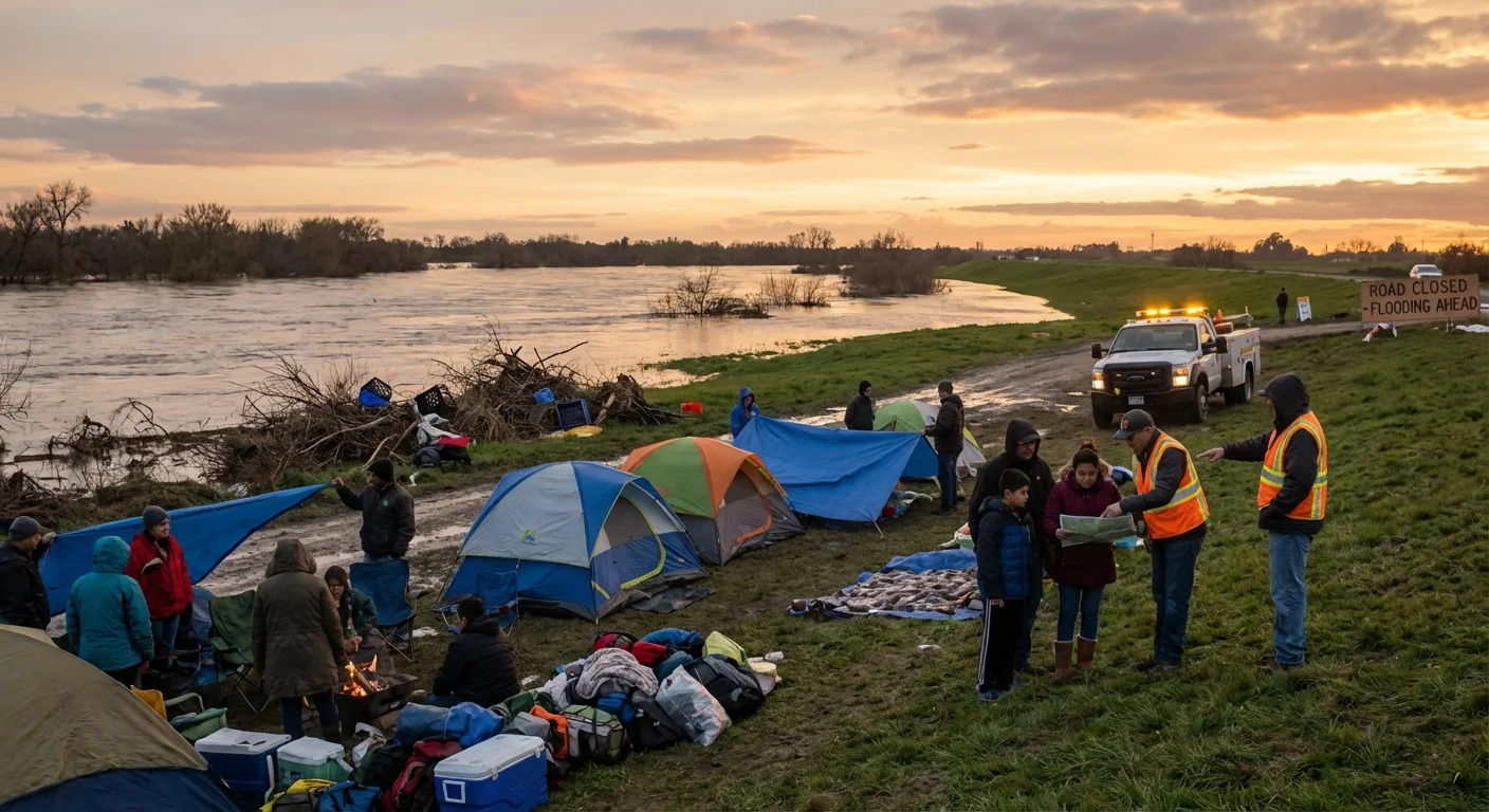
Pack medications, IDs, chargers, warm clothing, and pet supplies. Move valuables and documents to higher shelves before you go.
What Residents Should Do Now
- Leave immediately if ordered. Follow posted detours to higher ground.
- Avoid all floodwater. Just six inches can knock you down.
- Keep off bridges over fast water. Do not stop to take photos.
- Unplug electronics. Shut off gas only if officials advise it.
- Check on neighbors who may need help, then evacuate together.
Climate And Infrastructure Outlook
This breach is a warning from a warming world. More intense rain is the new baseline for the Pacific Northwest. Levee systems need upgrades that match today’s storms. That means stronger levee cores, wider floodways, and room for the river to spread safely. Nature-based solutions can help. Setback levees, restored wetlands, and open floodplains store peak flows and reduce strain on walls and roads.
Long term, communities can pair climate-ready infrastructure with smarter land use. Keep new homes out of the highest-risk zones. Elevate critical utilities. Build evacuation routes above historic high-water marks. These choices save lives and lower recovery costs.
Levees reduce risk, but they do not remove it. Plan as if the levee can fail, then prepare to act fast.


